Woorabinda, Queensland
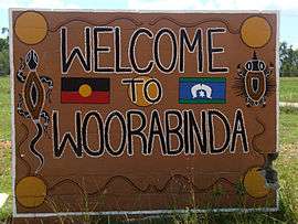
Woorabinda /ˈwʊərəbɪndə/ is a rural town and locality in the Aboriginal Shire of Woorabinda, Queensland, Australia.[2][3] In the 2016 census, Woorabinda had a population of 962 people.[1] It is an Aboriginal community.
| Woorabinda Queensland | |||||||||||||||
|---|---|---|---|---|---|---|---|---|---|---|---|---|---|---|---|
 | |||||||||||||||
 Woorabinda | |||||||||||||||
| Coordinates | 24.1288°S 149.4580°E | ||||||||||||||
| Population | 962 (2016 census)[1] | ||||||||||||||
| • Density | 4.371/km2 (11.320/sq mi) | ||||||||||||||
| Established | 1927 | ||||||||||||||
| Postcode(s) | 4713 | ||||||||||||||
| Area | 220.1 km2 (85.0 sq mi) | ||||||||||||||
| Time zone | AEST (UTC+10:00) | ||||||||||||||
| LGA(s) | Aboriginal Shire of Woorabinda | ||||||||||||||
| Region | Central Queensland | ||||||||||||||
| State electorate(s) | Gregory | ||||||||||||||
| Federal Division(s) | Flynn | ||||||||||||||
| |||||||||||||||
Geography
Woorabinda is in Central Queensland, inland about two hours' drive west of Rockhampton.
The seasonal Mimosa Creek is nearby and is a source of local water. During rainy season, the town can be isolated due to road flooding. Access is via the Fitzroy Developmental Road, which is sealed north towards Duaringa and where it meets the Capricorn Highway to Rockhampton. To the south, it is gravel road to Bauhinia Downs, where it meets the Dawson Highway and access to Gladstone.
East is the sealed Baralaba-Woorabinda Road, seasonally cut off by flooding. West has a number of cattle properties until the base of the Blackdown Tablelands, serviced by gravel roads.
There is also a sealed airstrip along the north road into town, used by chartered flights and aeromedical retrieval services. No commercial flights operate to the airstrip.
History
Wadja (also known as Wadjigu, Wadya, Wadjainngo, Mandalgu, and Wadjigun) is an Australian Aboriginal language in Central Queensland. The language region includes the local government areas of the Aboriginal Shire of Woorabinda and Central Highlands Region, including the Blackdown Tablelands. the Comet River, and the Expedition Range, and the towns of Woorabinda, Springsure and Rolleston.[4]
The town's name was chosen by Herbert Cecil Colledge, the superintendent of the settlement in 1927 using Aboriginal words, woora meaning kangaroo and binda meaning camp.[2]
Woorabinda was first established in 1927, with land gazetted from the County of Waroona, as a replacement for the Taroom Aboriginal Settlement. The land at Taroom was repossessed for the development of proposed Nathan Dam for the Dawson River Irrigation Scheme,[5] which was ultimately never built.
Central Queensland had a high level of frontier violence and Aboriginal deaths, such as at Cullin-La-Ringo at nearby Springsure and Hornet Bank along the Dawson River. There was a forcible relocation of dispossessed survivors into government-controlled settlements starting from 1897, with the introduction of the Aboriginals Protection Act—initially at Taroom, and then Woorabinda. Peoples from at least 17 different language groups were placed within the camp, some from as far as Mornington Island,[6] and were under the control of a local Superintendent beneath the state Chief Protector of Aborigines.
The movement of approximately 300 Taroom residents occurred via foot and hired truck[7] over the 250 km. This walk from Taroom to Woorabinda was commemorated by the community with a supported re-enactment in 2014.[8]
The Woorabinda community is the only DOGIT Aboriginal community within the Central Queensland region. DOGIT communities have a special type of land tenure which applies only to former Aboriginal reserves. The land title is a system of community level land trusts, owned and administered by the local council.
At the 2006 census, Woorabinda had a population of 851.[9]
Education
Woorabinda State School is a government primary (Prep-6) school for boys and girls at Carbine Street (24.1365°S 149.4561°E).[10][11] In 2017, the school had an enrolment of 144 students with 16 teachers and 19 non-teaching staff (13 full-time equivalent).[12] It includes a special education program.[10]
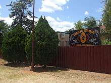
Wadja Wadja High School is a private secondary (7-12) school for boys and girls at 116 Munns Drive (24.1332°S 149.4560°E).[10][13] In 2017, the school had an enrolment of 77 students with 4 teachers and 12 non-teaching staff (9 full-time equivalent).[12]
Cape Bedford relocation
In May 1942, during World War II, a Lutheran Aboriginal mission at Cape Bedford on Cape York in far North Queensland was closed to become used as an army camp. The relocation has also been attributed to governmental fears of Aboriginal loyalty to the German Lutheran pastor and possibly against non-Aboriginal Australian interests in favour of the Japanese. The 254 Aboriginal residents, of Guugu Yimithirr identity, were forcibly relocated; initially to Townsville via road and boat, and then via train to the ironback dormitory at Woorabinda. This trip was poorly provisioned and people arrived at their end destination having been deprived of food and blankets during the winter overland trip.
There was tension between the Cape Bedford evacuees and the residents of Woorabinda, partially due to the strong Lutheran Christian beliefs held by those from Cape Bedford. However, the evacuees also experienced many cultural experiences previously unavailable to them because of the strong church presence, such as corroborees. During this time, informal Lutheran church services and ministering were maintained by the evacuees to hold onto their Christian beliefs, creating a core strength of spiritual leadership within this group. Choral singing started during this time within the Guugu Yimithirr language from translated hymns as part of their services, which became a core part of their future church identity.[14][15] They maintained a separate identity to the Woorabinda residents during the seven years they spent within the community.
Many died from sickness and exposure due to the poor sanitation and inadequate shelter from the frost and cold winter nights of the inland climate, which the Guugu Yimithirr peoples would not have previously experienced, as they were from a warm, humid coastal climate. The official number of deaths during this period was 33, but could have been up to 48. There were 13 recorded births during that time.[16][17] During their time at Woorabinda, the Cape Bedford peoples experienced paid labour and schooling for the first time.
The survivors were allowed to return to Cape Bedford in 1949, after the war, to what is now known as Hopevale. Most returned north, however, a small contingent remained, which maintained a presence and link to the north which remains to this day.
Economy
Unemployment is at 70%;[18] the nearby townships include Baralaba, 40 km away, and Taroom, which are mining towns with a hundredth of the rate of unemployment. Woorabinda has also been identified as amongst Queensland's most disadvantaged suburbs,[19] the others of which are also Indigenous townships.
Government service providers are the main source of employment, with local industry in the form of the takeaway cafe and Woorabinda Pastoral Company, owned by the council. The satellite Foleyvale Station[20] is just north of Duaringa, and is included in the Woorabinda lands used pastorally.
Alcohol Management Plan
In 2008, the community and council voted for the total ban of alcohol consumption within the town limits to become a "dry" community. The town has had a significant decrease in alcohol-fuelled violence since the Alcohol Management Plan was introduced.[21]
As of 2013, there has been ongoing movement within the community for a reintroduction of alcohol,[22] with a community-led vote majority for its reintroduction. This has been as part of a larger movement within Aboriginal communities of Queensland for Alcohol Management Plan reviews.
The town also hosts the Mimosa Creek Healing Centre, which is a detoxification and rehabilitation centre for men recovering from alcohol abuse.
Education
There are two schools in the community. One is the Woorabinda State School,[23] which includes years from prep to year seven. Woorabinda State School opened in 1928, closed in 1970 and subsequently reopened.[24] The school motto is 'Proud and Deadly'. There is a school tuck shop which runs a paid canteen from which meals can be purchased by the community. Part of the school includes the Community Indigenous Knowledge Centre,[25] an initiative of the State Library of Queensland, which is for access by the community.
High school is represented by Wadja Wadja High School,[26] which is an independent non-denominational, co-educational Aboriginal Community School. Alternatively, children are also sent by school bus to the nearby high school in Baralaba to year 10, or to boarding school.
Facilities
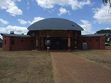
Woorabinda has a Knowledge Centre (library) operated by the Woorabinda Aboriginal Shire Council.[27]
Nations and Population
The two main groups of people in Woorabinda are the Gangulu Nation and the Wadja Nation, both of whom have Native Title claims to the land.[28][29] The area claimed for the Wadja people is limited to the Woorabinda current land geography; the Gangulu nation expands as far south as Theodore, west past Blackwater, and east to Mount Morgan.
There is a much higher proportion of people under the age of 18 in Woorabinda than in the wider non-indigenous community.[30] Half of the population is under the age of 25,[31] which is significantly higher than the Australian 0–24 years age group, which is one third of the population.[32]
Notable people
- Reggie Cressbrook, North Queensland Cowboys NRL player
- Mick Gooda, Aboriginal activist, Australian Human Rights Commission's Aboriginal and Torres Strait Islander Social Justice Commissioner
References
- Australian Bureau of Statistics (27 June 2017). "Woorabinda (SSC)". 2016 Census QuickStats. Retrieved 20 October 2018.

- "Woorabinda - town in Aboriginal Shire of Woorabinda (entry 38114)". Queensland Place Names. Queensland Government. Retrieved 17 November 2019.
- "Woorabinda - locality in Aboriginal Shire of Woorabinda (entry 49299)". Queensland Place Names. Queensland Government. Retrieved 17 November 2019.
-

- "Agency Details". www.archivessearch.qld.gov.au. Retrieved 25 April 2019.
- Woorabinda, (18 August 1927). The Capricornian (Rockhampton, Qld.: 1875 - 1929), p. 6. Retrieved 24 August 2015
- Woorabinda: Aboriginal Settlement, The Mackay Daily Mercury, p.9, Monday 15 August 1927
- Indigenous youngsters walk 200 kilometres from Taroom to Woorabinda, retracing ancestors' steps, ABC News; Marlina Whop, 10 July 2014
- Australian Bureau of Statistics (25 October 2007). "Woorabinda (L) (Urban Centre/Locality)". 2006 Census QuickStats. Retrieved 25 June 2011.
- "State and non-state school details". Queensland Government. 9 July 2018. Archived from the original on 21 November 2018. Retrieved 21 November 2018.
- "Woorabinda State School". Retrieved 21 November 2018.
- "ACARA School Profile 2017". Archived from the original on 22 November 2018. Retrieved 22 November 2018.
- "Wadja Wadja High School". Retrieved 21 November 2018.
- Rowse, Tim. "Dangers and revelations: World War II in Indigenous autobiography". Griffith Review. 48.
- Magowan, Fiona; Wrazen, Louise Josepha (2013). Performing Gender, Place, and Emotion in Music: Global Perspectives. Boydell & Brewer. ISBN 1580464645.
- Richards, Jonathan (2012). "'What a howl there would be if some of our folk were so treated by an enemy': The evacuation of Aboriginal people from Cape Bedford Mission, 1942". Aboriginal History. 46: 67–98.
- "Black Image - History". Retrieved 25 April 2019.
- "Qld town nation's worst for jobs". www.couriermail.com.au. 19 December 2013. Retrieved 25 April 2019.
- "Most disadvantaged suburbs revealed". NewsComAu. 21 July 2015. Retrieved 25 April 2019.
- Margolis, Zara (5 December 2014). "Woorabinda cattle drove underway in Central Queensland". ABC Rural. Retrieved 25 April 2019.
- Woorabinda launches five-year community plan to address jobs, violence, health issues (6 June 2015). ABC News. Accessed 25 August 2015.
- Woorabinda residents vote in favour of alcohol ban lift (26 March 2014). The Morning Bulletin. Retrieved 25 August 2015.
- Woorabinda State School
- "Opening and closing dates of Queensland Schools". Queensland Government. Retrieved 18 April 2019.
- "Woorabinda Indigenous Knowledge Centre". Retrieved 25 April 2019.
- "Wadja Wadja High School - Woorabinda". Retrieved 25 April 2019.
- "Woorabinda". plconnect.slq.qld.gov.au. State Library of Queensland. Retrieved 22 January 2018.
- Gaangalu Nation (QC2012/009), National Native Title Tribunal, retrieved 23 August 2015
- Wadja People (QC2012/010), National Native Title Tribunal, retrieved 23 August 2015
- Quarterly Report on Key Indicators, 2008; Poor health and safety in Indigenous communities revealed, National Indigenous Times, 7 June 2008
- Statistics, c=AU; o=Commonwealth of Australia; ou=Australian Bureau of (29 April 2010). "Population/People - Population/People". www.abs.gov.au. Retrieved 25 April 2019.
- Statistics, c=AU; o=Commonwealth of Australia; ou=Australian Bureau of (29 April 2010). "Population/People - Population/People". www.abs.gov.au. Retrieved 25 April 2019.
Further reading
- McIvor, Roy (2010). Cockatoo: My Life in Cape York. Stories and Art. Roy McIvor. Magabala Books. Broome, Western Australia. ISBN 978-1-921248-22-1.
External links
| Wikimedia Commons has media related to Woorabinda. |
- "Woorabinda". Queensland Places. University of Queensland.
- "Woorabinda Healing Camp" (videorecording). Red Cross. 2013.