Paracel Islands
The Paracel Islands, also known as Xisha Islands (simplified Chinese: 西沙群岛; traditional Chinese: 西沙群島; pinyin: xīshā qúndǎo; lit.: 'West Sand Archipelago')[4] and Hoang Sa Archipelago (Vietnamese: Quần đảo Hoàng Sa, lit. 'Yellow Sand Archipelago'), are a disputed archipelago in the South China Sea.
| Disputed islands Native name: 西沙群岛 西沙群島 Quần đảo Hoàng Sa | |
|---|---|
.jpg) Nautical chart of the Paracel Islands | |
| Geography | |
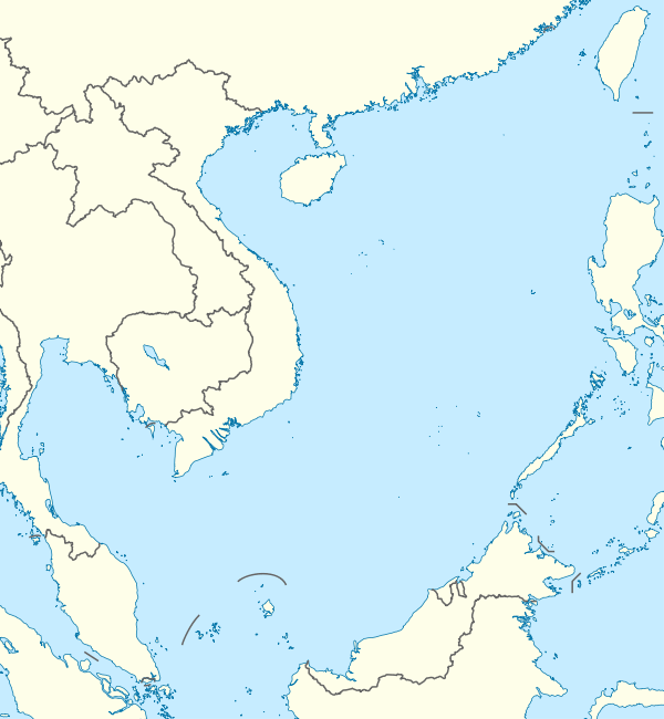 Location of the Paracel Islands within the South China Sea | |
| Location | South China Sea |
| Coordinates | 16°40′N 112°20′E[1] |
| Total islands | Over 30 |
| Major islands | Woody, Rocky, Tree, Money, Robert, Pattle, Triton, Duncan, Lincoln, Drummond |
| Area | 15,000 km2 ocean surface (7.75 km2 land surface) |
| Coastline | 518 kilometres (322 mi) |
| Highest point |
|
| Administered by | |
| People's Republic of China[2] | |
| Prefecture-level city Province | Sansha[3] Hainan |
| Claimed by | |
| Vietnam | |
| City | Da Nang |
| People's Republic of China | |
| Province | Hainan |
| Republic of China (Taiwan) | |
| Municipality | Kaohsiung |
| Demographics | |
| Population | Over 1,000 (as of 2014) |
| Ethnic groups | Chinese |
| Paracel Islands | |||||||||||||||||
|---|---|---|---|---|---|---|---|---|---|---|---|---|---|---|---|---|---|
| Chinese name | |||||||||||||||||
| Simplified Chinese | 西沙群岛 | ||||||||||||||||
| Traditional Chinese | 西沙群島 | ||||||||||||||||
| Literal meaning | Western Sandy Archipelago | ||||||||||||||||
| |||||||||||||||||
| Vietnamese name | |||||||||||||||||
| Vietnamese | Quần đảo Hoàng Sa | ||||||||||||||||
| Hán-Nôm | 群島黃沙 | ||||||||||||||||
The archipelago includes about 130 small coral islands and reefs, most grouped into the northeast Amphitrite Group or the western Crescent Group. They are distributed over a maritime area of around 15,000 square kilometres (5,800 sq mi), with a land area of approximately 7.75 square kilometres (2.99 sq mi). The archipelago is approximately equidistant from the coastlines of the People's Republic of China and Vietnam; and approximately one-third of the way from central Vietnam to the northern Philippines.[5]
The archipelago includes Dragon Hole, the deepest underwater sinkhole in the world.[6][7]
The colonial government of French Indochina set up telecommunication and weather stations on Pattle Island in the Crescent Group and Woody Island (South China Sea) ('Boisée' in French) in the Amphitrite Group in the 1930s, which they regularly supplied until 1945.[5] Later, French and Vietnamese forces landed on Pattle Island in the Crescent Group in January 1947. By 1955 South Vietnam had taken possession of the Crescent Group. This situation changed with the Battle of the Paracel Islands in January 1974 when the PRC expelled the South Vietnamese from the Paracel Islands. South Vietnam's claim to the islands was inherited by the Socialist Republic of Vietnam which has ruled all of Vietnam since 1976.
In July 2012, China (PRC) declared a city named Sansha, under Hainan Province, as administering the area.[8]
Turtles and seabirds are native to the islands, which have a hot and humid climate, abundant rainfall and frequent typhoons. The archipelago is surrounded by productive fishing grounds and a seabed with potential, but as yet unexplored, oil and gas reserves.
In February 2017, the Asia Maritime Transparency Initiative reported 20 outposts of the PRC built on reclaimed land in the Paracels, three of which have small harbours capable of berthing naval and commercial ships.[9]
Geography
- Geographic coordinates: 16°40′N 112°20′E[1]
- Coastline: 518 km (322 mi)
- Climate: tropical
- Elevation extremes:
- Lowest point: South China Sea, sea level
- Highest point: unnamed location on Rocky Island 14 m (46 ft)
- Natural resources: fish, coral reefs, possible reserves of oil and gas of unknown size
- Natural hazards: typhoons
Climate
| Climate data for Pattle Island | |||||||||||||
|---|---|---|---|---|---|---|---|---|---|---|---|---|---|
| Month | Jan | Feb | Mar | Apr | May | Jun | Jul | Aug | Sep | Oct | Nov | Dec | Year |
| Record high °C (°F) | 31.3 (88.3) |
30.8 (87.4) |
33.1 (91.6) |
34.3 (93.7) |
35.9 (96.6) |
35.9 (96.6) |
35.1 (95.2) |
35.0 (95.0) |
34.0 (93.2) |
34.1 (93.4) |
32.8 (91.0) |
30.4 (86.7) |
35.9 (96.6) |
| Average high °C (°F) | 25.7 (78.3) |
26.7 (80.1) |
28.5 (83.3) |
30.6 (87.1) |
32.1 (89.8) |
31.8 (89.2) |
31.5 (88.7) |
31.0 (87.8) |
30.4 (86.7) |
29.2 (84.6) |
27.7 (81.9) |
26.8 (80.2) |
29.3 (84.7) |
| Daily mean °C (°F) | 23.2 (73.8) |
23.9 (75.0) |
25.5 (77.9) |
27.5 (81.5) |
29.1 (84.4) |
29.2 (84.6) |
28.9 (84.0) |
28.7 (83.7) |
28.0 (82.4) |
27.0 (80.6) |
25.7 (78.3) |
24.9 (76.8) |
26.8 (80.2) |
| Average low °C (°F) | 21.7 (71.1) |
22.2 (72.0) |
23.6 (74.5) |
25.6 (78.1) |
27.1 (80.8) |
27.4 (81.3) |
27.1 (80.8) |
26.8 (80.2) |
26.1 (79.0) |
25.3 (77.5) |
24.4 (75.9) |
22.9 (73.2) |
25.0 (77.0) |
| Record low °C (°F) | 14.9 (58.8) |
18.1 (64.6) |
18.7 (65.7) |
19.1 (66.4) |
21.7 (71.1) |
23.0 (73.4) |
22.4 (72.3) |
21.0 (69.8) |
21.6 (70.9) |
21.2 (70.2) |
18.9 (66.0) |
13.8 (56.8) |
13.8 (56.8) |
| Average precipitation mm (inches) | 13 (0.5) |
12 (0.5) |
23 (0.9) |
44 (1.7) |
74 (2.9) |
117 (4.6) |
225 (8.9) |
162 (6.4) |
216 (8.5) |
241 (9.5) |
152 (6.0) |
30 (1.2) |
1,308 (51.5) |
| Average precipitation days | 7.5 | 5.5 | 4.8 | 2.4 | 6.7 | 7.1 | 7.8 | 9.0 | 11.4 | 13.3 | 14.0 | 7.9 | 97.2 |
| Average relative humidity (%) | 80.6 | 81.6 | 81.5 | 81.8 | 82.2 | 84.2 | 84.6 | 85.3 | 85.7 | 84.5 | 83.8 | 81.9 | 83.1 |
| Mean monthly sunshine hours | 207 | 226 | 248 | 276 | 298 | 245 | 238 | 245 | 193 | 223 | 191 | 199 | 2,788 |
| Source: Vietnam Institute for Building Science and Technology[10] | |||||||||||||
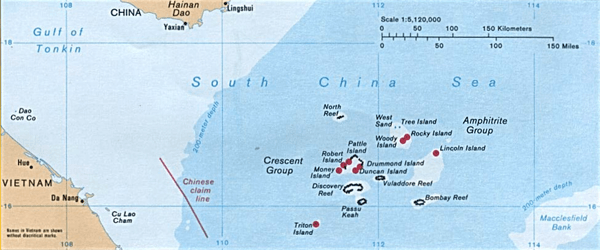
Amphitrite group
The Amphitrite group was named after the French frigate Amphitrite, which observed the islands while carrying a Jesuit mission to Canton in 1698–1700.[11][12][13]
Lying in the northeast of the Paracel Islands at 16°53′N 112°17′E,[1] the group consists of low narrow islands with sand cays, enclosed shallow lagoons connected by reefs of rock, and is about 37 km (23 mi) northwest of Lincoln Island. The group approximately forms an ellipse with a north–south axis of 22 km (14 mi).
The northern section of the group comprises West Sand, Tree Island and the Qilian Yu sub-group (The "Seven Sisters": North Island, Middle Island, South Island, North Sand, Middle Sand, South Sand and two small "sands".) The centre of the group consists of Woody Island and Rocky Island, approximately 5 km (3 mi) south of the southern tip of the eastern extremity of the northern section. The southwest corner of the group is occupied by the Iltis Bank.
The largest island of the Paracels, Woody Island (which has an area of 213 ha (530 acres)), has over 1,000 residents[14] including fishermen and their families, military personnel and civilian administrators.[15]
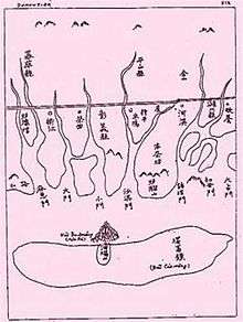
Crescent group

Lying about 70 km (43 mi) southwest of the Amphitrite group, at 16.5°N 111.7°E, the Crescent group consists of islands and reefs that form a crescent-like structure from west to east, enclosing a deep central lagoon. The group measures 31 by 15 km (19 by 9 mi) east-west and north–south. All of the islands in the group support vegetation except on their small cays.
The islands are named after former senior figures in the British East India Company (EIC). Three were members of the EIC's 'Select Committee' in Canton: James Drummond, Thomas Pattle and John William Roberts. Jonathan Duncan was Governor in Council of Bombay, and William Taylor Money was Superintendent of the Bombay Marine.
Money Island lies at the southwest extremity of the group, and has some small cays on the southern side. The Chinese name for Money Island, Jin Yin Dao, is simply the translation of the English name.
Antelope Reef, submerged at high tide and containing a central lagoon, lies 2.4 km (1.5 mi) east of Money Island.
Northeast of this are Robert Island (also named Round Island) and Pattle Island, separated from each other by a 3.5 km (2.2 mi) wide deep channel. A weather station was built on Pattle Island (by the French) in 1932, and a lighthouse and radio station in 1937.
Northeast of this is Quanfu Dao ("All Wealth Island").
Observation Bank, also named Silver Islet, and the Lesser Silver Islet, are the northernmost of the group and contain a small cay.
Just south of them are Yagong Dao (He Duck) and Xianshe Yu (Salty Hut).
At the eastern side of the group lies a 12 km (7 mi) long boomerang shaped reef with Stone Islet at its north end and Drummond Island at its south end.
The Duncan Islands (16°27′N 111°43′E[1]), consisting of Duncan Island and Palm Island, lie approximately 3 km (2 mi) west of Drummond Island and about 8 km (5 mi) east of Antelope Reef. Kuangzai Shazhou (Little Basket) lies about halfway between Palm Island and Antelope Reef.
Other features
Taking 16°40′N 112°20′E as the centre of the Paracel Islands, then the Amphitrite Group is ENE, and the Crescent Group is West.
Southeast
- Bombay Reef: This elongated reef is situated at the southeastern corner of the Paracel Islands (16°N 112.5°E) and lies approximately 90 km (56 mi) southeast of the Crescent group. With most parts submerged, the reef measures approximately 18 by 5 km (11 by 3 mi) (E-W by N-S). Bombay Reef encloses a deep lagoon with rocks on its edge.
Eastern sub-group
- Bremen Bank: Located 24 km (15 mi) north of Bombay Reef (16.3°N 112.5°E), is the southwestern-most feature of this subgroup. This submerged shallow bank measures approximately 23 km (14 mi) in length from northeast to southwest. The shallowest area reaches a depth of about 12 metres (39 ft) and is located in the southwestern part of the bank.
- Jehangire Bank: East of the Bremen Bank at 16.3°N 112.7°E
- Neptuna Bank: North of the Bremen Bank at 16.5°N 112.5°E
- Pyramid Rock: NE of the Neptuna Bank at 16.6°N 112.6°E
- Lincoln Island: Surrounded by a coral reef, located 37 km (23 mi) southeast from the Amphitrite Group at 16.7°N 112.7°E, the island is covered with brushes and fairly high trees, including coconut palm trees. The depth increases sharply on the northern and eastern sides of the island but the southern and south western regions are shallow. An observation post on the western side was found by officers of the German government surveys in 1883. In 1948, Great Britain requested France for permission to use the feature for military exercises.
Northeast
- Dido Bank: Separate from, and NE of, the Eastern sub-group at 16°49′N 112°53′E[1]
(ENE: Ampitrite group)
Northwest
- North Reef: Situated approximately 56 km (35 mi) north from the Crescent group and about 70 km (43 mi) west-northwest from the Amphitrite group at 17.1°N 111.5°E,[1] the reef is the most northwesterly feature of the Paracel Islands. Most parts of the reef are submerged. There are rugged rocks are around the edge that are barely above water. There is a passage into the lagoon on the southwestern side of the reef.
(West: Crescent group)
Inner southwest
- Discovery Reef: Measuring approximately 27 km (17 mi) in length from east to west, and 7 km (4 mi) from north to south, the reef is located about 18 km (11 mi) south of the Crescent Group at 16.25°N 111.7°E. Completely submerged, the elongated ring structure is the largest single reef in the Paracel Islands. The reef has two large, deep openings into the lagoon on its southern side. In the ocean nearby is Dragon Hole the deepest known sinkhole in the world.[6][7]
- Passu Keah: This small reef encloses a shallow lagoon and is located about 12 km (7 mi) south of the eastern side of Discovery Reef at 16.1°N 111.8°E, approximately 37 miles (60 km) east-northeast from Triton Island. The sand cay measures 9 km (6 mi) in length.
Outer southwest
- Triton Island: The sand cay supports vegetation and stands on a steep-sided coral reef measuring 1.5 km (1 mi) in length. This southwesternmost island of the Paracels is situated about 56 km (35 mi) from Discovery Reef at 15.8°N 111.2°E.
Central
- Vuladdore Reef: Located slightly south of the centre of the group at 16.3°N 112°E, this mostly submerged reef is orientated east–west and measures approximately 12 km (7 mi) by 3 km (2 mi). Some small spiral rocks are to be seen on the reef.
List of entities
| English name | Chinese name | Vietnamese name | Coordinates | Area (ha) |
Height (m)[16][1] |
Location / notes |
|---|---|---|---|---|---|---|
| Amphitrite group | Xuande Qundao (宣德群島) | Nhóm An Vĩnh | 16°53′N 112°17′E | ENE [1] | ||
| Woody Island | Yongxing Dao (永興島) | Đảo Phú Lâm | 16°50′N 112°20′E | 210 | ? | Centre of Amphitrite group [1] |
| Rocky Island | Shidao (石島) | Đảo Đá | 16°50′40″N 112°20′50″E | 8 | 14 | Connected to (NE of) Woody Is.[1] |
| West Sand | Xisha Zhou (西沙洲) | Cồn cát Tây | 16°58′39″N 112°12′43″E | 4 | 0 | NW of Amphitrite group |
| Tree Island | Zhaoshudao (趙述島) | Đảo Cây | 16°58′48″N 112°16′16″E | 22 | 0 | N of Amphitrite group [1] |
| ("Seven Sisters") | Qilian Yu Subgroup(七連嶼) | NE of Amphitrite Group | ||||
| North Island | Bei Dao (北島) | Đảo Bắc | 16°57′50″N 112°18′34″E | 4 | 0 | N1 of Seven Islets [1] |
| Middle Island | Zhong Dao (中島) | Đảo Trung | 16°57′18″N 112°19′28″E | 13 | 0 | N2 of Seven Islets |
| South Island | Nan Dao (南島) | Đảo Nam | 16°56′47″N 112°20′04″E | 17 | 0 | N3 of Seven Islets |
| North Sand | Bei Shazhou (北沙洲) | Cồn cát Bắc | 16°56′16″N 112°20′30″E | 2 | 0 | N4 of Seven Islets |
| Middle Sand | Zhong Shazhou (中沙洲) | Cồn cát Trung | 16°56′03″N 112°20′37″E | 5 | 0 | N5 of Seven Islets |
| South Sand | Nan Shazhou (南沙洲) | Cồn cát Nam | 16°55′45″N 112°20′45″E | 6 | 0 | N6 of Seven Islets [1] |
| (New West Sand) | Xixin Shazhou (西新沙洲) | - | 16°55′N 112°19′E | 0.2 | 0 | N7a of Seven Islets (7W) |
| (Sth S Sand) | Dongxin Shazhou (东新沙洲) | - | 16°55′24″N 112°20′45″E | 0.4 | 0 | N7b of Seven Islets (7E); South of South Sand |
| Iltis Bank | Yin Shuo Tan (銀铄滩) | Bãi Bình Sơn | 16°46′N 112°13′E | -10 | SW of Woody Island [1] | |
| Crescent group | Yongle Qundao (永樂群島) | Nhóm Lưỡi Liềm | 16°30′N 111°40′E | |||
| Money Island | Jinyin Dao (金銀島) | Đảo Quang Ảnh | 16°26′52″N 111°30′30″E | 36 | 6 | W end of Crescent group[1] |
| Antelope Reef | Lingyang Jiao (羚羊礁) | Đá Hải Sâm | 16°27′N 111°35′E | 0 | W Crescent Group, S of Robert Is.[1] | |
| Robert Island (Round Island) | Ganquan Dao (甘泉島) | Đảo Hữu Nhật | 16°30′20″N 111°35′07″E | 30 | 8 | W of Crescent group; Has a well |
| Pattle Island | Shanhu Dao (珊瑚島) | Đảo Hoàng Sa | 16°32′02″N 111°36′25″E | 31 | 9 | N of Robert Island [1] Has a well |
| (All Wealth) | Quanfu Dao (全富島) | Đảo Ốc Hoa | 16°34′29″N 111°40′24″E | 2 | 0 | NE of Pattle, SW of Observation Bank |
| Observation Bank (Silver Islet) | Yin Yu (銀嶼) | Bãi Xà Cừ | 16°34′50″N 111°42′30″E | 1 | 0 | NE of Crescent group |
| (Lesser Silver Islet) | Yinyu Zi (銀嶼仔) | - | 16°34′45″N 111°42′15″E | 0.2 | 0 | SE of Silver Islet |
| (He Duck) | Yagong Dao (鴨公島) | Đảo Ba Ba | 16°34′00″N 111°41′11″E | 1 | 0 | SW of Observation Bank |
| (Salty Hut) | Xianshe Yu (咸舍嶼) | (Đá Trà Tây?) | 16°32′N 111°42′E | 0 | SW of Observation Bank, W of Stone Islet | |
| (Stone Islet) | Shi Yu (石嶼) | (Đảo Lưỡi Liềm?) | 16°30′N 111°46′E | 0.2 | 0 | E of Crescent group |
| Drummond Island | Jinqing Dao (晉卿島) | Đảo Duy Mộng | 16°27′50″N 111°44′30″E | 21 | 3 | E of Crescent group |
| Duncan Island | Chenhang Dao (琛航島) | Đảo Quang Hòa | 16°27′05″N 111°42′45″E | 48 | ? | S of Crescent group[1] |
| Palm Island | Guangjin Dao (廣金島) | Đảo Quang Hòa Tây | 16°27′04″N 111°42′07″E | 6 | ? | S of Crescent group[1] |
| (Little Basket) | Kuangzai Shazhou (筐仔沙洲) | - | 16°26′49″N 111°36′24″E | 1 | 0 | SE of Antelope Reef |
| Eastern sub-group | ||||||
| Bremen Bank | Binmei Tan (濱湄灘) | Bãi Châu Nhai | 16°20′00″N 112°25′40″E | -11 | Eastern sub-group | |
| Jehangire Bank | Zhanhan Tan (湛涵灘) | Bãi Quảng Nghĩa | 16°19′40″N 112°41′10″E | -12 | Eastern sub-group | |
| Neptuna Bank | Beibian Lang (北邊廊) | Bãi Thuỷ Tề | 16°30′50″N 112°32′42″E | -15 | Eastern sub-group | |
| Pyramid Rock | Gaojian Shi (高尖石) | Hòn Tháp | 16°34′36.5″N 112°38′32.5″E | 4 | 5 | Eastern sub-group [1] |
| Lincoln Island | Dong Dao (東島) | Đảo Linh Côn | 16°40′N 112°44′E | 160 | 5 | Eastern sub-group [1] "Water can be found on the island" |
| Other features | ||||||
| Discovery Reef | Huaguang Jiao (華光礁) | Đá Lồi | 16°13′52″N 111°41′35″E | -4 | Inner SW [1] | |
| Passu Keah | Panshi Yu (盤石嶼) | Đảo Bạch Quy | 16°03′24″N 111°45′42″E | 40 | 0 | Inner SW, S of Discovery Reef[1] |
| Herald Bank | Songtao Tan (嵩燾灘) | Bãi Ốc Tai Voi | 15°43′N 112°13′E | -236 | ESE | |
| Bombay Reef | Langhua Jiao (浪花礁) | Đá Bông Bay | 16°02′41″N 112°31′06″E | 0 | SE [1] | |
| Vuladdore Reef | Yuduo Jiao (玉琢礁) | Đá Chim Én | 16°20′50″N 112°01′30″E | 0 | Central | |
| Dido Bank | Xidu Tan (西渡灘) | Bãi Gò Nổi | 16°49′N 112°53′E | -23 | NE [1] | |
| North Reef | Bei Jiao (北礁) | Đá Bắc | 17°05′25″N 111°30′13″E | 0 | NW [1] | |
| Triton Island | Zhongjian Dao (中建岛) | Đảo Tri Tôn | 15°47′N 111°12′E | 120 | 3 | Outer SW [1] |
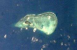
Satellite images
 Money Island
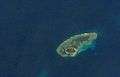 Pattle Island
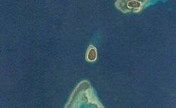 Robert Island
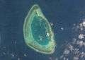 Antelope Reef
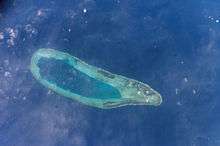 Bombay Reef
 Bremen Bank
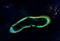 Discovery Reef
 Iltis Bank
 Lincoln Island
 North Reef
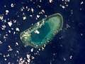 Passu Keah Reef
 Triton Island
Etymology
Hoàng Sa
The Vietnamese call the islands Hoang Sa, (黃沙 or Yellow Sands), and this name is found in historic Vietnamese documents dating back to 1483, included "An Nam quốc họa đồ" which was published in 1490.[17] In the modern language system it is written as Hoàng Sa or Cát Vàng. They all have the same meaning — the Yellow Sands or the Yellow Sandbank. Before the early 19th century, the present-day Spratly Islands were treated as features of Hoàng Sa.[18][19] It was not until the reign of Emperor Minh Mạng (1820–1841) that the Spratlys were distinctly delineated and officially named Vạn Lý Trường Sa (萬里長沙), the Ten-thousand League-long Sandbank.[20][21]
Xisha and other Chinese names
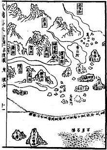
The Chinese name Xisha (西沙), literally "western sands" or "shoals", is a name adopted in the 20th century to distinguish it from the "eastern sands" (the Dongsha or Pratas), the "southern sands" (the Nansha or Spratlys), and the "central sands" (the Zhongsha or Macclesfield Bank). Prior to that, there had been no consistent designation of these islands in early Chinese sources, with names such as Changsha, Shitang, Shichuang and others being used for Paracel and Spratly inconsistently.[23] In the 14th century Song Dynasty work Zhu fan zhi by Zhao Rugua, the names Qianli Changsha (千里長沙, lit. "Thousand mile-Long Sands") and Wanli Shichuang (萬里石床 lit. "Ten-thousand mile-Rock Bed") were given, interpreted by some to refer to Paracel and Spratly respectively, but opinions differed.[24] The Yuan dynasty work Daoyi Zhilüe by Wang Dayuan considers that Shitang (石塘) to be the same as Wanli Shitang (萬里石塘, lit. "Ten-thousand mile-Rock Embankment"), which starts from Chaozhou and extends to Borneo, west to Côn Sơn Island off Vietnam and down as far as Java.[25] The History of Yuan uses the terms Qizhouyang (七洲洋, "The Ocean of Seven Islands") and Wanli Shitang, which are taken to mean Paracel and Spratly respectively.[25][26] In the Mao Kun map from the Zheng He's voyage of the early 15th century, groups of islands were named as Shitang (石塘), Wansheng Shitangyu (萬生石塘嶼), and Shixing Shitang (石星石塘), with Shitang (sometimes including Wansheng Shitangyu) being taken by some to mean Paracel.[27][28] Another Ming text, Haiyu (On the Sea), uses Wanli Shitang to refer to Paracel and Wanli Changsha for Spratly.[28]
During the Qing dynasty, a set of maps refer to Paracel as Qizhouyang (Shitang became Spratly, and Changsha became Zhongsha), while a book Hai Lu (Illustrations of the Sea) refers to Paracel as Changsha and Spratly as Shitang. A sea chart prepared in the Daoguang era, Yiban Lu (Particular Illustrations) by Zheng Guangzu, uses Xisha to refer to Paracel.[29] Xisha became the standard name used in China in the 20th century, and was used in 20th century maps published by the Republic of China, for example in 1935,[30] and the 1947 11-dash line map which claimed Paracel and Spratly as its territories.[31]
Pracel and Paracel
_China%2C_Formosa_(Taiwan)_and_Luzon_(Philippines)_-_Geographicus_-_Formosa-bonne-1771.jpg)
The name 'Paracel' is found in the first Portuguese maps of the region. The Portuguese, whose vessels frequented the South China Sea as early as at the beginning of the 16th century, were the first to refer to these islands as 'Ilhas do Pracel' in the 16th century.
Regarding the likely origin of the term Paracel, the word is a variant of the more common form pracel or parcel, from the Spanish: placer,[32] which was used by the Portuguese and Spanish navigators to designate shallow sandy seas or submerged banks, such as Placer de los Roques.[33]
Pracel is a moderately elevated chain of islets, sandbanks, and reefs. These features are continuously distributed and stretched over a noticeable distance of tens or hundreds of kilometers in length. Pracel may not be a suitable place for human residents, but its irregular depth creates an ideal environment inhabited by fish. Pracel often forms a natural bulwark as an outer line of defense for a coast or a land.[34]
The Portuguese were later followed by the Dutch, the English, the Spanish, and the French in the waters of the island group. On the "Map of the coast of Tonquin and Cochinchina", made in 1747 by Pierre d'Hondt, the dangerous band of rugged rocks was labeled "Le Paracel", a French phonetic notation. Because of their location on an important seaborne route the Paracel Islands drew much attention from navigators and hydrographers in the Age of Exploration. Disputes in the area since the Second World War have again drawn attention to the islands.
On the "Map of Europe, Africa and Asia" published in 1598 by Cornelis Claesz, an unnamed band of rocks and sandbanks are shown near the present-day location of the Paracel and Spratly Islands. About two decades later, the names Pracel and Costa de Pracel (Coast of Pracel) appeared on the Chart of Asia and eight city maps published in 1617 by Willem Jansz Blaeu, a Dutch map maker. The coast belonged to the Kingdom of Cauchi China.[34][35]
East India Company
The islands were first scientifically surveyed by Daniel Ross of the British East India Company in 1808.[36] The names of Duncan, Drummond, Money, Pattle and Roberts islands were all chosen in honour of senior figures in the East India Company.
Infrastructure and natural resources
Infrastructure
The PRC is investing millions in infrastructure and development to support its territorial claims over the archipelago, and as a result there has been, and continues to be, a lot of construction activity. In recent years Woody Island has acquired an upgraded airport, an upgraded sea port, and a city hall. A primary school for children of construction workers and troops stationed there is planned.[37]
Fresh water
There is limited supply of fresh water on the islands. In 2012, it was reported that China (PRC) planned to build a solar-energy-powered desalination plant on the islands.[38] In 2016, it was reported that the first desalination plant was activated.[39] On most of the islands controlled by China in the South China Sea, drinking water comes in barrels together with other supplies from small boats, making it as scarce as fuel.
With the activation of a desalination plant on China's most militarized South China Sea outpost, Beijing improves its troops ability to endure longer during conditions that may have otherwise deprived them of important supplies at sea, including drinking water. In due time, desalination facilities may make their way to China's artificial islands in the Spratly group.
Electricity
Both wind and solar powered facilities exist to supply electricity on the islands.
Communication
There is a post office, hospital, bank and hostel on Woody Island. The Chinese postal zip code of the island is 572000, and the telephone area code is +86 (898).
Transport
There is an airport on Woody Island with a 2,400 metres (7,900 ft) long runway, which can handle take-offs and landings of Boeing-737s or planes of similar size. Flight services operate on the Haikou – Xisha route. There are three main roads on Woody Island as well as an 800 metres (2,600 ft) long cement causeway that connects Woody Island and Rocky Island. Extensive port facilities have been constructed on Duncan Island.

Ecology and tourism
Paracel Islands' geographical and ecological traits are often likened as "China’s Maldives", however, controversial conflicts between environment conservation and human activities including military operations, developments, and tourism on Paracel Islands have become public concerns in recent years.[40] Local ecosystem include endangered fish such as whale sharks, oceanic birds, marine mammals (at least historically) such as blue whales, fin whales, and Chinese white dolphins, and marine reptile species such as critically endangered green sea turtles, hawksbill sea turtles, and Leatherback sea turtles;[41] however, direct damaging of the ecosystem by military group and tourists has been documented.[42] Governmental actions to cease illegal tourism are ongoing.[43]
The islands have been open for tourists since 1997.[44] Chinese tourists can take a 20-hour ferry to the Islands, paying up to US$2,000 for a 5-day cruise, and are placed on a long waitlist before being accepted.[45] The BBC article states that "Chinese tourism has strong political implications, as the Chinese tourists are being used as 'foot soldiers of China' by Beijing to further China's territorial claims there". The video also states "Vietnam is considered unlikely to send military vessels to stop them".[45]
There are two museums on Woody Island; a Naval Museum and a Maritime Museum. In April 2012, the Vice-Mayor and officials from the Haikou Municipal Government made several announcements about developing new docking facilities and hotels within the Crescent Group - on Duncan and Drummond Islands specifically.[46] Promotion of the naturally unspoilt reef system was cited as the driver for new tourism potential with other such reefs, such as the Great Barrier Reef in Australia, now placed under threat of extinction due to human activities.[47] However, according to The China Post, this was denied by a PRC Government official in April 2012, due to sensitivities surrounding the islands.[48]
Territorial disputes and their historical background
After the 1884–1885 Sino-French War, in an international context, France officially gained control of Annam and Tonkin as protectorates and fully established French colonial rule in Vietnam by signing a number of treaties with Chinese and Vietnamese governments including Tientsin Accord, Treaty of Huế (1884) and Treaty of Tientsin (1885). Article 2 of the Treaty of Tientsin (1885) forced China to stop any claims to suzerainty all over Vietnam. Therefore, the French also took over the control of the Paracel Islands which were under the Nguyễn dynasty's administration, still nominally ruled Annam at the time.[49]
Between 1881 and 1883 the German navy surveyed the islands continuously for three months each year without seeking the permission of either France or China. No protest was issued by either government and the German government published the results of the survey in 1885.[50] In 1932, France nonetheless formally claimed both the Paracel and Spratly Islands. China and Japan both protested. In 1933, France seized the Paracels and Spratlys, announced their annexation, formally included them in French Indochina, and built a couple of weather stations on them, but did not disturb the numerous Chinese fishermen it found there. In 1941, the Japanese Empire made the Paracel and Spratly islands part of Taiwan, then under its rule.
After the communists gained control of China in 1949, they occupied Woody Island, the main island of the Amphitrite group and the only island that was occupied at the time. Pattle Island in the Crescent group, on the other hand, was taken by French Indochina and then controlled by South Vietnam following independence in 1956. Tensions over the islands have continued to rise unceasingly since then.[51]
UNCLOS EEZ
The Paracel islands are claimed by both China and Vietnam and the majority of those islands lie within 200 NM of China's and Vietnam's geographic baseline.[52]
Military engagement
In 1974, the political and diplomatic dispute over the islands became an armed conflict between China and South Vietnam. On January 16, South Vietnamese naval officers and an American observer reported to Saigon some suspected military activities of the Chinese navy on the Drummond and Duncan islands. After receiving the report, the government of South Vietnam decided to counter the Chinese forces, to defend the South Vietnamese-controlled section (the western half of the Paracels) from Chinese occupation,[53] and sent a unit of frigates to the area. On January 19, there were sea and land battles between the Chinese and Vietnamese forces with casualties on both sides. At the end, the Chinese fleet defeated the naval force of South Vietnam. With the ongoing civil war with the Viet Cong embroiling South Vietnam's attention and the absence of the USA's support, no military attempt was made to re-engage the PRC over the islands. After the military engagement and the subsequent victory, the PRC gained the entire archipelago and has taken control of Paracel Islands ever since. It was a significant turning point for the PRC but the sovereignty dispute on the islands remains unresolved with Vietnam.
Historical perspectives
Vietnam
5th–17th centuries
- 1460–1497, under the reign of Emperor Lê Thánh Tông of the Lê dynasty (1428–1789), the Vietnamese began conducting commercial activities on and around Hoàng Sa, including harvesting abundant sea-products and conducting salvage operations on shipwrecks.[17]
- In 1634, during year 5th of Emperor Đức Long of Vietnam (1629–1635), the ship Grootebroek of the Dutch East India Company sank in the vicinity of the Paracel archipelago. Using a small boat, captain Huijch Jansen and 12 sailors managed to reach Đàng Trong, territory of Lord Nguyễn Phúc Nguyên (1613–1635), to seek rescue for other castaways remained on the islands.[54]
- 1680–1705, Lord Trịnh Căn of Tonkin instructed Đỗ Bá Công Đạo to publish Thiên Nam tứ chí lộ đồ (天南四至路圖), an encyclopedia consists of 4 series of maps that detail routes from Thăng Long, capital of Đại Việt, to other countries in the Southeast Asia. Part of this work was based on the Hồng Đức Atlas (Hồng Đức Bản Đồ) developed during the time of Emperor Lê Thánh Tông (1460–1497). This encyclopedia was considered one of the oldest and rarely preserved Vietnamese documents regarding the islands. The volume "Đường từ phủ Phụng Thiên đến Chiêm Thành" (The Route to Champa from Phụng Thiên Province), remarkably described the archipelago with maps. For instance, a statement found in the volume read "In the middle of the sea, there is a long sandbank called Bãi Cát Vàng, which is approximately 400-league long and 20-league wide rising up above the sea." Bãi Cát Vàng means Hoàng Sa, Golden Sandbank.[17][55]
- In the 18th century, under instructions of the Nguyễn Lords, the salvage operations officially started with the formation of Hoàng Sa and Bắc Hải Companies. Their responsibility was to carry out the mission at Hoàng Sa (Golden Sandbank) and Vạn Lý Trường Sa (Ten-thousand-league Long Sandbank) respectively. This effort was continued thereafter with successive establishments of other naval task units in accordance with strategic policies toward the two archipelagos under the Nguyễn dynasty. Noticeably, a number of naval battles between the Dutch fleet and the Nguyễn Royal Navy occurred in 1643 and 1644. The Hoàng Sa naval task unit consisted of 70 men recruited from An Vĩnh and An Hải villages of Quảng Ngãi, while the majority of members of the Bắc Hải Company came from Bình Thuận province.[17][20][56][57]
1700–1799
- In 1776, the Phủ Biên Tạp Lục (撫邊雜錄), the Miscellaneous Records on the Pacification of the Frontiers, published by Lê Quý Đôn, a philosopher, an encyclopaedist, and a Minister of Construction during the Lê dynasty (1428–1789). These six volumes detail the Nguyễn dynasty's territories, including the exploitation of the Paracel and Spratly Islands from 1702 onwards.[17][56][57]
- 1777–1784, when traveling to Cochinchina, Father Jean-Baptiste Grosier recorded his impression about maritime activities of the Vietnamese from Huế, Đà Nẵng, and Quảng Ngãi. The abbot Grosier wrote that the people from those ports were excellent and cleverest navigators in this Kingdom. One of their activities was making long-distance sailing every year to the long chain of islands and rocks known as the Paracels to collect debris from shipwrecks.[58]
1800–1899
- 1802–1820, under the reign of Emperor Gia Long, the territory of his kingdom included Tonkin, Cochin China, part of Cambodia, and "certain islands off the coast including the well known Paracels which bear such an evil reputation as a source of danger to navigation in the China Seas."[59]
- In 1807, the East India Company sent Captain Daniel Ross to Cochinchina to survey the Paracel Islands. Upon arriving to the kingdom, he presented a letter of introduction entrusted by the English company to the reigning king, who was believed to be Emperor Gia Long at that time.[60] Subsequently, Captain Ross completed chartering the south coast of China in 1807, the Paracel Islands in 1808, part of the coast of Cochin China in 1809, and the coast of Palawan in 1810. Most notably, in his surveys published in 1821 under the title "(South) China Sea, Sheet I & II", the Spratly Islands was referred to as The Dangerous Ground, and was later renamed as Storm Island on the 1859 edition of the chart.[61] Separately, in another document, the "Correct Chart of the China Sea", published by Herbert in 1758, the Paracel archipelago was described as a long group of islands and reefs extending from 13 to 17 degrees North, which approximately correspond to the geographic latitudes of the present-day Spratly and Paracel Islands, respectively.[61] It is quite clearly that the captain himself, and probably most navigators of his time, did not differentiate the two archipelagos, but instead had delineated the present-day Spratly Islands as part of the Paracels. Captain Daniel Ross was a well known hydrographer of the Navy of Government of English Bengal and founder of the Bombay Geographical Society.[62]
- In 1815, Emperor Gia Long ordered Phạm Quang Anh's Hoàng Sa naval task unit to sail to the islands to make surveys and report on maritime routes and draw up maps.[57][63]
- In 1816, according to Jean-Baptiste Chaigneau, Emperor Gia Long officially claimed the sovereignty of the Paracel Islands, which would include the present-day Spratly archipelago. These two islands were later delineated distinctly under the reign of his successor, Emperor Minh Mạng. Chaigneau was one of the most respected advisors to Emperor Gia Long. He spent more than 30 years in Cochinchina and became the first French Consul to this kingdom in 1821.[64]
- In 1821, the Lịch triều hiến chương loại chí (歷朝憲章類誌) published by Phan Huy Chú, a historian, an encyclopaedist, and an officer of the Ministry of Construction in the time of emperor Minh Mạng. This remarkable work was prepared in 10 years (1809–1819) and consisted of 10 volumes. One of them, the Địa Dư Chí volume, details territories of Dai Nam Kingdom. In 1838, he published the Đại Nam Thống Nhất Toàn Đồ, the Unified Đại Nam Complete Map, that distinctly delineated Vạn Lý Trường Sa (the Ten-thousand-league Long Sandbank) and Hoàng Sa (the Golden Sandbank).[20]
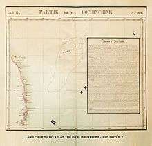
- In 1827, a world atlas produced by Belgian geographer Philippe Vandermaelen was published in Belgium. Vietnam was described by four maps in this atlas. One of these maps has the title "Partie de la Cochinchine", in which Paracel Islands was included, indicating that it was part of Cochinchine (southern Vietnam region). The map also featured geography, politics, minerals and statistics about the Empire of An Nam (former name of Vietnam). Moreover, the map titled "Partie de la Chine" in the atlas had identified Hainan Island as the southernmost point of China at that time.[65]
- In 1833, Emperor Minh Mạng ordered Ministry of Construction to build a temple, erect steles, and plant many trees on the islands for navigation purposes.[57][63]
- In 1834, Emperor Minh Mạng ordered Trương Phúc Sĩ, a naval task unit commander, accompanied by 21 men sailing to the islands to survey and draw map of Hoàng Sa.[17]
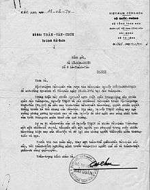
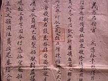
- In 1835, Emperor Minh Mạng issued a royal ordinance to order 24 troops to the Paracel Islands. The royal ordinance has been preserved by generations of Đặng family and was publicly disclosed in early 2009.[66]
- In 1835, the King ordered Phạm Văn Nguyên's naval task unit, accompanied by workers from Bình Định and Quãng Ngãi provinces, to build Hoàng Sa temple with a wind screen and erect steles on Bàn Than Thạch (Bàn Than Rock) of the present-day Woody Island. The mission was completed in 10 days. Notably, about 33m southwest from the erection, there was a little ancient temple where a stele engraved with the words "Vạn Lý Ba Bình" found. This inscription means Ten Thousand Leagues of Calming Waves. The date of the actual erection of the ancient temple remains unknown[57][63]
- In 1836, Emperor Minh Mạng received a report from his Ministry of Construction that recommended a comprehensive survey of all the East Sea islands because of their "great strategic importance to our maritime borders."[57][67] The King ordered Phạm Hữu Nhật, a royal navy commander, to erect a wooden stele on the islands. The post was engraved with the following inscription: The 17th of the reign of Minh Mạng by the royal ordinance commander of the navy Phạm Hữu Nhật came here to Hoàng Sa for reconnaissance to make topographical measurements and leave this stele as record thereof.[57][63]
- In 1838, Bishop Jean-Louis Taberd published the "Latin-Annamese Dictionary". The dictionary contains the "An Nam Đại Quốc Họa Đồ" (The Great Annam Map). In the neighborhood of the present-day coordinate of the islands, words found on the map read "Paracel seu Cát Vàng" (Paracel or Cát Vàng). Cát Vàng means Hoàng Sa, Golden Sands or Golden Sandbank.[21]
- In 1842, Hai Lu Do Chi, a historical Chinese document was written in the 22nd year of the reign of the Daoguang Emperor (1820–1850) of the Qing dynasty (1644 to 1912) of China. A statement found in this book read: Wang Li Shi Tang (万里石塘) is a sandbank rising above the sea. Several thousand leagues in length, it forms a rampart on the periphery of the Kingdom of Annam. Wang Li Shi Tang means Ten-thousand-league Long Sandbank.[57]
- In 1858, Napoleon III ordered French troops to attack Tourane, the present-day Đà Nẳng city. Subsequently, France launched more attacks and forced Cochin China and some provinces in the South to become her colonies. French Indochina was formed in 1887 and consisted of Tonkin, Annam, Cochin China, and Cambodia.
- The 1887 Chinese-Vietnamese Boundary convention signed between France and China after the Sino-French War stated that China was the owner of the Spratly and Paracel islands.[68]
- 1895–1896, German vessel Bellona and Japanese ship Himeji Maru[69] sank at the islands. Chinese fishermen looted and resold them at Hainan. These countries protested but local Chinese authorities, the Governor of Liang Guang, denied any responsibilities on the ground that the Paracels were abandoned and belonged to neither country.[57]
China
618–1279
| Wikisource has original text related to this article: |
There are some Chinese cultural relics in the Paracel islands dating from the Tang and Song eras,[70][note 1] and there is some evidence of Chinese habitation on the islands during these periods.[71] According to the Wujing Zongyao, a book published in the Northern Song dynasty in 1044, the Song government then included the Islands in the patrol areas of the Navy of the Court.[72]
1279–1368
In 1279, the Yuan dynasty emperor sent the high-level official and astronomer, Guo Shoujing, to the South China Sea to survey and measure the islands and the surrounding sea area. Guo's base of survey was located in the Paracel Islands. His activities were recorded in the Yuan Shi, or History of Yuan. According to the Yuan Shi, the South China Sea islands were within the boundary of the Yuan dynasty. Maps published in the Yuan era invariably included the Changsha (the Paracels) and the Shitang (the Spratlys) within the domain of Yuan.
| Wikisource has original text related to this article: |
1368–1912
Relevant local annals and other historic materials of the Ming (1368–1644) and the Qing (1644–1912) dynasties continued to make reference to the South China Sea islands as China's territory. The Qiongzhou Prefecture (the highest administrative authority in Hainan), exercised jurisdiction over the Paracel and Spratly Islands in the Ming and Qing Dynasties.
In the 19th century, Europeans found that Chinese fishermen from Hainan annually sojourned on the Paracel and Spratly Islands for part of the year.[73][74] For three months each year between 1881 and 1884, the German Imperial Navy sent two boats (the ship Freya and the warship Iltis) to study and map the Paracel Islands without either seeking the permission of or incurring protest by the Chinese government. This mission was finished without any problems and the German Admiralty published the results in 1885 in a document called “Die Paracel-Inseln” (The Paracel Islands).[50]
In 1909, Zhang Renjun (Chinese: 張人駿), the Viceroy of Liangguang, ordered Guangdong Fleet Admiral Li Zhun (李準) to sail to the Paracel Islands. In June, with over 170 sailors in three warships named Fubo (伏波號), Guangjin (廣金號) and Shenhang (琛航號), he inspected 15 islands, erected stone tablets engraved with each island's name, raised China's flag and fired cannons to declare the islands "sacred territory of China",[75] which France did not protest.[76] In 1910, the Qing government decided to invite Chinese merchants to contract for the administration of the development affairs of the South China Sea islands, and demanded that officials shall provide protection and maintenance in order to highlight Chinese territory and protect its titles and interests.[77]
1912–1950s
After the fall of the Qing dynasty, the new Government of Guangdong Province decided to place the Paracel Islands under the jurisdiction of the Ya Xian County of Hainan Prefecture in 1911. The Southern Military Government in 1921 reaffirmed the 1911 decision. China continued to exercise authority over the South China Sea islands by such means as granting licenses or contracts to private Chinese merchants for the development and exploitation of guano and other resources on those islands and protesting against foreign nations' claims, occupations, and other activities. For example, in May 1928, the Guangdong provincial government sent a naval vessel, the Hai-jui (海瑞號), with an investigation team organized by the provincial government and Sun Yat-Sen University to investigate and survey the islets,[78] after which the investigation team produced a detailed Report of Surveys on the Paracel Islands.[79]
On July 27, 1932, the Chinese Foreign Ministry instructed the Chinese Envoy to France to lodge a diplomatic protest to the French Foreign Ministry and to deny France's claims to the Paracel Islands. On November 30 of the same year, Zhu Zhaoshen, a high-level inspection official of the Chinese Foreign Ministry, issued public correspondence Number 66 to the French Consul in Guangzhou, reiterating that "it is absolutely beyond doubt that the Xisha [Paracel] Islands fall within the boundary of China". Despite repeated Chinese protests, French troops, who had colonized French Indochina in the 19th century, invaded and occupied the Paracel Islands on July 3, 1938. This took place shortly after the breakout of the Second Sino-Japanese War, when the armed forces of China and Japan were busy elsewhere. Three days later, on July 6, the Japanese Foreign Ministry also issued a declaration in protest of the French occupation:
The statement of Great Britain and France made respectively in 1900 and 1921 already declared that the Xisha [Paracel] Islands were part of the Administrative Prefecture of Hainan Island. Therefore, the current claims made by An'nam or France to the Xisha Islands are totally unjustifiable.
During the Second World War, the Japanese expelled the French troops and took over the islands in spite of the 1938 declarations. The Spratlys and the Paracels were conquered by Japan in 1939. Japan administered the Spratlys via Taiwan's jurisdiction and the Paracels via Hainan's jurisdiction.[80] The Paracels and Spratlys were handed over to Republic of China control after the 1945 surrender of Japan,[81]:124 since the Allied powers had assigned the Republic of China to receive Japanese surrenders in that area.[82] At the end of the war (Asian-Pacific Region), Nationalist China formally retook the Paracels, Spratlys and other islands in the South China Sea in October and November 1946. In the Geneva accord of 1954 Japan formally renounced all of its claims to, inter alia, the South China Sea islands which it had occupied during the World War II.[83] After WW2 ended, the Republic of China was the "most active claimant". The Republic of China then garrisoned Woody Island in the Paracels in 1946 and posted Chinese flags and markers on it; France tried, but failed, to make them leave Woody island.[84] The aim of the Republic of China was to block the French claims.[82][85] In December 1947, the Republic of China drew up a map showing its eleven-dotted line U shaped claim to the entire South China Sea, including the Spratly and Paracel Islands as Chinese territory.[86]
20th-century events
- In the 1910-20s, the French Ministry of Colonies and the Ministry of Foreign Affairs agreed that the Paracel Islands were under Chinese sovereignty, and that France should not try to claim them, either on behalf of itself, or Annam. Therefore, France did not protest in 1921 when the government of Guangdong province declared the Paracels to be under the administration of Hainan Island. 5 years later in 1926, France refused an application from a French company to exploit guano in the Paracels. It also refused a similar application from a Japanese company.[87]
- In 1932, France nonetheless formally claimed both the Paracel and Spratly Islands. China and Japan both protested. In 1933, France seized the Paracels and Spratlys, announced their annexation, formally included them in French Indochina, and built a couple of weather stations on them.[87]
- In 1938 Japan took the islands from France, garrisoned them, and built a submarine base at Itu Aba (now Taiping / 太平) Island. In 1941, the Japanese Empire made the Paracel and Spratly islands part of Taiwan, then under its rule.[87]
- After World War II, Nationalist China reaffirmed its sovereignty over the islands in the South China Sea, and dispatched a patrol force to the islands, but this was challenged by the French.
- After the fall of the nationalist regime in China in 1949, the PRC gained control of the eastern half of the Paracel islands. Several small clashes occurred between the French and the communist Chinese naval forces during this period, but eventually a de facto line of control was established with the PRC occupying Woody Island, while the remainder was held by Franco-Vietnamese forces.
- In 1951, at the international Treaty of San Francisco conference, Vietnam's representative claimed that both the Paracels and Spratlys are territories of Vietnam, and was met with no challenge from all nations at the event. However, neither the PRC nor the ROC participated in the conference. Separately, the ROC negotiated and signed its own treaty with Japan regarding the islands on April 29, 1952.[87]
- In 1954, according to the Geneva Agreements, which were signed by a number of nations including the PRC,[88][89] Vietnam was partitioned into two states, North Vietnam and South Vietnam. The 17th parallel was used as the provisional military demarcation line, which was effectively extended into the territorial waters. The Paracel archipelago lies south of this line and belongs to South Vietnam accordingly.
- In 1956, after the French withdrawal from Vietnam, South Vietnam replaced French control of the islands. By February 1956, the South Vietnamese Navy was already stationed on Pattle Island by Ngô Đình Diệm.[87] Again, both the PRC and ROC politically and diplomatically condemned the decision and reaffirmed their claims to the islands. Although the South Vietnamese "inherited" the French claim to the entire Paracel Islands, the period was peaceful, and both sides held onto what was in their control without venturing into other's domain. At this time, maps and other official documents of the North Vietnam government asserted that the islands belonged to the PRC,[90] mainly due to the fact that the PRC was the largest supporter of North Vietnam during the Vietnam War.
- On September 4, 1958, the government of the PRC proclaimed the breadth of its territorial sea to be twelve nautical miles (22 km) which applied to all its territory, including the Paracel and Spratly Islands. Ten days later, the prime minister of North Vietnam, Phạm Văn Đồng, in his letter to Zhou Enlai stated that his government had recognized the declaration of the PRC government.[81][57][91][92]
- On January 19, 1974, the Battle of the Paracel Islands occurred between the PRC and South Vietnam. After the battle, the PRC took control over the entire Paracel Islands.
- In 1982, Vietnam established Hoang Sa District in Quang Nam-Da Nang covering these islands.[93][94]
- In a statement released on 13 July 1999 by the foreign ministry of Taiwan, under President Lee Teng-hui stated that "legally, historically, geographically, or in reality", all of the South China Sea and the islands were Taiwan's territory and under Taiwanese sovereignty.[95] The ROC's and the PRC's claims "mirror" each other.[96] Taiwan and China are largely strategically aligned on the islands issue, since they both claim exactly the same area, so Taiwan's claims are viewed as an extension of China's claims.[97] Taiwan and China both claim the entire island chains, while all the other claimants only claim portions of them, and China has proposed cooperation with Taiwan against all the other countries claiming the islands, such as Vietnam.[98] China has urged Taiwan to cooperate and offered Taiwan a share in oil and gas resources while shutting out all the other rival claimants.[99] Board director Chiu Yi of Taiwan's state run oil company, CPC Corp, has named Vietnam as the "greatest threat" to Taiwan.[98] The United States has regularly ignored Taiwan's claims in the South China Sea and does not include Taiwan in any talks on dispute resolution for the area.[100]
21st-century events and land reclamation
- In July 2012 the National Assembly of Vietnam passed a law demarcating Vietnamese sea borders to include the Paracel and Spratly Islands.[101][102]
- In response to the Vietnamese move, Beijing announced the establishment of the prefecture-level city of Sansha covering the Paracel and Spratly Islands.
- The Philippines and Vietnam promptly lodged diplomatic protests strongly opposing the establishment of the Sansha City under Chinese jurisdiction.[103][104]
- In April 2013, a representative from the Vietnamese Foreign Ministry’s National Boundary Commission gave a diplomatic note to a representative of the Chinese Embassy in Hanoi demanding that China cancel its plan to bring tourists to the Paracel archipelago.[105]
- (Main article: Haiyang Shiyou 981 standoff)
- According to reports, at the beginning of May 2014, Chinese and Vietnamese naval vessels collided near the islands as Hanoi sought to prevent a Chinese oil rig from setting up in the area.[106] On May 26, a Vietnamese fishing boat sank near the oil rig, after colliding with a Chinese vessel. As both sides imputed the blame to each other, Vietnam released a video footage in a week later, showing a Chinese vessel ramming into its ship before it sank; the Chinese said they were on the defensive while Vietnamese vessels were attacking the Chinese fishing boats.[107]
- Taiwan rejected all rival claims to the Paracel islands amidst the standoff, repeating its position that all of the Paracel Islands, Spratly Islands, Macclesfield Bank and Pratas Islands belong to the Republic of China along with "their surrounding waters and respective seabed and subsoil", and that Taiwan views both Vietnam and mainland China's claims as illegitimate. This statement was released by Taiwan's Ministry of Foreign Affairs, which added – "There is no doubt that the Republic of China has sovereignty over the archipelagos and waters."[108]
- In January 2016, photographs emerged that indicate that China is reclaiming land and expanding military facilities in the Paracels, including at Duncan Island, North Island, and Tree Island. Commentators have likened this work to the initial stages of China's large-scale construction in the Spratly Islands.[109]
- On July 12, 2016, an arbitral tribunal under the auspices of the Permanent Court of Arbitration at The Hague backed the Philippines in an arbitration proceedings against China's claim on the territories within the "nine-dash line" which include the Paracel Islands, saying that it is unlawful under the United Nations Convention on the Law of the Sea (UNCLOS).[110][111] The tribunal argued that there was no evidence that China had historically exercised exclusive control over the waters or resources, hence there was "no legal basis for China to claim historic rights" over the nine-dash line.[112][113] The ruling however was rejected by both China and Taiwan.[114][115]
- In February 2017, the Asia Maritime Transparency Initiative reported that Chinese authorities had carried out land reclamation on 20 reefs, thus establishing 20 Chinese outposts so far. These include Duncan Island and Drummond Island which also have small helipads. Of these, three were capable of berthing small naval and commercial merchant ships.[9] Vietnam had responded to this by expanding its already existing facilities on some of the Spratly islands occupied by it.[116]
In popular culture
- The film Storm in the South China Sea (南海风云)[117][118] was produced in China in 1976, showing the Battle of the Paracel Islands in 1974.
- Battlefield 4, a 2013 first-person shooter video game, includes a map based on the Paracel Islands, titled "Paracel Storm".
United States FIPS country code
The United States FIPS 10-4 country code for the Paracel Islands is PF.
See also
Notes
- Hainan was a part of Guangdong by then.
References
Citations
- Sailing Directions (Enroute), Pub. 161: South China Sea and the Gulf of Thailand (PDF). Sailing Directions. United States National Geospatial-Intelligence Agency. 2017. p. 9-11.
- "EAST ASIA/SOUTHEAST ASIA :: PARACEL ISLANDS". Central Intelligence Agency. Archived from the original on October 29, 2018. Retrieved April 8, 2020.
- 民政部关于国务院批准设立地级三沙市的公告 [Ministry of Public Affairs Announcement: State Council Ratification on the Establishment of Shashi City] (in Chinese). Ministry of Civil Affairs (Ministry of Foreign Affairs of the People's Republic of China). June 21, 2012. Archived from the original on June 25, 2012. Retrieved July 24, 2014.
- Jones, Gareth Wyn (2002). "Provinces". In Boland-Crewe, Tara; Lea, David (eds.). The Territories of the People's Republic of China. London: Europa Publications. p. 101. ISBN 978-0-203-40311-2.
- "Paracel Islands". The World Factbook. CIA. Archived from the original on September 24, 2014. Retrieved September 18, 2014.
- "China Exclusive: South China Sea "blue hole" declared world's deepest". New China. news.xinhuanet.com. July 23, 2016. Archived from the original on July 24, 2016. Retrieved July 26, 2016.
- "Researchers just discovered the world's deepest underwater sinkhole in the South China Sea". Washington Post. July 26, 2016. Archived from the original on July 27, 2016. Retrieved July 26, 2016.
- "China sets up Sansha City to administer South China Sea islands". Sina. June 21, 2012. Archived from the original on March 3, 2016. Retrieved June 21, 2012.
- "The Paracels: Beijing's Other South China Sea Buildup". www.amti.csis.org. Asia Maritime Transparency Initiative. February 8, 2017. Archived from the original on February 9, 2017. Retrieved February 9, 2017.
- "Vietnam Building Code Natural Physical & Climatic Data for Construction" (PDF) (in Vietnamese). Vietnam Institute for Building Science and Technology. Archived from the original (PDF) on July 22, 2018. Retrieved July 22, 2018.
- J. B. Nicolas-Denis d'Apres de Mannevillett, Instruction sur la navigation des Indes-Orientales et de la Chine, pour servir au Neptune oriental Archived January 1, 2016, at the Wayback Machine, Chez Demonville, Paris, 1775. Retrieved 6 April 2009.
- Young Men's Catholic Association, Catholic progress Archived January 1, 2016, at the Wayback Machine, Vol. 7, Burns and Oates, London, 1878. Retrieved 6 April 2009.
- Michael Sullivan, The meeting of Eastern and Western art Archived January 1, 2016, at the Wayback Machine, Revised and expanded edition. Retrieved 6 April 2009.
- In June 2014, UK newspaper The Independent stated that Woody Island has a population of 1,443: AP (June 15, 2014). "China begins building school on Yongxing island - that has disputed ownership with Vietnam". The Independent (UK). Archived from the original on July 15, 2014. Retrieved September 7, 2017.
- 三沙市全国陆地面积最小人口最少 粮食全靠运输 [Sansha: Smallest Population Density in China - Completely Reliant on Imported Foodstuffs] (in Chinese). Sohu. July 9, 2012. Archived from the original on October 16, 2015. Retrieved July 24, 2014.
- This is the maximum height, or for submerged features, the minimum depth, in metres. A height of zero indicates low sandy cays or beaches, reefs that dry at low tide, or similar. Source:
- Tập San Sử Địa. "Đặc Khảo Hoàng Sa và Trường Sa – A Special Research on Paracel and Spratly Islands" (PDF). Geographical Digest, Vol 29., Saigon, 1974. Reproduced version. Archived (PDF) from the original on August 6, 2009. Retrieved April 13, 2009.
- Saxe Bannister, A Journal of the First French Embassy to China, 1698–1700, Thomas Cautley Newby Publisher, 1859. Retrieved 2009-04-25.
- Conrad Malte-Brun, Universal geography, Vol. 2, John Laval and S.F. Bradford, Philadelphia, 1829. Retrieved 2009-04-25.
- Phan Huy Chú, The Encyclopedia Lịch Triều Hiến Chương Loại Chí, 1821. Translated into modern Vietnamese from Chinese by Nguyen Tho Duc, Saigon, 1972
- Jean Louis, Dictionarium Anamitico-Latinum et Latino-Anamiticum, 1838
- The Overall Survey of the Ocean's Shores, Appendix 1 China in Southern Island 万生石塘 annotated as the Paracel Islands by J.V.Mills, White Lotus Press ISBN 974-8496-78-3
- Jianming Shen (1998). Myron H. Nordquist; John Norton Moore (eds.). Security Flashpoints: Oil, Islands, Sea Access and Military Confrontation. Brill. pp. 158–159. ISBN 978-9041110565. Archived from the original on September 4, 2015. Retrieved July 19, 2015.
- Jianming Shen (1998). Myron H. Nordquist, John Norton Moore (eds.). Security Flashpoints: Oil, Islands, Sea Access and Military Confrontation. Brill. pp. 156–157. ISBN 978-9041110565. Archived from the original on October 16, 2015. Retrieved July 19, 2015.CS1 maint: uses editors parameter (link)
- Jianming Shen (1998). Myron H. Nordquist, John Norton Moore (eds.). Security Flashpoints: Oil, Islands, Sea Access and Military Confrontation. Brill. pp. 163–164. ISBN 978-9041110565. Archived from the original on September 4, 2015. Retrieved July 19, 2015.CS1 maint: uses editors parameter (link)
- Frank H. Columbus, ed. (December 1, 1998). Asian Economic and Political Issues, Volume 1. Nova Biomedical. pp. 3–4. ISBN 978-1560725985. Archived from the original on September 4, 2015. Retrieved July 19, 2015.
- "郑和航海图" (in Chinese), cited in The Overall Survey of the Ocean's Shores, App. 1: "China in Southern Island". White Lotus Press. ISBN 974-8496-78-3.
- Jianming Shen (1998). Myron H. Nordquist, John Norton Moore (eds.). Security Flashpoints: Oil, Islands, Sea Access and Military Confrontation. Brill. pp. 168–169. ISBN 978-9041110565. Archived from the original on May 10, 2016. Retrieved July 19, 2015.CS1 maint: uses editors parameter (link)
- Jianming Shen (1998). Myron H. Nordquist, John Norton Moore (eds.). Security Flashpoints: Oil, Islands, Sea Access and Military Confrontation. Brill. pp. 170–171. ISBN 978-9041110565. Archived from the original on September 4, 2015. Retrieved July 19, 2015.CS1 maint: uses editors parameter (link)
- Stefan Talmon, Bing Bing Jia, eds. (November 1, 2014). The South China Sea Arbitration: A Chinese Perspective. Hart Publishing. p. 3. ISBN 9781782253754. Archived from the original on September 4, 2015. Retrieved July 19, 2015.CS1 maint: uses editors parameter (link)
- Martin Riegl, Jakub Landovský, Irina Valko, eds. (November 26, 2014). Strategic Regions in 21st Century Power Politics. Cambridge Scholars Publishing. pp. 66–68. ISBN 9781443871341. Archived from the original on September 4, 2015. Retrieved July 19, 2015.CS1 maint: uses editors parameter (link)
- Martín Fernández de Navarrete, Diccionario marítimo español, 1831
- "Parcel". Archived from the original on March 5, 2016. Retrieved March 2, 2016.
- Nguyễn Đại Việt, Paracel and Spratly Islands on Charts and Maps made by Westerners, Hoàng Sa và Trường Sa trên Bản đồ Tây Phương Archived March 5, 2016, at the Wayback Machine, 2009.
- Henry Yule, Arthur Coke Burnell, Hobson-Jobson: The Anglo-Indian Dictionary Archived January 1, 2016, at the Wayback Machine, Published by Wordsworth Editions, 1886. Retrieved on 7-7-2014.
- D. J. Hancox, John Robert Victor Prescott, A Geographical Description of the Spratly Islands and an Account of Hydrographic Surveys Amongst Those Islands, IBRU, 1995
- Bristow, Michael (June 16, 2014). "China to build school on disputed Paracel Islands". BBC News. Archived from the original on August 22, 2016. Retrieved October 3, 2014.
- "Construction tensions in the South China Sea". Asia Times. October 26, 2012. Archived from the original on March 16, 2013. Retrieved March 13, 2013.
- "Archived copy". Archived from the original on June 30, 2018. Retrieved June 29, 2018.CS1 maint: archived copy as title (link)
- China Insider, 2013, Outcry after Chinese tourists pictured hunting rare sea creatures in disputed Paracel Islands Archived May 7, 2016, at the Wayback Machine
- 黄晖; 董志军; 练健生 (November 2008). "论西沙群岛珊瑚礁生态系统自然保护区的建立". 热 带 地 理 – Tropical Geography. 28 (6).
- South China Sea, between the Philippines, Borneo, Vietnam, and China Archived April 18, 2016, at the Wayback Machine - WWF
- China Insider, 2015, China to crack down on illegal tourism in Paracel Islands Archived May 6, 2016, at the Wayback Machine
- "CIA - The World Factbook -- Paracel Islands". user.iiasa.ac.at. Retrieved May 7, 2020.
- Ethirajan, Anbarasan (October 1, 2014). "Tourists "used" in China-Vietnam Paracel Islands dispute". BBC News Newsday. Archived from the original on May 8, 2016. Retrieved October 3, 2014.
The page contains an interesting video. On completion of the video, the page links to another article Archived March 4, 2020, at the Wayback Machine, dated 16 June 2014, also containing an interesting video. And so on. - "China approves dock project in disputed Paracel islands". BBC News (China). April 27, 2012. Archived from the original on June 17, 2019. Retrieved June 21, 2018.
- "Paracel Islands (Paracel Islands - the new Great Barrier Reef)". VisitHainan.com.au. Archived from the original on September 17, 2014. Retrieved November 23, 2014.
- "China official denies plans for Paracel Islands tourism". The China Post. April 6, 2012. Archived from the original on October 6, 2014. Retrieved December 23, 2012.
- Chere, L. (1988). The Diplomacy of the Sino-French War (1883–1885): Global Complications of an Undeclared War. Notre Dame, IN, pp. 193–9.
- François-Xavier Bonnet, Geopolitics of Scarborough Shoal. IRASEC, Bangkok. November 2012, Archived June 29, 2019, at the Wayback Machine
- Corr, Anders (January 15, 2018). Great Powers, Grand Strategies: The New Game in the South China Sea. Naval Institute Press. ISBN 9781682472361.
- Mark J. Valencia; Jon M. Van Dyke; Noel A. Ludwig (1997). Sharing the Resources of the South China Sea. University of Hawaii Press. p. 263. ISBN 978-0-8248-1881-4. Archived from the original on February 24, 2017. Retrieved October 31, 2016.
- Thomas J. Cutler, The Battle for the Paracel Islands Archived October 8, 2010, at the Wayback Machine, Naval Institute Press, Annapolis, MD. Retrieved on 4-24-2009.
- W.J.M. Buch, La Compagnie des Indes Néerlandaises et l'Indochine Archived January 17, 2012, at the Wayback Machine, pp.134–135, 1936, Persee. Retrieved May 4, 2009.
- Đỗ Bá Công Đạo, Toàn Tập Thiên Nam Tứ Chí Lộ Đồ Thư, Translated into modern Vietnamese from Chinese by Buu Cam, Hồng Đức Bản Đồ, Saigon, 1962.
- Lê Quý Đôn, The Encyclopedia of Thuận Hóa and Quảng Nam Phủ Biên Tập Lục, 1776. Translated into modern Vietnamese from Chinese by Le Xuan Giao, Saigon, 1972.
- Monique Chemillier-Gendreau, Sovereignty Over the Paracel and Spratly Islands, p36 Archived January 1, 2016, at the Wayback Machine, p37 Archived January 1, 2016, at the Wayback Machine, p68 Archived January 1, 2016, at the Wayback Machine, p69 Archived January 1, 2016, at the Wayback Machine, p71 Archived January 1, 2016, at the Wayback Machine, p72 Archived January 1, 2016, at the Wayback Machine, p74 Archived January 1, 2016, at the Wayback Machine, p129 Archived July 14, 2014, at the Wayback Machine, Kluwer Law International, ISBN 90-411-1381-9. Retrieved August 4, 2009
- Jean-Baptiste Grosier, De la Chine ou Description Générale De Cet Empire, p. 16, 3rd Edition, Chez Pillet, Imprimeur Libraire, Paris, 1818. Retrieved August 4, 2009
- Richard Simpson Gundry, China and Her Neighbours, p.3, Chapman and Hall Ltd., 1893, London. Retrieved July 4, 2009
- J. J. Higginbotham, Selections from the Asiatic Journal and Monthly Register for British India and its Dependencies: "A Cuccinct Historical Narrative of the East India Company's Endeavours" Archived January 1, 2016, at the Wayback Machine, Vol. 13, p.447, 1822, Higginbotham & Co. Retrieved August 4, 2009
- David Hancox et al., A Geographical Description of the Spratly Islands and an Account of Hydrographic Surveys Amongst Those Islands Archived January 1, 2016, at the Wayback Machine, Marine Time Briefing, Vol. 1–6, pp. 31–32, International Research Unit. Retrieved November 4, 2009.
- L. S. Dawson, Memoirs of Hydrography Archived January 1, 2016, at the Wayback Machine, Part I, p.43, 1750–1850, The Imperial Library, Eastbourne. Retrieved August 4, 2009
- The Encyclopedia of Nguyễn Dynasty History "Đại Nam Thực Lục Chính Biên", 1848 (Part I), 1864 (Part II), 1879 (Part III).
- J. B. Chaigneau, Le Mémoire sur la Cochinchine, 1820.
- Thanh Nien News (May 14, 2014). "Vietnam submits atlas as proof of island ownership". Thanh Niên. Archived from the original on May 25, 2014. Retrieved June 7, 2014.
- Tìm thấy sắc chỉ cổ về Hoàng Sa Archived April 4, 2009, at the Wayback Machine, BBC, Retrieved February 4, 2009.
- Khâm Định Đại Nam Hội Điển Sự Lệ, The Great Encyclopedia of History of the Nguyễn dynasty
- Wortzel, Larry M.; Higham, Robin D. S. (1999). Dictionary of Contemporary Chinese Military History (illustrated ed.). ABC-CLIO. p. 180. ISBN 978-0313293375. Archived from the original on January 1, 2016. Retrieved December 16, 2015.
- "Himeji Maru Cargo Ship 1888-1896". Wrecksite. Retrieved June 10, 2019.
- Museum of Guangdong Province (October 1974). "Briefing Investigation Report of Guangdong Province Xisha Islands' Culture Relics". Culture Relics: 1–29, 95–102. Archived from the original on January 9, 2009. Retrieved November 28, 2008.
- Han, Zhenhua; LI Jinming (April 1990). "Niangniang Temple and Corallite Little Temple in Paracel and Spratly Islands". Southeast Asian Affairs: 86. Archived from the original on January 8, 2009. Retrieved November 28, 2008.
- 我国对西沙南沙群岛主权的历史和法理依据 [Chinese Sovereignty Over the Xisha and Nansha Islands - Historic and Legal Basis for the Claim] (in Chinese). CNKI. Archived from the original on July 28, 2014. Retrieved July 24, 2014.
- ed. Kivimäki 2002 Archived April 3, 2014, at the Wayback Machine, p. 9.
- Bateman, Emmers 2008 Archived January 1, 2016, at the Wayback Machine, p. 43.
- Chang, Teh-Kuang (1991). "China's Claim of Sovereignty over Spratly and Paracel Islands: A Historical and Legal Perspective". Case Western Reserve Journal of International Law. 23: 405. Archived from the original on July 29, 2018. Retrieved July 29, 2018.
- migration (July 11, 2014). "Paracels: Valid arguments on both sides". The Straits Times. Archived from the original on July 29, 2018. Retrieved July 29, 2018.
- Myron H. Nordquist, John Norton Moore, University of Virginia, "Security flashpoints: oil, islands, sea access and military confrontation", pp. 165–174.
- Hungdah, Chiu; Park, Choon-Ho (1975). "Legal status of the Paracel and Spratly Islands". Ocean Development & International Law. 3: 1–28. doi:10.1080/00908327509545556.
- Myron H. Nordquist, John Norton Moore, University of Virginia, "Security flashpoints: oil, islands, sea access and military confrontation", pp. 176.
- Timo Kivimäki (2002). War Or Peace in the South China Sea?. NIAS Press. p. 10. ISBN 978-87-91114-01-4. Archived from the original on January 1, 2016. Retrieved December 16, 2015.
- Morley, James W.; Nishihara, Masashi (January 7, 1997). Vietnam Joins the World. M.E. Sharpe. pp. 126–127. ISBN 978-0-7656-3306-4. Archived from the original on January 1, 2016. Retrieved December 16, 2015.
- Severino 2011 Archived January 1, 2016, at the Wayback Machine, p. 74.
- Myron H. Nordquist, John Norton Moore, University of Virginia, "Security flashpoints: oil, islands, sea access and military confrontation", p174-185
- ed. Kivimäki 2002 Archived January 1, 2016, at the Wayback Machine, p. 11.
- "Spratly Islands - reefs, shoals, atolls, and islets, South China Sea". Encyclopædia Britannica. Archived from the original on May 20, 2015. Retrieved May 16, 2014.
- Severino 2011 Archived January 1, 2016, at the Wayback Machine, p. 76.
- Stein Tonnesson, International Peace Research Institute, Oslo, The South China Sea in the Age of European Decline Archived March 5, 2016, at the Wayback Machine, pp. 2–4, 12, 40–41, Modern Asian Studies, Cambridge University Press, United Kingdom, 2006. Retrieved 2009-4-13.
- 1954: Peace deal ends Indo-China war Archived January 20, 2013, at the Wayback Machine, BBC News. Retrieved on 4-23-2009.
- Robert B. Asprey, War in the Shadows Archived January 1, 2016, at the Wayback Machine, IUniverse, 2002. ISBN 0-595-22594-2. Retrieved on 4-23-2009.
- Myron H. Nordquist et al., University of Virginia, Center for Oceans Law, Security Flashpoints Archived January 1, 2016, at the Wayback Machine, pp.142–143, Martinus Nijhoff Publishers, 1998. Retrieved on 4-17-2009.
- Giải pháp cho Việt Nam về Công hàm của ông Phạm Văn Đồng? Archived April 29, 2015, at the Wayback Machine RFA Vietnamese 2008-09-17
- "Late Vietnam PM's letter gives no legal basis to China's island claim". Thanh Niên. June 3, 2014. Archived from the original on June 11, 2014. Retrieved June 10, 2014.
- (in Vietnamese)"Huyện đảo Hoàng Sa". Da Nang City. Archived from the original on September 4, 2015. Retrieved August 28, 2012.
- "The Hoang Sa (Paracel) and Truong Sa (Spratly) archipelagoes and international law 1988". Authority of Foreign Information Service of Vietnam. Archived from the original on March 13, 2013. Retrieved August 28, 2012.
- "Archived copy". Archived from the original on March 25, 2014. Retrieved March 10, 2014.CS1 maint: archived copy as title (link) STRATFOR's 1999
- http://www.atimes.com/atimes/China/LG29Ad01.html Sisci 2010 Archived July 10, 2013, at the Library of Congress Web Archives
- Wortzel, Higham 1999 Archived January 1, 2016, at the Wayback Machine, p. 180.
- "Archived copy". Archived from the original on March 25, 2014. Retrieved March 10, 2014.CS1 maint: archived copy as title (link) Kastner Aug 10, 2012.
- "Archived copy". Archived from the original on March 25, 2014. Retrieved May 14, 2014.CS1 maint: archived copy as title (link) Kastner Jun 13, 2012.
- "Archived copy". Archived from the original on November 17, 2014. Retrieved May 14, 2014.CS1 maint: archived copy as title (link) Womack Feb 14, 2013.
- China gets tough as Vietnam claims disputed islands, Sydney Morning Herald, 23 June 2012 (archived from the original Archived June 26, 2012, at the Wayback Machine on 2012-06-22)
- "Pittsburgh Post-Gazette". Archived from the original on June 23, 2012. Retrieved June 25, 2012.
- "Statement of the Spokesman of the Ministry of Foreign Affairs of Viet Nam: Vietnam opposes the establishment of the so-called "Sansha City."". Ministry of Foreign Affairs of Viet Nam. June 21, 2012. Archived from the original on May 9, 2013. Retrieved July 24, 2012.
- "Philippines summons Chinese ambassador to protest Sansha city". Sina.com. July 6, 2012. Archived from the original on July 14, 2012. Retrieved July 24, 2012.
- Vietnam asks China to end tourism plan in Hoang Sa Archived May 9, 2013, at the Wayback Machine, April 2013, TalkVietnam.com
- Associated Press (May 7, 2014). "Ships collide as Vietnam tries to stop China oil rig deployment in disputed waters". South China Morning Post. Archived from the original on May 7, 2014. Retrieved May 7, 2014.
- Bloomberg News (June 6, 2014). "Vietnam Says China Still Ramming Boats, Airs Sinking Video". Bloomberg. Archived from the original on January 12, 2015. Retrieved June 6, 2014.
- Staff writer with CNA (May 11, 2014). "Taiwan reiterates Paracel Islands sovereignty claim". Taipei Times. p. 3. Archived from the original on October 16, 2015. Retrieved June 16, 2014.
- Victor Robert Lee (February 13, 2016). "Satellite Images: China Manufactures Land at New Sites in the Paracel Islands". The Diplomat. Archived from the original on February 17, 2016. Retrieved February 17, 2016.
- "Timeline: South China Sea dispute". Financial Times. July 12, 2016. Archived from the original on December 14, 2016. Retrieved July 13, 2016.
- Beech, Hannah (July 11, 2016). "China's Global Reputation Hinges on Upcoming South China Sea Court Decision". TIME. Archived from the original on July 13, 2016. Retrieved July 13, 2016.
- "A UN-appointed tribunal dismisses China's claims in the South China Sea". The Economist. July 12, 2016. Archived from the original on September 13, 2017. Retrieved September 7, 2017.
- Perez, Jane (July 12, 2016). "Beijing's South China Sea Claims Rejected by Hague Tribunal". The New York Times. Archived from the original on July 12, 2016. Retrieved March 3, 2017.
- "South China Sea: Tribunal backs case against China brought by Philippines". BBC. July 12, 2016. Archived from the original on June 20, 2018. Retrieved June 21, 2018.
- Jun Mai, Shi Jiangtao (July 12, 2016). "Taiwan-controlled Taiping Island is a rock, says international court in South China Sea ruling". South China Morning Post. Archived from the original on July 15, 2016. Retrieved July 13, 2016.CS1 maint: uses authors parameter (link)
- "UPDATED: Vietnam Responds with Spratly Air Upgrades". www.amti.csis.org. CSIS. Archived from the original on February 22, 2017. Retrieved February 9, 2017.
- 《南海风云》 [Storm in the South China Sea] (in Chinese). Archived from the original on October 4, 2014. Retrieved July 24, 2014.
- 《南海风云》 [Storm in the South China Sea] (in Chinese). Douban. Archived from the original on July 28, 2014. Retrieved July 24, 2014.
Sources
- (1686) Do Ba Cong Dao (translated by Buu Cam), "Toan Tap Thien Nam Tu Chí Lo Do Thu ", Hong Duc Ban Do, Saigon, 1962.
- (1776) Le Quí Don (translated by Le Xuan Giao), "Phu Bien Tap Luc", Saigon, 1972.
- (1821) Phan Huy Chu (translated by Nguyen Tho Duc), "Lich Trieu Hien Chuong Loai Chí", Saigon, 1972.
- (1837) Jean Louis TABERD, "Note on the Geography of Cochinchina", Journal of the Royal Asiatic Society of Bengal, Calcutta, Vol. VI, 9/1837.
- (1838) Jean Louis TABERD, "Additional Notice on the Geography of Cochinchina", Journal of the Royal Asiatic Society of Bengal, Calcutta, Vol. VII, 4/1838, pp 317–324.
- (1849) GUTZLAFF, "Geography of the Cochinchinese Empire", Journal of The Geographical Society of London, vol the 19th, p. 93.
- (1999) Vietnamese Claims to the Truong Sa Archipelago. Todd C. Kelly, August 1999.
- (????) Dr. Phan Van Hoang's historical and geographical analysis on Vietnam and China's claims on the Paracels – Vietnamese language link
- (2017) Sailing Directions (Enroute), Pub. 161: South China Sea and the Gulf of Thailand (PDF). Sailing Directions. United States National Geospatial-Intelligence Agency. 2017. p. 9–11.
Further reading
- Menon, Rajan, "Worry about Asia, Not Europe", The National Interest, Sept–Oct 2012 Issue, September 11, 2012
- Bateman, Sam; Emmers, Ralf, eds. (2008). Security and International Politics in the South China Sea: Towards a co-operative management regime (illustrated ed.). Taylor & Francis. ISBN 978-0203885246.
- Bezlova, Antoaneta (January 29, 2008). "China moves to expand its reach". Asia Times. Retrieved March 10, 2014.
- Bouchat, Clarence J. (2014). The Paracel Islands and U.S. Interests and Approaches in the South China Sea. Carlisle, PA: Strategic Studies Institute and U.S. Army War College Press. ISBN 9781584876236. Retrieved July 25, 2014.
- The Editors of Encyclopædia Britannica. "Spratly Islands - Britannica Online Encyclopedia". Britannica.com. Darshana Das, Gloria Lotha. Retrieved April 16, 2014.
- Kastner, Jens (August 10, 2012). "Taiwan pours cement on maritime dispute". Asia Times. Retrieved March 10, 2014.
- Kivimäki, Timo, ed. (2002). War Or Peace in the South China Sea?. Contributor: Nordic Institute of Asian Studies (illustrated ed.). NIAS Press. ISBN 978-8791114014. ISSN 0904-597X.
- Lee, Peter (July 29, 2010). "US goes fishing for trouble". Asia Times. p. 2. Retrieved May 14, 2014.
- Lin, Cheng-yi (February 22, 2008). "Buffer benefits in Spratly initiative". Asia Times. pp. 1–2. Retrieved May 14, 2014.
- Morley, James W.; Nishihara, Masashi, eds. (1997). Vietnam Joins the World. M.E. Sharpe. ISBN 978-0765633064.
- Pak, Hŭi-gwŏn (2000). The Law of the Sea and Northeast Asia: A Challenge for Cooperation. Volume 35 of Publications on Ocean Development, V. 35 (illustrated ed.). Martinus Nijhoff Publishers. ISBN 978-9041114075.
- Severino, Rodolfo (2011). Where in the World is the Philippines?: Debating Its National Territory (illustrated ed.). Institute of Southeast Asian Studies. ISBN 978-9814311717.
- Sisci, Francesco (June 29, 2010). "US toe-dipping muddies South China Sea". Asia Times. Retrieved May 14, 2014.
- STRATFOR's Global Intelligence Update (July 14, 1999). "Taiwan sticks to its guns, to U.S. chagrin". Asia Times. Retrieved March 10, 2014.
- Womack, Brantly (February 14, 2013). "Rethinking the US-China-Taiwan triangle". Asia Times. Retrieved May 14, 2014.
- Wortzel, Larry M.; Higham, Robin D. S. (1999). Dictionary of Contemporary Chinese Military History. ABC-CLIO. ISBN 978-0313293375.
- Editorial (May 13, 2014). "Timing of flareups in South China Sea is no coincidence". Want China Times. Archived from the original on May 17, 2014. Retrieved May 14, 2014.
External links
| Wikimedia Commons has media related to Paracel Islands. |
| Wikivoyage has a travel guide for Paracel Islands. |
- CIA World Factbook for Paracel Islands
- Territorial claims in the Spratly and Paracel Islands

| Da Nang city |  | |
|---|---|---|
| Bình Định Province | ||
| Bình Thuận Province | ||
| Khánh Hòa Province |
| |
| Ninh Thuận Province | ||
| Phú Yên Province | ||
| Quảng Nam Province | ||
| Quảng Ngãi Province | ||
※ denotes provincial seat. / § Sovereignty over Hoàng Sa & Trường Sa archipelagoes is disputed as of 25 June 2020. | ||
Haikou (capital) | ||||||||||||||||||
| Prefecture-level cities |
|  Hainan in China | ||||||||||||||||
| Provincial administered |
| |||||||||||||||||
| |||||||||
| |||||||||