Jalpaiguri district
Jalpaiguri district (Pron: dʒɔlpaːiːguɽiː) is a district of the Indian state of West Bengal. It is situated between 26° 16' and 27° 0' North latitudes and 88° 4' and 89° 53' East longitudes. The district was established in 1869 in British India.
Jalpaiguri district | |
|---|---|
District of West Bengal | |
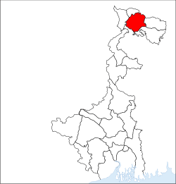 Location of Jalpaiguri district in West Bengal | |
| Country | India |
| State | West Bengal |
| Division | Jalpaiguri |
| Headquarters | Jalpaiguri |
| Government | |
| • Lok Sabha constituencies | Jalpaiguri, Alipurduar |
| • Vidhan Sabha constituencies | Nagrakata, Dhupguri, Mekhliganj, Maynaguri, Mal, Dabgram-Phulbari, Jalpaiguri, Rajganj |
| Area | |
| • Total | 3,044 km2 (1,175 sq mi) |
| Population (2011) | |
| • Total | 3,872,846 |
| • Density | 1,300/km2 (3,300/sq mi) |
| • Urban | 1,103,847 |
| Demographics | |
| • Literacy | 84.79 per cent |
| • Sex ratio | 954 |
| Time zone | UTC+05:30 (IST) |
| Major highways | NH 31, NH 31A, NH 31C, NH 31D |
| Average annual precipitation | 3160 mm |
| Website | http://www.jalpaiguri.gov.in/ |
The headquarters of the district are in the Indian city of Jalpaiguri, which is also the divisional headquarters of North Bengal.
History
Jalpaiguri district comprises western Dooars and the major part of the eastern Morang ; and this area, according to Sailen Debnath, in the ancient time was a part of the kingdom of Kamrup, and since the middle of the seventh century it became a part of Kamarupa.[1] Sailen writes that three of the five ancient capitals of Kamatapur were geographically in the district of Jalpaiguri; and the three capitals were at Chilapata, Mainaguri and Panchagarh in sequence. According to him, Hingulavas, the first capital of the next Koch kingdom as well was in Jalpaiguri district. Hingulavas has well been identified with Mahakalguri in Alipurduar Sub-Division.[1]
Geography

Jalpaiguri is a part of West Bengal which is situated in North Bengal.
The district situated in the northern part of West Bengal has international borders with Bhutan and Bangladesh in the north and south respectively and district borders with Darjeeling hills in the west and northwest and Alipurduar district and Cooch Behar district on the east.
National protected areas include the Gorumara National Park and the Chapramari Wildlife Sanctuary.
Climate
Jalpaiguri is part of monsoon climate zone of South-Eastern Asia. May is the hottest month of this region with average maximum temperature of about 32 °C whereas January is coldest with 11 °C. Highest ever recorded maximum and minimum temperature are 40 °C and 2 °C. The average annual humidity in the district is of 82%. The annual average rainfall is 3160mm. December is the driest month with average rainfall 0.2 mm and July is wettest with 809.3 mm. Number of rainy days are 0 to 1 during November to February and 24 days during July. Thunderstorms are common weather phenomenon during May.
Divisions
Sub-divisions
Jalpaiguri district earlier had three sub-divisions – Jalpaiguri Sadar subdivision, Mal subdivision and Alipurduar subdivision. Alipurduar district was created in June 2014 and Jalpaiguri district was left with two subdivisions – Jalpaiguri Sadar and Mal.[2][3]
Assembly constituencies
The district is divided into seven assembly constituencies:[4]
- Dhupguri (assembly constituency no. 15),
- Maynaguri (assembly constituency no. 16),
- Jalpaiguri (assembly constituency no. 17),
- Rajganj (assembly constituency no. 18),
- Dabgram-Phulbari (assembly constituency no. 19),
- Mal (assembly constituency no. 20) and
- Nagrakata (assembly constituency no. 21).
Nagrakata and Malbazar constituencies are reserved for Scheduled Tribes candidates. Dhupguri, Mainaguri and Rajganj constituencies are reserved for Scheduled Castes candidates. Dhupguri, Mainaguri, Malbazar, Dabgram-Phulbari, Jalpaiguri and Rajganj constituencies form the Jalpaiguri (Lok Sabha constituency), which also contains one assembly constituency from Cooch Behar district.
Impact of delimitation of constituencies
As per order of the Delimitation Commission in respect of the delimitation of constituencies in the West Bengal, the district will be divided into seven assembly constituencies:[4]
- Dhupguri (SC) (assembly constituency no. 15),
- Maynaguri (SC) (assembly constituency no. 16),
- Jalpaiguri (SC) (assembly constituency no. 17),
- Rajganj (SC) (assembly constituency no. 18),
- Dabgram-Phulbari (assembly constituency no. 19),
- Mal (ST) (assembly constituency no. 20) and
- Nagrakata (ST) (assembly constituency no. 21).
Malbazar and Nagrakata constituencies will remain to be reserved for Scheduled Tribes candidates. Dhupguri, Mainaguri, Jalpaiguri and Rajganj constituencies will be reserved for Scheduled Castes candidates. Along with one assembly constituency from Cooch Behar district, Dhupguri, Mainaguri, Jalpaiguri, Rajganj, Dabgram-Phulbari, and Malbazar constituencies will form the Jalpaiguri (Lok Sabha constituency), which will be reserved for Scheduled Castes.
Police stations
There are 16 police stations in the district, viz.:[5]
Telephone districts
There are six telephone area codes of Jalpaiguri district. They are 03561, 03562, 03563, 03564, 03565, 03566.
Transport
One can avail train from the major railway stations in the vicinity like New Jalpaiguri railway station/ Jalpaiguri/ Jalpaiguri Road/ New Maynaguri railway station/ New Mal Junction railway station. By road it is connected with rest of the country. Air travel is available up to Bagdogra Airport, and from there it is connected by a 20 km expressway from the district border.
Demographics
According to the 2011 census Jalpaiguri district has a population of 3,872,846,[9] roughly equal to the nation of Liberia.[10] This gives it a ranking of 66th in India (out of a total of 640).[9] The district has a population density of 621 inhabitants per square kilometre (1,610/sq mi) .[9] Its population growth rate over the decade 2001-2011 was 33.77%.[9] Jalpaiguri has a sex ratio of 954females for every 1000 males,[9] and a literacy rate of 79.79%.[9]
Jalpaiguri district has a majority of Hindus which includes Bengali population. The second largest religion in the district is Islam, (mainly Sunni). Other minority communities, speaking languages include Gorkhas (Nepali), Marwaris, Biharis, Punjabi, Urdu, Munda; a language distantly related to Khmer and Vietnamese, spoken by about 25,000 people.[11] Rajbanshi language is widely exercised in Jalpaiguri district. A vast area on the western part of the district at Salugara and Fulbari is inhabited by Nepalis.
| Historical population | ||
|---|---|---|
| Year | Pop. | ±% p.a. |
| 1901 | 546,764 | — |
| 1911 | 663,222 | +1.95% |
| 1921 | 695,946 | +0.48% |
| 1931 | 740,993 | +0.63% |
| 1941 | 847,841 | +1.36% |
| 1951 | 916,747 | +0.78% |
| 1961 | 1,359,292 | +4.02% |
| 1971 | 1,750,159 | +2.56% |
| 1981 | 2,214,871 | +2.38% |
| 1991 | 2,800,543 | +2.37% |
| 2001 | 3,401,173 | +1.96% |
| 2011 | 3,872,846 | +1.31% |
| source:[12] | ||
Flora and fauna
It is home to Gorumara National Park, which was established in 1994 and has an area of 79 km2 (30.5 sq mi).[13] Apart from Gorumara National Park, the district contains Chapramari Wildlife Sanctuary.
References
- Sailen Debnath, The Dooars in Historical Transition, ISBN 9788186860441, N.L. Publishers
- "Alipurduar a new district on June 25". The Times of India, 21 June 2014. Retrieved 6 September 2014.
- "Alipurduar district birth on June 25". The Telegraph, 21 June 2014. Retrieved 6 September 2014.
- "Delimitation Commission Order No. 18" (PDF). West Bengal. Election Commission. Retrieved 6 September 2014.
- "Administrative setup". Official website of the Jalpaiguri district. Archived from the original on 10 April 2009. Retrieved 7 November 2008.
- "Jalpaiguri Metropolitan Region". Jalpaiguri City Census 2011 data. Census 2011. Retrieved 1 January 2016.
- http://www.censusindia.gov.in/2011census/C-16.html
- "DISTRIBUTION OF THE 22 SCHEDULED LANGUAGES-INDIA/STATES/UNION TERRITORIES - 2011 CENSUS" (PDF).
- "District Census 2011". Census2011.co.in. 2011. Retrieved 30 September 2011.
- US Directorate of Intelligence. "Country Comparison:Population". Retrieved 1 October 2011.
Liberia 3,786,764 July 2011 est.
- M. Paul Lewis, ed. (2009). "Bijori: A language of India". Ethnologue: Languages of the World (16th ed.). Dallas, Texas: SIL International. Retrieved 30 September 2011.
- Decadal Variation In Population Since 1901
- Indian Ministry of Forests and Environment. "Protected areas: Sikkim". Archived from the original on 23 August 2011. Retrieved 25 September 2011.
External links
| Wikimedia Commons has media related to Jalpaiguri district. |
Places adjacent to Jalpaiguri district | ||||||||||
|---|---|---|---|---|---|---|---|---|---|---|
| ||||||||||
Cities, towns and locations in Jalpaiguri district | |||||
|---|---|---|---|---|---|
| Cities, municipal and census towns |
| ||||
| Locations other than cities and towns |
| ||||
| Related Topics |
| ||||