Sukabumi
Sukabumi (Sundanese: ᮞᮥᮊᮘᮥᮙᮤ) is a city surrounded by the regency of the same name (enclave) in the southern foothills of Mount Gede, in West Java, Indonesia, about 100 km (62 mi) south of the national capital, Jakarta.
Sukabumi | |
|---|---|
| Regional transcription(s) | |
| • Sundanese | ᮊᮧᮒ ᮞᮥᮊᮘᮥᮙᮤ |
 Ahmad Yani Road in Sukabumi | |
 Coat of arms | |
| Nickname(s): | |
| Motto(s): | |
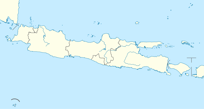
 Location within West Java | |
| Coordinates: 6°55′05″S 106°55′53″E | |
| Country | |
| Province | |
| Historic residency | |
| Settled | 1709 |
| Consolidated | 1 April 1914 (as Gemeente Soekaboemi) |
| Government | |
| • Body | Sukabumi City Government |
| • Mayor | Mohamad Muraz |
| • Vice Mayor | Achmad Fahmi |
| Area | |
| • Total | 48.42 km2 (18.70 sq mi) |
| • Water | 4.815 km2 (1.859 sq mi) |
| Elevation | 584 m (1,916 ft) |
| Population (2015) | |
| • Total | 318,117 |
| • Rank | 37th, Indonesia |
| • Density | 6,600/km2 (17,000/sq mi) |
| Demonym(s) | Sukabumian Warga Sukabumi (id) Urang Sukabumi (su) |
| Time zone | UTC+7 (Indonesia Western Time) |
| Postcodes | 431xx |
| Area code | (+62)266 |
| Registration plate | F |
| HDI | |
| Largest district by area | Lembursitu – 10.73 square kilometres (4.14 sq mi) |
| Largest district by population | Cikole (57,640 – 2016 est)[2] |
| Website | sukabumikota.go.id |

At an altitude of approximately 584 m (1,916 ft), the city is a minor hill station resort, with a cooler climate than the surrounding lowlands. The area around Sukabumi is also a popular destination for whitewater rafting. Tea and Rubber production is a major industry in the area. The suburban area surrounding Sukabumi circling the mountain has grown tremendously in population, such that northern Sukabumi Regency, hugging the volcano, and bordering Greater Jakarta, is home to the bulk of the regency's population. The area of the city is 48.42 km2, and the population at the 2010 Census was 300,359; the latest official estimate (as for December 2015) was 318,117. However, some 1.8 million people, as of the 2010 census figures, live in the surrounding metropolitan area. The bulk of the metro area population is unusual in that it forms a narrow southwest ring around Mount Gede. The eastern portion of the ringed population belt continues on to Cianjur Regency.
History
Early history
The area around Sukabumi was already inhabited at least in the 11th century. The first written record found in this area was the Sanghyang Tapak inscription in Cibadak, 20 km west of the city. Written in Kawi script, the stone tells about the prohibition of fishing activity in the nearby river by the authorities of the Sunda Kingdom.[3]
At the end of the 16th century, the area was captured by the Banten Sultanate, after the fall of the Sunda Kingdom. The area however became contested in the 1620s between Banten, the Mataram Sultanate in the east and the Batavia-based Dutch East India Company. After a series of military clashes between them, the area was included in a buffer zone territory between Banten and Mataram, although the area is considered de jure as a part of Mataram.[4]
In 1677, after the Dutch forced Mataram to sign a series of unequal treaties as a consequence of Dutch assistance for quelling the Trunajaya rebellion, Sukabumi came under direct control of Tjiandjoer.[5][6] By that time, there were only few rural Sundanese settlements existed, one of the largest was Tjikole.[7]
Colonial Sukabumi
Sukabumi Coffee Plantations
The area around the present-day Sukabumi (or Soekaboemi in Van Ophuijsen Spelling System) began to develop in the 18th century when the Dutch East India Company started to open coffee plantation areas in the western Priangan region of Java.[8][9] Due to the high demands of coffee in Europe, in the year of 1709 the Dutch governor-general Abraham van Riebeeck started to open coffee plantations around the area of Tjibalagoeng (present-day Bogor), Tjiandjoer, Djogdjogan, Pondok Kopo, and Goenoeng Goeroeh.[10] Coffee plantations in these five areas had then undergone expansion and intensification during the era of Hendrick Zwaardecroon (1718-1725), where the Tjiandjoer regent at that time Wira Tanoe III acquired territorial expansion of his regency as a compensation for more coffee plantations openings.[11][12]
The growth of Goenoeng Goeroeh coffee plantation led to the establishment of small settlements around its area, one of those was the Tjikole (Cikole) hamlet, named after the nearby Tjikole River. In 1776, regent of Tjiandjoer Wira Tanoe Datar VI established the Tjikole Viceregency which were the indirect predecessor of the present-day Sukabumi Regency.[13] The viceregency consisted of six districts of Djampang Koelon, Djampang Tengah, Goenoeng Parang, Tjiheoelang, Tjimahi, and Tjitjoeroeg. The administrative center was located in Tjikole, due to its very strategic locations for communications between Batavia and Tjiandjoer which were the capital of the Priangan Residency at that time.[14][15]
Tjikole becomes Soekaboemi
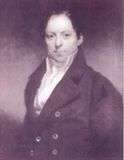
After the Dutch East Indies were under the rule of the British in 1811, vast lands in the Tjikole area were bought by Stamford Raffles, the Governor-General of the Dutch East Indies at that time, via an auction held in Batavia.[16] The name Soekaboemi was first used on 1815, when a Priangan-based plantation owner (known then as Preanger Planter) and surgeon named Andries de Wilde visited Tjikole in 1814. From his consultations with local people, De Wilde wrote a letter to Nicolaus Engelhard, his friend and plantation investor, where De Wilde asked Engelhard to propose a name change of the viceregency from Tjikole to Soekaboemi, to which Raffles agreed.[17][18]
In Dutch colonial times, Sukabumi was the site of Politieschool, the colonial police academy.
During the Japanese occupation of Indonesia during the Second World War, the Japanese had created a strategic garrison in Ujung Genteng, part of the South Sukabumi Regency. Remains of the harbor and lookout towers at the end of this peninsula are still in place, along with the caves that the Japanese lived and died in towards the end of the war. Ujung Genteng is directly North of Christmas Island and Australia and would have made an excellent point of defense or attack, without official records to substantiate this, it is presumed that they had their sights on Christmas Island and a close link to Australia.
Present day
In early 2005, Sukabumi Regency became the first place in Indonesia that polio was reported in ten years, the beginning of a nationwide outbreak of the disease which had been believed to be eradicated in the country.[19]
Government and politics
.svg.png)
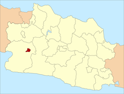
Administrative districts
The city of Sukabumi is divided into seven districts (kecamatan), listed below with their areas and their populations at the 2010 Census and at the latest 2015 estimates:[2]
| District | Area in km2 | Population 2010 Census | Population 2015 Estimate |
|---|---|---|---|
| Baros | 5.51 | 29,536 | 31,737 |
| Cibeurum | 9.18 | 34,719 | 40,681 |
| Cikole | 6.50 | 56,775 | 57,640 |
| Citamiang | 3.99 | 47,580 | 49,351 |
| Lembursitu | 11.08 | 33,719 | 36.384 |
| Warudoyong | 7.59 | 52,780 | 55,180 |
| Gunung Puyuh | 5.18 | 43,622 | 47,144 |
Transportation
After almost one year of hiatus, the railway transport between Sukabumi and Bogor of 57 kilometers was reactivated, with the new train called 'Pangrango' on 9 November 2013. The train has one executive-class car and three economy-class cars.[20]
Bogor-Ciawi–Sukabumi Toll Road is under construction that will connect Bogor Regency, Bogor city, Sukabumi Regency and Sukabumi city. The 15.35-kilometer first section of the toll road between Ciawi and Cigombong was inaugurated by Indonesian President Joko Widodo on 3 December 2018.[21]
Culinary
Sukabumi also has some traditional dishes that are worth trying, for example Roti Priangan, Mochi, Bandros, Soto Mie and Bubur.
References
- Wawali, Pertahankan Julukan Kota Santri | www.radarsukabumi.com Archived 9 October 2016 at the Wayback Machine
- Kota Sukabumi Dalam Angka 2016
- Marwati Djoened Poesponegoro, Nugroho Notosusanto (1992). "Kerajaan Sunda". Sejarah nasional Indonesia: Jaman kuna. PT Balai Pustaka. p. 376. ISBN 978-979-407-408-4.
- G. G. Bandilenko, E.I. Gnevusheva, D.V. Deopik, V.A. Tsyganov (1992). History of Indonesia. pp. 175–179.CS1 maint: multiple names: authors list (link)
- Suryaningrat, Bayu (1982). Sajarah Cianjur Sareng Raden Aria Wira Tanu Dalem Cikundul Cianjur. Rukun Warga Cianjur-Jakarta, Jakarta.
- G. G. Bandilenko, E.I. Gnevusheva, D.V. Deopik, V.A. Tsyganov (1992). History of Indonesia. pp. 201–202.CS1 maint: multiple names: authors list (link)
- Jaya, Ruyatna (2003). Sejarah Sukabumi. Sukabumi City Government. p. 8.
- Beekman, E. M. (1988). Fugitive Dreams: An Anthology of Dutch Colonial Literature. University of Massachusetts Press. p. 90. ISBN 0870235753.
- Brommer, Bea (2015). To My Dear Pieternelletje:Grandfather and Granddaughter in VOC Time, 1710-1720. Leiden: Brill. p. 19. ISBN 9789004293328.
- Danasasmita, Saleh (1983). Sejarah Bogor, Volume 1. Bogor: Pemerintah Daerah Kotamadya DT II Bogor. p. 85.
- Klaveren, N. A. (1983). The Dutch Colonial System in the East Indies. Springer. p. 60. ISBN 9789401768481.
- Kumar, Ann (1997). Java and Modern Europe: Ambiguous Encounters. Routledge. p. 292. ISBN 1138863149.
- Coolsma, S. (2010). De zendingseeuw voor Neederlandsch Oost-Indië. Nabu Press. p. 118. ISBN 9781174732164.
- MPI Foundation (2005). West Java Miracle Sight: A Mass of Verb and Scene Information. p. 724.
- Marihandono, Djoko (2008). Titik balik historiografi di Indonesia. University of Indonesia. p. 217. ISBN 9789793258805.
- Bosma, Ulbe (2009). Being "Dutch" in the Indies: A History of Creolisation and Empire, 1500-1920. Ohio University Press. p. 97. ISBN 9789971693732.
- Dutch East Indies. Topografische Dienst (1918). Jaarverslag. p. 202.
- Dinas Pariwisata Provinsi Daerah Tingkat I Jawa Barat (1986). Wajah Pariwisata Jawa Barat. Bandung: Dinas Pariwisata Jawa Barat. p. 178. ISBN 9789798075001.
- Indonesia confirms the second case of polio, ABC Radio Australia 5 April 2005.
- "PT KAI revives Bogor-Sukabumi route". 10 November 2013.
- "This New Toll Road Drastically Cuts the Time It Takes You to Drive to Sukabumi". Jakarta Globe. Retrieved 4 December 2018.
External links
- (in Indonesian) Official site
| 2,000,000 and more | |
|---|---|
| 1,000,000–1,999,999 | |
| 500,000–999,999 | |
| 200,000–499,999 | |