Shabran District
Shabran (Azerbaijani: Şabran) is a district of Azerbaijan. Şabran city is its administrative center.
Şabran | |
|---|---|
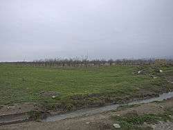 Orchards north of Gəndov | |
.svg.png) Map of Azerbaijan showing Shabran District | |
| Country | Azerbaijan |
| Capital | Şabran |
| Area | |
| • Total | 1,090 km2 (420 sq mi) |
| Population (2011)[3] | |
| • Total | 53,000 |
| Zip Code | AZ1700 |
| Telephone code | (+994) 23[4] |
History
Davachi District was formed on August 8, 1930. But in 1963, it was eliminated and included into Absheron District, but in 1965, the district was re-established again. In 1992, new Siazan District was formed on the basis of Davachi District by the order of the National Assembly of Azerbaijan, which included part of Davachi District's territory. In 2010, Davachi District was renamed to Shabran District.[5]
Geography
Greater part of the district is mountainous. The Caspian Sea is located in 12 km from Shabran city. The district borders upon Quba, Khachmaz, Shamakhi and Siazan Districts. Forests occupy 27000 ha in mountainous territories and plains near the Caspian Sea and they are of great importance with its climatic and natural resources for the district. The Shabran and Davachi Rivers flow through the district's territory, and the Valvalachay and Gilgilchay Rivers flow in northern and southern borders directly to the Caspian Sea. Samur-Davachi lowland has an altitude of −28 m below the world ocean level.[6]
Shabran District is located in the north-east of Greater Caucasus. The district is located near Greater Caucasus Range. There are also mud volcanoes in the territory of the district. Breeds of the Cretaceous, Paleogene and Neogene periods spread in mountainous parts, but breeds of Anthropogenic period spread in low-lying parts. The territory is rich of oil, gas, gravel, sand, clay and other natural resources. Medicinal mineral waters, “Galaalty” sanatorium, high-temperature Khaltan springs are broadly used by the population.
Climate in low-lands and low-mountainous parts is warm and subtropical, but in mountainous is mild cold. Summer of district is dry, amount of annual precipitation is not more than 300–600 mm. Brown mountainous-forest, mountainous-chestnut, light-chestnut soils spread in mountainous, but alkaline, grey, brown and other soils spread in low-lying parts. There are sandstones on the seashore. Vegetation cover consists of bush tangles, rare forest meadows, semi-deserts covered with glades or semi-deserts covered both with glades and saline. The district is rich for its fauna and birds of various species.[7]
Population
According to the annual report of the State Statistical Committee, every year the total number of population is increasing. In comparison to 2010, the statistic indicator for the population raised by 6500 thousand and reached to 58700 people in 2018.[8] There is an increase of approximately 12.5 percent.[8] 29,900 of the population is men and 28,800 percent is women.[9] At the beginning of 2018, the number of young people in age 14–29 in the region is 15,100 people. Among these, 7.8 are men and 7.3 are women.[10]
| Region | 2000 | 2001 | 2002 | 2003 | 2004 | 2005 | 2006 | 2007 | 2008 | 2009 | 2010 | 2011 | 2012 | 2013 | 2014 | 2015 | 2016 | 2017 | 2018 |
|---|---|---|---|---|---|---|---|---|---|---|---|---|---|---|---|---|---|---|---|
| Shabran region | 46,4 | 46,8 | 47,3 | 47,8 | 48,2 | 48,7 | 49,3 | 49,9 | 50,5 | 51,3 | 52,2 | 53,0 | 53,9 | 54,7 | 55,5 | 56,3 | 57,2 | 58,0 | 58,7 |
| urban population | 20,4 | 20,5 | 20,7 | 20,9 | 21,1 | 21,3 | 21,5 | 21,7 | 21,9 | 22,2 | 22,6 | 23,0 | 23,3 | 23,6 | 24,0 | 24,2 | 24,5 | 24,8 | 25,1 |
| rural population | 26,0 | 26,3 | 26,6 | 26,9 | 27,1 | 27,4 | 27,8 | 28,2 | 28,6 | 29,1 | 29,6 | 30,0 | 30,6 | 31,1 | 31,5 | 32,1 | 32,7 | 33,2 | 33,6 |
The main population in the district are Azerbaijanis (54 942), the second biggest ethnic group are tats. According to 2009 census the ethnic distribution looks like this:
| Ethnic group | Quantity(according to 2009 census) | |
| Azerbaijani | 54 942 | |
| Tat ethnic group | 1 967 | |
| Turkish | 1 376 | |
| Lezgi | 70 | |
| Russians | 32 | |
| tatar | 8 | |
| Ukrainian | 2 | |
| Other | 17 | |
| total | 58.300 | |
Economy of district
According to 2014 data Overall production reaches 165902.4 thousand manat. The main sectors of this district are building (42107.9 manat) and agriculture (83113.8 manat). The overall income of district is 4561.3 thousand manat and spending equals to 11825.6 thousand manat according to 2014 statistics.
Historical monuments
One of the oldest monument is Chiragalla in the Charmin Village. It's located on 1232 m slope and was built in the fifth-sixth century.[11]
Part of the Silk Road
Shabran City is also a historical monument in its way – this is the city through which caravans of “The Great Silk Road” passed and where caravans of camels stayed and rested.[7]
References
- "Şabran rayonu".
- "Şabran rayonu".
- "Şabran rayonu". The State Statistical Committee of the Republic of Azerbaijan.
- "Şəhərlərarası telefon kodları". Aztelekom MMC. Aztelekom İB. Retrieved 19 August 2015. (in Azerbaijani)
- "Azerbaijani region to be renamed". news.az. Archived from the original on 2010-04-04.
- "Shabran". discoverazerbaijan.az.
- "Девечинский район". azerbaijan.az.
- Samadov (www.anarsamadov.net), Anar. "Population". The State Statistical Committee of the Republic of Azerbaijan. Retrieved 2018-12-18.
- "Political division, population size and structure: Population by sex, towns and regions, urban settlements of the Republic of Azerbaijan at the beginning of the 2018". The State Statistical Committee of the Republic of Azerbaijan. Retrieved 2018-12-18.
- "Political division, population size and structure: Population at age 14-29 by towns and regions of the Republic of Azerbaijan at the beginning of the 2018". The State Statistical Committee of the Republic of Azerbaijan. Retrieved 2018-12-18.
- Quliyev, Nurbala. Bura Gülüstani-İrəm torpağıdır.