President Roxas, Cotabato
President Roxas, officially the Municipality of President Roxas, is a 1st class municipality in the province of Cotabato, Philippines. According to the 2015 census, it has a population of 47,575 people.[3]
President Roxas | |
|---|---|
| Municipality of President Roxas | |
 Seal | |
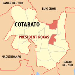 Map of Cotabato with President Roxas highlighted | |

| |
.svg.png) President Roxas Location within the Philippines | |
| Coordinates: 7°09′16″N 125°03′21″E | |
| Country | |
| Region | Soccsksargen (Region XII) |
| Province | Cotabato |
| District | 2nd District |
| Founded | May 8, 1967 |
| Barangays | 25 (see Barangays) |
| Government | |
| • Type | Sangguniang Bayan |
| • Mayor | Jonathan O. Mahimpit |
| • Vice Mayor | Jaime H. Mahimpit |
| • Congressman | Rudy S. Caoagdan |
| • Electorate | 30,833 voters (2019) |
| Area | |
| • Total | 618.25 km2 (238.71 sq mi) |
| Elevation | 125.9 m (413.1 ft) |
| Population (2015 census)[3] | |
| • Total | 47,575 |
| • Density | 77/km2 (200/sq mi) |
| • Households | 10,870 |
| Economy | |
| • Income class | 1st municipal income class |
| • Poverty incidence | 41.57% (2015)[4] |
| • Revenue (₱) | 170,393,728.15 (2016) |
| Time zone | UTC+8 (PST) |
| ZIP code | 9405 |
| PSGC | |
| IDD : area code | +63 (0)64 |
| Climate type | tropical rainforest climate |
| Native languages | Hiligaynon Cebuano Matigsalug language Ilianen language Tagalog |
| Website | www |
Geography
The municipality of President Roxas is composed of two parts: the northern and the southern part.
The Northern President Roxas is bounded by the Municipalities of Damulog and Kibawe of the province of Bukidnon on the north, on the south by the Municipality of Antipas, on the west by the Municipality of Carmen and on the east by the Municipality of Arakan.
Meanwhile, the Southern President Roxas is bounded on the north by the Municipality of Antipas, on the south by Kidapawan, on the west by Matalam and on the east by the Municipality of Magpet.
Barangays
President Roxas is politically subdivided into 25 barangays. [2]
- Alegria
- Bato-bato
- Del Carmen
- F. Cajelo (New Maasin)
- Edaoman
- Ilustre
- Kamarahan
- Camasi
- Kisupaan
- La Esperanza
- Labu-o
- Lamalama
- Lomonay
- New Cebu
- Poblacion
- Sagcungan
- Salat
- Sarayan
- Tuael
- Greenhill
- Cabangbangan
- Datu Indang
- Datu Sundungan
- Kimaruhing
- Mabuhay
Climate
| Climate data for President Roxas, Cotabato | |||||||||||||
|---|---|---|---|---|---|---|---|---|---|---|---|---|---|
| Month | Jan | Feb | Mar | Apr | May | Jun | Jul | Aug | Sep | Oct | Nov | Dec | Year |
| Average high °C (°F) | 30 (86) |
30 (86) |
31 (88) |
32 (90) |
30 (86) |
29 (84) |
29 (84) |
29 (84) |
30 (86) |
30 (86) |
30 (86) |
30 (86) |
30 (86) |
| Average low °C (°F) | 21 (70) |
21 (70) |
21 (70) |
23 (73) |
23 (73) |
23 (73) |
23 (73) |
23 (73) |
23 (73) |
23 (73) |
22 (72) |
22 (72) |
22 (72) |
| Average precipitation mm (inches) | 51 (2.0) |
41 (1.6) |
38 (1.5) |
45 (1.8) |
82 (3.2) |
108 (4.3) |
114 (4.5) |
120 (4.7) |
95 (3.7) |
96 (3.8) |
76 (3.0) |
52 (2.0) |
918 (36.1) |
| Average rainy days | 10.2 | 8.1 | 9.8 | 15.3 | 22.5 | 23.9 | 25.2 | 25.4 | 23.3 | 24.1 | 21.0 | 16.8 | 225.6 |
| Source: Meteoblue [5] | |||||||||||||
Demographics
| Population census of President Roxas | ||
|---|---|---|
| Year | Pop. | ±% p.a. |
| 1970 | 20,639 | — |
| 1975 | 20,351 | −0.28% |
| 1980 | 25,784 | +4.84% |
| 1990 | 32,774 | +2.43% |
| 1995 | 36,788 | +2.19% |
| 2000 | 41,231 | +2.47% |
| 2007 | 43,133 | +0.62% |
| 2010 | 44,229 | +0.92% |
| 2015 | 47,575 | +1.40% |
| Source: Philippine Statistics Authority[3][6][7][8] | ||
In the 2015 census, the population of President Roxas, Cotabato, was 47,575 people,[3] with a density of 77 inhabitants per square kilometre or 200 inhabitants per square mile.
History
Most of the territories comprising the new municipality were formerly part of Kidapawan, the mother municipality extending up to the borders of Bukidnon are the vast Arakan plains, which could boast of its rich and fertile valley suitable for agricultural crops such as rubber, coffee, sugar cane, palay and corn.[9]
Barrio Kabacan, renamed Barrio President Roxas that eventually became the seat of the municipal government was an insignificant area before 1951. In fact, it was Barrio Labuo, where the Manobo Chieftain, Datu Guabong Linog resided with his people who was thriving the area even before the outbreak of the World War II. The Manobo natives have learned to co- exist with the settlers from Visayas and Luzon. After the war, floods of emigrants from different parts of the country continued to arrive at a much faster rate so that by 1957, they had occupied almost all the vast fertile land of the Arakan plains. By this time settlers of Barrio President Roxas had bonded together into an organization called “La castellana home seekers Association” whose membership were mostly people from negros Occidental. This group helped enhanced the rapid development of the area outpacing the rest of the earlier settlements.
In the early 60’s, Barrio President Roxas became a booming logging community. The concessionaires constructed logging roads extending beyond the Arakan Valley, making it the center of commerce and Agriculture. In the early part of 1970, the road, which was constructed by logging companies stationed at Poblacion was utilized as the main route of transportation in going out to Kidapawan passing Barangay Tuael through Barangay Binay and Poblacion of the Municipality of Magpet. It was in 1967 when the National Highway at km. 114 Paco, Kidapawan was opened. This project propelled the growth of programs and development in the area. Mobility of the people became easy not only in President Roxas but also of the entire Arakan Valley which is composed of five (5) municipalities.
Economy
Industries:
- Banana chip making
- Fish crackers
- Sandal making
- Macaroni chips
- Native chicken production
Tourist attractions
- Tuael Bird Sanctuary Hill in Barangay Tuael which is situated in the property of the Pajora Family is three kilometers from the heart of the municipality. The sanctuary hill is the habitat of thousands of bird in different species. One of them is the well known black crown heron (Nytocorax). The sire is crammed with nest drooping in the branches, grass and shrubs, and fledglings of different ages. These birds that continue to increase in number are believed to have migrated from the adjacent Asian countries. They possess distinctiveness by flying in a cadense, gracefully swinging and spreading their wings as if they are dancing on the air.
- Hillside Spring Resort (formerly Skyline Resort) - A resort located at the heart of President Roxas, with a rustic setting and cool water of the pools coming right from the headwater of the mountain streams.
- Barangay Poblacion Hot Spring - a piece of nature looking like a big well that exudes heat even surrounded by fresh waters with hot water flowing from one end.
- Winding River - The winding river of Kabacan, located in Barangay Poblacion is ideal for rafting and tubing, with its water stemming from the foot of mount Apo came cascading, rushing and running down all the way to Liguasan Marsh. This river which was declared as the cleanest body of water in the province of Cotabato, has been the home of different water creatures.
- Mountain Range Of Greenhill - the best place where one can likely have mountain trekking, biking, hiking and jogging the place is on highest elevation of solid ground that overlooks the rice plants, coconut plantation and entire lower portion of the municipality.
References
- "Municipality". Quezon City, Philippines: Department of the Interior and Local Government. Retrieved 31 May 2013.
- "Province: North Cotabato". PSGC Interactive. Quezon City, Philippines: Philippine Statistics Authority. Retrieved 12 November 2016.
- Census of Population (2015). "Region XII (Soccsksargen)". Total Population by Province, City, Municipality and Barangay. PSA. Retrieved 20 June 2016.
- "PSA releases the 2015 Municipal and City Level Poverty Estimates". Quezon City, Philippines. Retrieved 12 October 2019.
- "President Roxas: Average Temperatures and Rainfall". Meteoblue. Retrieved 30 January 2020.
- Census of Population and Housing (2010). "Region XII (Soccsksargen)". Total Population by Province, City, Municipality and Barangay. NSO. Retrieved 29 June 2016.
- Censuses of Population (1903–2007). "Region XII (Soccsksargen)". Table 1. Population Enumerated in Various Censuses by Province/Highly Urbanized City: 1903 to 2007. NSO.
- "Province of North Cotabato". Municipality Population Data. Local Water Utilities Administration Research Division. Retrieved 17 December 2016.
- "Archived copy". Archived from the original on 2011-05-07. Retrieved 2011-04-20.CS1 maint: archived copy as title (link)
External links
- President Roxas Profile at PhilAtlas.com
- Philippine Standard Geographic Code
- Philippine Census Information
Northern part | ||||||||||
|---|---|---|---|---|---|---|---|---|---|---|
| ||||||||||