Wayne County, Michigan
Wayne County is the most populous county in the U.S. state of Michigan. As of 2019, the United States Census estimated its population as 1,749,343 making it the 19th-most populous county in the United States.[3] The county seat is Detroit,[4] the largest and most populous city in Michigan and 23rd-most populous city in the United States. The county was founded in 1796 and organized in 1815.[1]
Wayne County | |
|---|---|
| County of Wayne | |
.jpg) Wayne County Courthouse, listed on the National Register of Historic Places | |
 Flag  Seal | |
 Location within the U.S. state of Michigan | |
 Michigan's location within the U.S. | |
| Coordinates: 42°17′N 83°16′W | |
| Country | |
| State | |
| Founded | August 15, 1796 (created) 1815 (organized)[1][2] |
| Named for | Anthony Wayne |
| Seat | Detroit |
| Largest city | Detroit |
| Area | |
| • Total | 673 sq mi (1,740 km2) |
| • Land | 612 sq mi (1,590 km2) |
| • Water | 61 sq mi (160 km2) 9.0% |
| Population | |
| • Estimate (2019) | 1,749,343 |
| • Density | 2,974/sq mi (1,148/km2) |
| Time zone | UTC−5 (Eastern) |
| • Summer (DST) | UTC−4 (EDT) |
| Congressional districts | 11th, 12th, 13th, 14th |
| Website | www |
Wayne County is included in the Detroit-Warren-Dearborn, MI Metropolitan Statistical Area. It is one of several U.S. counties named after Revolutionary War-era general Anthony Wayne.
History
Wayne County was the sixth county in the Northwest Territory, formed August 15, 1796 from portions of territorial Hamilton County, territorial Knox County and unorganized territory. It was named for the U.S. general "Mad Anthony" Wayne. It originally encompassed the entire area of the Lower Peninsula of Michigan, most of the Upper Peninsula, as well as smaller sections that are now part of northern Ohio, Indiana, Illinois and Wisconsin. By proclamation of the Territorial Secretary and Acting Governor, Winthrop Sargent, on August 15, 1796, the boundaries of Wayne County were declared to begin at the mouth of the Cuyahoga River then west to Fort Wayne, then to the southernmost point of Lake Michigan and along the western shore north to the territorial boundary in Lake Superior and then along the territorial boundary through Lake Huron, Lake St. Clair, and Lake Erie back to the starting point.[5]
On January 14, 1803, the Governor of Indiana Territory, William Henry Harrison, issued a similar proclamation defining the boundaries as beginning at a point where an east and west line passing through the southernmost extreme of Lake Michigan would intersect a north and south line, passing through the westernmost extreme of the lake, then north to the territorial boundary, then along said boundary line to a point where an east and west line passing through the southerly extreme of Lake Michigan would intersect the same, then along this last mentioned line to the place of beginning. This boundary would include Chicago, Illinois and a sizable strip of Wisconsin along Lake Michigan.[6]
These boundaries would be adjusted as Indiana and Illinois became states and as other counties were formed within Michigan Territory.
Geography
According to the U.S. Census Bureau, the county has a total area of 673 square miles (1,740 km2), of which 612 square miles (1,590 km2) is land and 61 square miles (160 km2) (9.0%) is water.[7] Its water area includes parts of the Detroit River and Lake St. Clair.
Wayne County borders on Oakland County and Macomb County to the north, Washtenaw County to the west, Essex County, Ontario, Canada to the east, and Monroe County to the south.
The eastern (and sometimes southern) boundary is a water boundary in the Detroit River and Lake St. Clair with Essex County, Ontario. Automotive traffic crosses this boundary at the Detroit-Windsor Tunnel and the Ambassador Bridge. Due to the southwestern course of the river, this small portion of Canada actually lies to the south of Wayne County. The southern communities of the county are usually referred to as "Downriver", in reference to their location downstream of downtown Detroit.
Grosse Ile is the largest island in Wayne County and is connected to the mainland by the Wayne County Bridge and the Grosse Ile Toll Bridge.
Adjacent counties
- Washtenaw County (west)
- Monroe County (south/southwest)
- Macomb County (northeast)
- Oakland County (northwest)
- Essex County, Ontario, Canada (east/southeast)
National protected area
Transportation
Wayne County Department of Public Services
The Wayne County Department of Public Services was formed in 1906 as the Wayne County Road Commission. It was the government agency in Wayne County, Michigan responsible for building and maintaining the county's roads and highways.[8]
The Wayne County Road Commission was an "exemplary" agency in the state of Michigan, and had great involvement and influence in roadway planning more widely in the state. It became "internationally renowned for innovative ideas, sometimes breaking ground well in advance of the Michigan State Highway Department."[9]:32
The county road commission was more advanced than the state's own public works department in several respects. It had long had its own in-house construction group to build bridges, before the state copied that practice in 1924.[9]:10 It adopted one or more bridge types before the state did.
Its first commissioners were Edward N. Hines, Cassius R. Benton, and automobile manufacturer Henry Ford. While the commission was authorized by an 80% positive vote of county voters in a 1906 referendum, it was controversial and there was a Michigan state supreme court case pressed which found it unconstitutional. Commissioners Benton and Ford quit, but commissioner Hines persisted and led the commission through reorganization getting around the obstacles.[9]:33 Hines was a commissioner continuously from 1906 to 1938.
Hines is credited with the idea of putting a painted line down a roadway's center to divide traffic, and other innovations that were later widely adopted.
The commission worked systematically, and it became a model to others. "As early as 1911, the commission felt confident in asserting that 'Wayne County is coming to be known as a leader in the good roads movement, and the Mecca of those upon whose shoulders devolves the duty of solving traffic problems.' Within a few years, the county hosted delegations of engineers from around the United States, as well as from a number of other countries, including Britain, Japan, Australia, and Borneo.[footnote omitted] The commission's international prominence was enhanced by its advocacy of concrete as a road material. It claimed credit for constructing the country's first mile of concrete-paved rural highway, a section of Woodward Avenue" just outside the Detroit city limits.[9]
The county road commission led in calling, during the 1930s, for superhighways in the state to relieve congestion; it worked to build superhighways in conjunction with the state plan that emerged, and which the county road commission endorsed.
The state relied upon the Wayne County Road Commission to provide expertise to build the Willow Run Expressway, during World War II as many state staff went into military service.[9]:18 The state hired the county road commission to supervise the building of the Lodge Expressway.[9]:27
A number of the county road commissions' works are listed on the National Register of Historic Places.[9][10]
The county road commission was merged into the general county government,[9]:42 becoming the Roads Division of the Department of Public Services.[11]
- Willow Run Freeway, now part of Interstate 94 (I-94)[9]
- Lodge Freeway, now M-10[9]
- East River Road-North Hickory Canal Bridge, East River Road over North Hickory Canal, Grosse Ile, Michigan (Wayne County Road Commission), NRHP-listed[10]
- Ferry Street-Thorofare Canal Bridge, Ferry Street over Thorofare Canal, Grosse Ile, Michigan (Wayne County Road Commission), NRHP-listed[10]
- Fort Street-Pleasant Street and Norfolk & Western Railroad Viaduct, Fort Street over Pleasant Street and Norfolk and Western Railway, Detroit, Michigan (Wayne County Road Commission), NRHP-listed[10]
- Parke Lane Road-Thorofare Canal Bridge, Parke Lane Road over Thorofare Channel, Grosse Ile, Michigan (Wayne County Road Commission), NRHP-listed[10]
- South Pointe Drive-Frenchman's Creek Bridge, South Pointe Drive over Frenchman's Creek, Grosse Ile, Michigan (Wayne County Road Commission), NRHP-listed[10]
- Waltz Road-Huron River Bridge, Waltz Road over Huron River, Huron Township, Michigan (Wayne County Road Commission), NRHP-listed[10]
Major highways


Airports

Demographics
| Historical population | |||
|---|---|---|---|
| Census | Pop. | %± | |
| 1810 | 2,227 | — | |
| 1820 | 3,574 | 60.5% | |
| 1830 | 6,781 | 89.7% | |
| 1840 | 24,173 | 256.5% | |
| 1850 | 42,756 | 76.9% | |
| 1860 | 75,547 | 76.7% | |
| 1870 | 119,068 | 57.6% | |
| 1880 | 168,444 | 41.5% | |
| 1890 | 257,114 | 52.6% | |
| 1900 | 348,793 | 35.7% | |
| 1910 | 531,591 | 52.4% | |
| 1920 | 1,177,645 | 121.5% | |
| 1930 | 1,888,946 | 60.4% | |
| 1940 | 2,015,623 | 6.7% | |
| 1950 | 2,435,235 | 20.8% | |
| 1960 | 2,666,297 | 9.5% | |
| 1970 | 2,666,751 | 0.0% | |
| 1980 | 2,337,843 | −12.3% | |
| 1990 | 2,111,687 | −9.7% | |
| 2000 | 2,061,162 | −2.4% | |
| 2010 | 1,820,584 | −11.7% | |
| Est. 2019 | 1,749,343 | [12] | −3.9% |
| U.S. Decennial Census[13] 1790-1960[14] 1900-1990[15] 1990-2000[16] 2010-2019[3] | |||
The 2010 United States Census[17] indicates Wayne County had a 2010 population of 1,820,584. This is a decrease of 240,578 people from the 2000 United States Census. Overall, the county had an -11.7% growth rate during this ten-year period. In 2010 there were 702,749 households and 450,651 families in the county. The population density was 2,974.4 per square mile (1,148.4 square kilometers). There were 821,693 housing units at an average density of 1,342.5 per square mile (518.3 square kilometers). 52.3% were White, 40.5% Black or African American, 2.5% Asian, 0.4% Native American, 0.8% of some other race and 2.4% of two or more races. 5.2% were Hispanic or Latino (of any race). 7.5% were of German, 6.8% Polish and 5.2% Irish ancestry.[18]
There were 702,749 households, out of which 33.1% had children under the age of 18 living with them, 37.4% were husband and wife families, 20.7% had a female householder with no husband present, 35.9% were non-families, and 30.7% were made up of individuals. The average household size was 2.56 and the average family size was 3.22.
In the county, the population was spread out, with 25.4% under age of 18, 9.7% from 18 to 24, 25.5% from 25 to 44, 26.8% from 45 to 64, and 12.7% who were 65 years of age or older. The median age was 37 years. For every 100 females, there were 92.4 males. For every 100 females age 18 and over, there were 88.7 males.
The 2010 American Community Survey 1-year estimate[17] indicates the median income for a household in the county was $39,408 and the median income for a family was $49,176. Males had a median income of $26,823 versus $17,744 for females. The per capita income for the county was $20,948. About 18.6% of families and 23.7% of the population were below the poverty line, including 34.8% of those under the age 18 and 11.7% of that age 65 or over.
Religion
In 2010 statistics, the largest religious group in Wayne County was the Archdiocese of Detroit, with 297,283 Catholics worshipping at 149 parishes, followed by 92,394 non-denominational adherents with 144 congregations, 76,422 NBC Baptists with 110 congregations, an estimated 67,775 Muslims with 38 congregations, 28,021 ABCUSA Baptists with 32 congregations, 22,687 Missouri Synod Lutherans with 52 congregations, 16,043 CoGiC Pentecostals with 66 congregations, 14,689 UMC Methodists with 53 congregations, 14,107 PC-USA Presbyterians with 36 congregations, and 13,199 AME Methodists with 29 congregations. Altogether, 43.3% of the population was claimed as members by religious congregations, although members of historically African-American denominations were underrepresented due to incomplete information.[19] In 2014, Wayne County had 780 religious organizations, the 12th most out of all US counties.[20]
Government
Wayne County is Michigan's first "charter county", with a home rule charter setting up its structures within limits set in state law and constitution. Most Michigan county governments are structured according to state law, without a locally adopted charter. The city is governed pursuant to the Home Rule Charter of Wayne County, Michigan, and the Wayne County Code is the codification of Wayne County's local ordinances. Unless a violation of the code or other ordinance is specifically designated as a municipal civil infraction (or unless expressly otherwise required by applicable state or federal laws), the violation is a misdemeanor.[21]
The county government operates the jail, maintains rural roads, keeps files of deeds and mortgages, maintains vital records for all areas except Detroit, administers public health regulations, and participates with the state in the provision of welfare and other social services. Most other local government functions – police and fire, building and zoning, tax assessment, street maintenance, etc. – are the responsibility of individual cities and townships.
Elected officials
- County Executive: Warren Evans (Democratic)
- Prosecuting Attorney: Kym Worthy (Democratic)
- Sheriff: Benny N. Napoleon (Democratic)
- County Clerk: Cathy M. Garrett (Democratic)
- County Treasurer: Eric Sabree (Democratic)
- Register of Deeds: Bernard J. Youngblood (Democratic)
- Wayne County Commission: Alisha Bell, Chair (Democratic) 15 members, elected from districts (14 Democrats, 1 Republican)
- Circuit Court (3rd Circuit encompasses Wayne County): 61 judges (non-partisan)
- Probate Court: 8 judges (non-partisan)
(information as of March 2017)
Department of Public Services
Formerly the Wayne County Road Commission, the Department of Public Services is the government agency in Wayne County responsible for building and maintaining the county's roads and highways. A number of the former agency's works are listed on the National Register of Historic Places.[9][10]
Corrections
The Wayne County Jail Division operates The Andrew C. Baird Detention Facility in Downtown Detroit, The Old Wayne County Jail in Downtown Detroit, and The William Dickerson Detention Facility in Hamtramck.[22]
Politics
Wayne County has backed the Democratic Party candidate for president in every election from 1932 onward, often by wide margins. Its large population has helped swing the election to Democrats in many statewide elections since then, with candidates running up large margins here offsetting Republican majorities in most rural counties of Michigan.
| Year | Republican | Democratic | Third Parties |
|---|---|---|---|
| 2016 | 29.3% 228,993 | 66.4% 519,444 | 4.3% 34,282 |
| 2012 | 26.1% 213,814 | 72.8% 595,846 | 1.0% 8,476 |
| 2008 | 24.6% 219,582 | 74.0% 660,085 | 1.4% 12,064 |
| 2004 | 29.8% 257,750 | 69.4% 600,047 | 0.8% 6,931 |
| 2000 | 29.0% 223,021 | 69.0% 530,414 | 2.0% 15,192 |
| 1996 | 24.0% 175,886 | 69.0% 504,466 | 7.0% 51,245 |
| 1992 | 27.0% 227,002 | 60.4% 508,464 | 12.7% 106,499 |
| 1988 | 39.0% 291,996 | 60.2% 450,222 | 0.8% 5,938 |
| 1984 | 42.3% 367,391 | 57.2% 496,632 | 0.5% 4,320 |
| 1980 | 35.4% 315,532 | 58.6% 522,024 | 6.0% 53,288 |
| 1976 | 38.2% 348,588 | 60.1% 548,767 | 1.7% 15,635 |
| 1972 | 45.1% 435,877 | 53.3% 514,913 | 1.7% 16,087 |
| 1968 | 26.2% 270,566 | 63.3% 654,157 | 10.6% 109,537 |
| 1964 | 23.8% 260,901 | 76.0% 831,674 | 0.2% 2,149 |
| 1960 | 33.7% 394,485 | 66.0% 773,327 | 0.4% 4,097 |
| 1956 | 42.0% 481,783 | 57.9% 664,618 | 0.2% 1,844 |
| 1952 | 42.1% 456,371 | 57.4% 622,236 | 0.4% 4,774 |
| 1948 | 38.0% 321,773 | 57.9% 489,654 | 4.1% 34,679 |
| 1944 | 36.1% 316,270 | 63.4% 554,670 | 0.5% 4,153 |
| 1940 | 37.7% 275,974 | 61.6% 451,003 | 0.8% 5,592 |
| 1936 | 30.5% 190,732 | 64.5% 404,055 | 5.0% 31,333 |
| 1932 | 39.1% 212,678 | 57.2% 310,686 | 3.7% 20,237 |
| 1928 | 62.3% 265,852 | 36.8% 157,047 | 0.9% 3,819 |
| 1924 | 80.1% 268,653 | 7.1% 23,817 | 12.8% 42,866 |
| 1920 | 74.8% 220,482 | 17.6% 51,773 | 7.7% 22,688 |
| 1916 | 51.8% 70,056 | 45.1% 60,935 | 3.1% 4,193 |
| 1912 | 30.1% 26,599 | 25.7% 22,678 | 44.3% 39,144 |
| 1908 | 63.7% 49,580 | 31.0% 24,128 | 5.3% 4,132 |
| 1904 | 69.4% 48,393 | 28.0% 19,548 | 2.6% 1,809 |
| 1900 | 55.3% 36,671 | 42.7% 28,337 | 2.0% 1,348 |
| 1896 | 56.7% 36,400 | 40.9% 26,231 | 2.4% 1,527 |
| 1892 | 47.9% 26,361 | 50.0% 27,508 | 2.2% 1,197 |
| 1888 | 44.2% 21,326 | 53.9% 25,986 | 1.9% 900 |
| 1884 | 44.5% 17,315 | 53.7% 20,930 | 1.8% 703 |
Communities

Cities
- Allen Park
- Belleville
- Dearborn Heights
- Dearborn
- Detroit (county seat)
- Ecorse
- Flat Rock
- Garden City
- Gibraltar
- Grosse Pointe
- Grosse Pointe Farms
- Grosse Pointe Park
- Grosse Pointe Shores (partially in Macomb County)
- Grosse Pointe Woods
- Hamtramck
- Harper Woods
- Highland Park
- Inkster
- Lincoln Park
- Livonia
- Melvindale
- Northville (partially in Oakland County)
- Plymouth
- River Rouge
- Riverview
- Rockwood
- Romulus
- Southgate
- Taylor
- Trenton
- Wayne
- Westland
- Woodhaven
- Wyandotte
Charter townships
Civil townships
Unincorporated communities
- Cherry Hill
- Martinsville
- New Boston
- Waltz
- West Sumpter
Ghost towns
- Rawsonville (part)
See also
- List of Michigan State Historic Sites in Wayne County, Michigan
- National Register of Historic Places listings in Wayne County, Michigan
- Saginaw Trail
- Sauk Trail
- Woodward Corridor
References
- "Bibliography on Wayne County". Clarke Historical Library, Central Michigan University. Retrieved January 23, 2013.
- Wayne County, Michigan History Magazine Archived May 13, 2006, at the Wayback Machine
- "State & County QuickFacts". United States Census Bureau. Retrieved August 29, 2013.
- "Find a County". National Association of Counties. Retrieved June 7, 2011.
- "Proclamation by Winthrop Sargent". Collections of the Pioneer Society of the State of Michigan together with Reports of County Pioneer Societies, Vol VIII (second ed.). Lansing, Mich.: Wynkoop Hallenbeck Crawford. 1907 [1886]. pp. 496–497. Retrieved October 15, 2006.
- "Proclamation by Governor Harrison". Collections of the Pioneer Society of the State of Michigan together with Reports of County Pioneer Societies, Vol VIII (second ed.). Lansing, Mich.: Wynkoop Hallenbeck Crawford. 1907 [1886]. pp. 540–542. Retrieved 2006-10-15.
- "2010 Census Gazetteer Files". United States Census Bureau. August 22, 2012. Archived from the original on November 13, 2013. Retrieved September 28, 2014.
- Staff. "Department of Public Services". Wayne County Department of Public Services.
- Roise, Charlene K.; Fraser, Clayton B. (August 1998). "National Register of Historic Places Multiple Property Documentation: Historic Highway Bridges of Michigan, 1875-1948 / Wayne County: An Exemplary Road Commission, 1906-1948". National Park Service.
- "National Register Information System". National Register of Historic Places. National Park Service. July 9, 2010.
- Roads Division. "History of the Wayne County Road Commission". Wayne County Department of Public Services. Archived from the original on November 1, 2012. Retrieved October 18, 2012.
- "Population and Housing Unit Estimates". Retrieved March 26, 2020.
- "U.S. Decennial Census". United States Census Bureau. Retrieved September 28, 2014.
- "Historical Census Browser". University of Virginia Library. Retrieved September 28, 2014.
- "Population of Counties by Decennial Census: 1900 to 1990". United States Census Bureau. Retrieved September 28, 2014.
- "Census 2000 PHC-T-4. Ranking Tables for Counties: 1990 and 2000" (PDF). United States Census Bureau. Retrieved September 28, 2014.
- "U.S. Census website". United States Census Bureau. Retrieved March 11, 2012.
- Data Access and Dissemination Systems (DADS). "U.S. Census website". census.gov.
- "County Membership Report Wayne County (Michigan)". The Association of Religion Data Archives. 2010. Retrieved January 2, 2020.
- "Social Capital Variables Spreadsheet for 2014". PennState College of Agricultural Sciences, Northeast Regional Center for Rural Development. December 8, 2017. Retrieved December 30, 2019.
- Wayne County Code § 1-25
- "Jail Division Archived 2012-10-29 at the Wayback Machine." Wayne County. Retrieved on November 5, 2012. "570 Clinton Street, Detroit, MI 48226" and "525 Clinton Street, Detroit, MI 48226" and "3501 Hamtramck Dr, Hamtramck, MI 48212"
- http://uselectionatlas.org/RESULTS
Further reading
- Farmer, Silas (1969) [1884]. The history of Detroit and Michigan, or, The metropolis illustrated: a chronological cyclopaedia of the past and present: including a full record of territorial days in Michigan, and the annuals of Wayne County. Detroit: S. Farmer & Co. OCLC 7959532.
External links
- Wayne County Government
- Wayne County Local History
- "Bibliography on Wayne County". Clarke Historical Library, Central Michigan University. Retrieved January 23, 2013.
- History of the Wayne County Road Commission
- Wayne County Road Commission Photos
- History: Facts about the World's First Mile of Concrete Highway
- Wayne County Code from Municode
Places adjacent to Wayne County, Michigan | ||||||||||
|---|---|---|---|---|---|---|---|---|---|---|
| ||||||||||
Municipalities and communities of Wayne County, Michigan, United States | ||
|---|---|---|
| Cities |
| Map of Michigan highlighting Wayne County |
| Charter townships | ||
| Civil townships | ||
| Unincorporated communities |
| |
| Ghost towns | ||
| Footnotes | ‡This populated place also has portions in an adjacent county or counties | |
| Topics | 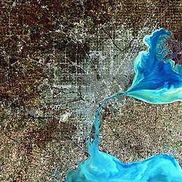 | |
|---|---|---|
| Detroit | ||
| Municipalities over 80,000 | ||
| Municipalities 40,000 to 80,000 | ||
| Cultural enclaves | ||
| Satellite cities | ||
| Counties in MSA | ||
| Counties in CSA | ||

| Authority control |
|
|---|