Newport County, Rhode Island
Newport County is one of five counties located in the U.S. state of Rhode Island. As of the 2010 census, the population was 82,888.[1] It is also one of the seven regions of Rhode Island. The county was created in 1703.[2] Like all of the counties in Rhode Island, Newport County no longer has any governmental functions (other than as court administrative and sheriff corrections boundaries). All of those functions in Rhode Island are now carried out either by the state government, or by the cities and towns of Rhode Island. Newport County is included in the Providence-Warwick, RI-MA Metropolitan Statistical Area, which is in turn constitutes a portion of the greater Boston-Worcester-Providence, MA-RI-NH-CT Combined Statistical Area.
Newport County | |
|---|---|
 | |
 Location within the U.S. state of Rhode Island | |
 Rhode Island's location within the U.S. | |
| Coordinates: 41°32′31″N 71°16′33″W | |
| Country | |
| State | |
| Founded | June 22, 1703 |
| Largest city | Newport |
| Area | |
| • Total | 314 sq mi (810 km2) |
| • Land | 102 sq mi (260 km2) |
| • Water | 211 sq mi (550 km2) 67%% |
| Population (2010) | |
| • Total | 82,888 |
| • Estimate (2019) | 82,082 |
| • Density | 260/sq mi (100/km2) |
| Time zone | UTC−5 (Eastern) |
| • Summer (DST) | UTC−4 (EDT) |
| Congressional district | 1st |
History
Newport County was constituted on June 22, 1703, as one of the two original counties of the Colony of Rhode Island and Providence Plantations. As originally established, Newport County consisted of four towns: Portsmouth, Newport, Jamestown, and New Shoreham. In 1746–47, two towns, Little Compton and Tiverton, were acquired from Massachusetts. In 1856, the town of Fall River was split off from Tiverton but was ceded to Massachusetts six years later in 1862 as part of the settlement of the boundary dispute between Rhode Island and Massachusetts. In 1963, the town of New Shoreham was transferred to Washington County. County government was abolished in Rhode Island in 1842 and today remains only for the purpose of delineating judicial administrative boundaries.
Geography

According to the U.S. Census Bureau, the county has a total area of 314 square miles (810 km2), of which 102 square miles (260 km2) is land and 211 square miles (550 km2) (67%) is water.[3]
The county consists of Aquidneck Island, Conanicut Island, Prudence Island, and the easternmost portion of the state on the mainland. The highest point in the county is Pocasset Hill, 320 feet (98 m) above sea level, located in Tiverton. The lowest elevation is at sea level.
Adjacent counties
- Bristol County - north
- Bristol County, Massachusetts - east
- Washington County - west
National protected areas
- Sachuest Point National Wildlife Refuge
- Touro Synagogue National Historic Site
Demographics
| Historical population | |||
|---|---|---|---|
| Census | Pop. | %± | |
| 1790 | 14,351 | — | |
| 1800 | 14,845 | 3.4% | |
| 1810 | 16,294 | 9.8% | |
| 1820 | 15,771 | −3.2% | |
| 1830 | 16,535 | 4.8% | |
| 1840 | 16,874 | 2.1% | |
| 1850 | 20,007 | 18.6% | |
| 1860 | 21,896 | 9.4% | |
| 1870 | 20,050 | −8.4% | |
| 1880 | 24,180 | 20.6% | |
| 1890 | 28,552 | 18.1% | |
| 1900 | 32,599 | 14.2% | |
| 1910 | 39,335 | 20.7% | |
| 1920 | 42,893 | 9.0% | |
| 1930 | 41,668 | −2.9% | |
| 1940 | 46,696 | 12.1% | |
| 1950 | 61,539 | 31.8% | |
| 1960 | 81,891 | 33.1% | |
| 1970 | 94,559 | 15.5% | |
| 1980 | 81,383 | −13.9% | |
| 1990 | 87,194 | 7.1% | |
| 2000 | 85,433 | −2.0% | |
| 2010 | 82,888 | −3.0% | |
| Est. 2019 | 82,082 | [4] | −1.0% |
| U.S. Decennial Census[5] 1790-1960[6] 1900-1990[7] 1990-2000[8] 2010-2019[1] | |||
2000 census
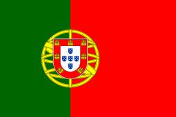
As of the census[9] of 2000, there were 85,433 people, 35,228 households, and 22,228 families living in the county. The population density was 821 people per square mile (317/km²). There were 39,561 housing units at an average density of 380 per square mile (147/km²). The racial makeup of the county was 91.46% White, 3.73% Black or African American, 0.43% Native American, 1.23% Asian, 0.07% Pacific Islander, 1.09% from other races, and 1.99% from two or more races. 2.82% of the population were Hispanic or Latino of any race. 19.6% were of Irish, 13.2% Portuguese, 11.8% English, 9.2% Italian, 6.3% German and 5.2% French ancestry. 92.0% spoke English, 2.3% Spanish, 2.1% Portuguese and 1.3% French as their first language.
There were 35,228 households out of which 28.60% had children under the age of 18 living with them, 49.90% were married couples living together, 10.30% had a female householder with no husband present, and 36.90% were non-families. 29.90% of all households were made up of individuals and 10.80% had someone living alone who was 65 years of age or older. The average household size was 2.35 and the average family size was 2.95.
In the county, the population was spread out with 22.50% under the age of 18, 8.40% from 18 to 24, 29.90% from 25 to 44, 24.80% from 45 to 64, and 14.40% who were 65 years of age or older. The median age was 39 years. For every 100 females, there were 94.60 males. For every 100 females age 18 and over, there were 91.40 males.
The median income for a household in the county was $50,448, and the median income for a family was $60,610. Males had a median income of $41,630 versus $29,241 for females. The per capita income for the county was $26,779. About 5.40% of families and 7.10% of the population were below the poverty line, including 9.00% of those under age 18 and 6.70% of those age 65 or over.
2010 census
As of the 2010 United States Census, there were 82,888 people, 34,911 households, and 21,076 families living in the county.[10] The population density was 809.6 inhabitants per square mile (312.6/km2). There were 41,796 housing units at an average density of 408.2 per square mile (157.6/km2).[11] The racial makeup of the county was 90.2% white, 3.5% black or African American, 1.6% Asian, 0.4% American Indian, 0.1% Pacific islander, 1.4% from other races, and 3.0% from two or more races. Those of Hispanic or Latino origin made up 4.2% of the population.[10] The largest ancestry groups were:


.svg.png)
.svg.png)


- 1.0% Sub-Saharan African
Of the 34,911 households, 26.2% had children under the age of 18 living with them, 46.8% were married couples living together, 10.2% had a female householder with no husband present, 39.6% were non-families, and 32.2% of all households were made up of individuals. The average household size was 2.27 and the average family size was 2.89. The median age was 43.2 years.[10]
The median income for a household in the county was $67,239 and the median income for a family was $82,477. Males had a median income of $58,191 versus $43,623 for females. The per capita income for the county was $36,994. About 4.5% of families and 7.3% of the population were below the poverty line, including 10.4% of those under age 18 and 6.1% of those age 65 or over.[13]
Communities

City
Towns
- Jamestown
- Little Compton
- Middletown
- Portsmouth
- Tiverton
Census-designated places
Villages
Villages have no separate corporate existence from the towns they are in.
- Adamsville
- Beavertail
- Bridgeport
- Briggs Point
- Bristol Ferry
- Castle Hill
- Cedar Island
- Cedar Point
- Coasters Harbor
- Coddington Point
- Common Fence Point
- Conanicut
- Corey Lane
- Despair Island
- Dutch Island
- Dyer Island
- Eagleville
- Easton Point
- Fogland Point
- Fort Adams
- Forty Steps
- Freebody Hill
- Goat Island
- Gould Island
- Grayville
- Green's End
- Hog Island
- Homestead
- Hope Island
- Hummocks
- Island Park
- Nannaquaket
- North Tiverton
- Ochre Point
- Patience
- Prudence
- Quaker Hill
- Rose Island
- Sachuest
- Sakonnet
- Tiverton Four Corners
- Tonomy Hill
- Tunipus
Politics
| Year | Republican | Democratic | Third parties |
|---|---|---|---|
| 2016 | 36.7% 15,077 | 55.7% 22,851 | 7.6% 3,117 |
| 2012 | 38.5% 15,202 | 59.5% 23,463 | 2.0% 787 |
| 2008 | 37.4% 15,717 | 60.7% 25,479 | 1.9% 801 |
| 2004 | 41.1% 16,622 | 56.9% 22,992 | 2.0% 812 |
| 2000 | 37.7% 14,258 | 54.9% 20,790 | 7.4% 2,790 |
| 1996 | 32.8% 11,500 | 54.0% 18,951 | 13.2% 4,645 |
| 1992 | 31.2% 12,386 | 44.4% 17,584 | 24.4% 9,674 |
| 1988 | 48.8% 16,923 | 50.8% 17,597 | 0.4% 144 |
| 1984 | 57.4% 19,629 | 42.3% 14,466 | 0.3% 114 |
| 1980 | 42.4% 14,555 | 40.5% 13,904 | 17.2% 5,897 |
| 1976 | 45.8% 15,155 | 53.7% 17,768 | 0.6% 184 |
| 1972 | 59.8% 19,142 | 40.1% 12,844 | 0.2% 49 |
| 1968 | 37.7% 10,504 | 58.4% 16,251 | 3.9% 1,075 |
| 1964 | 26.4% 7,078 | 73.7% 19,782 | |
| 1960 | 43.2% 11,942 | 56.8% 15,677 | |
| 1956 | 63.0% 16,063 | 37.0% 9,433 | 0.0% 2 |
| 1952 | 57.6% 15,136 | 42.3% 11,116 | 0.0% 10 |
| 1948 | 53.4% 10,756 | 45.9% 9,254 | 0.7% 136 |
| 1944 | 45.3% 9,435 | 54.6% 11,375 | 0.1% 21 |
| 1940 | 48.1% 9,882 | 51.8% 10,645 | 0.1% 14 |
| 1936 | 48.3% 9,358 | 49.1% 9,499 | 2.6% 504 |
| 1932 | 51.9% 8,633 | 47.1% 7,838 | 1.0% 165 |
| 1928 | 55.9% 8,578 | 43.9% 6,748 | 0.2% 33 |
| 1924 | 67.2% 9,608 | 27.8% 3,975 | 4.9% 706 |
| 1920 | 76.7% 9,319 | 18.3% 2,228 | 4.9% 599 |
| 1916 | 56.8% 4,003 | 41.6% 2,932 | 1.5% 108 |
| 1912 | 39.9% 2,583 | 38.4% 2,487 | 21.6% 1,400 |
| 1908 | 62.3% 3,639 | 33.4% 1,949 | 4.3% 251 |
| 1904 | 61.1% 3,683 | 37.5% 2,263 | 1.4% 87 |
| 1900 | 63.4% 3,283 | 34.3% 1,776 | 2.3% 121 |
| 1896 | 71.6% 3,415 | 22.9% 1,092 | 5.6% 266 |
| 1892 | 53.5% 2,746 | 44.0% 2,258 | 2.5% 127 |
| 1888 | 58.8% 2,447 | 39.3% 1,634 | 1.9% 79 |
| 1884 | 59.7% 2,040 | 35.3% 1,205 | 5.0% 171 |
| 1880 | 67.7% 2,064 | 32.1% 979 | 0.2% 6 |
References
- "State & County QuickFacts". United States Census Bureau. Archived from the original on June 7, 2011. Retrieved November 22, 2013.
- "Rhode Island: Individual County Chronologies". Rhode Island Atlas of Historical County Boundaries. The Newberry Library. 2009. Retrieved March 15, 2015.
- "2010 Census Gazetteer Files". United States Census Bureau. August 22, 2012. Retrieved March 14, 2015.
- "Population and Housing Unit Estimates". Retrieved May 21, 2020.
- "U.S. Decennial Census". United States Census Bureau. Retrieved March 14, 2015.
- "Historical Census Browser". University of Virginia Library. Retrieved March 14, 2015.
- Forstall, Richard L., ed. (March 27, 1995). "Population of Counties by Decennial Census: 1900 to 1990". United States Census Bureau. Retrieved March 14, 2015.
- "Census 2000 PHC-T-4. Ranking Tables for Counties: 1990 and 2000" (PDF). United States Census Bureau. April 2, 2001. Retrieved March 14, 2015.
- "U.S. Census website". United States Census Bureau. Retrieved May 14, 2011.
- "DP-1 Profile of General Population and Housing Characteristics: 2010 Demographic Profile Data". United States Census Bureau. Archived from the original on February 13, 2020. Retrieved January 12, 2016.
- "Population, Housing Units, Area, and Density: 2010 - County". United States Census Bureau. Archived from the original on February 13, 2020. Retrieved January 12, 2016.
- "DP02 SELECTED SOCIAL CHARACTERISTICS IN THE UNITED STATES – 2006-2010 American Community Survey 5-Year Estimates". United States Census Bureau. Archived from the original on February 13, 2020. Retrieved January 12, 2016.
- "DP03 SELECTED ECONOMIC CHARACTERISTICS – 2006-2010 American Community Survey 5-Year Estimates". United States Census Bureau. Archived from the original on February 13, 2020. Retrieved January 12, 2016.
- Leip, David. "Dave Leip's Atlas of U.S. Presidential Elections". uselectionatlas.org. Retrieved 7 April 2018.
External links
| Wikisource has the text of an 1879 American Cyclopædia article about Newport County, Rhode Island. |
Places adjacent to Newport County, Rhode Island | ||||||||||
|---|---|---|---|---|---|---|---|---|---|---|
| ||||||||||
Municipalities and communities of Newport County, Rhode Island, United States | ||
|---|---|---|
| City | Map of Rhode Island highlighting Newport County | |
| Towns | ||
| CDPs | ||
| Other villages | ||
Providence (capital) | ||
| Topics |
| |
| Society |
| |
| Regions | ||
| Cities | ||
| Towns |
| |

| Authority control |
|
|---|