Hightstown, New Jersey
Hightstown is a borough in Mercer County, New Jersey, United States. As of the 2010 United States Census, the borough's population was 5,494,[8][9][10] reflecting an increase of 278 (+5.3%) from the 5,216 counted in the 2000 Census, which had in turn increased by 90 (+1.8%) from the 5,126 counted in the 1990 Census.[19]
Hightstown, New Jersey | |
|---|---|
| Borough of Hightstown | |
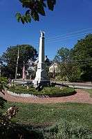 The Hightstown Civil War Memorial | |
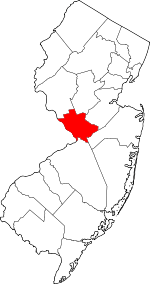
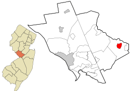 Location in Mercer County and the state of New Jersey. | |
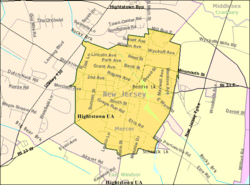 Census Bureau map of Hightstown, New Jersey | |
 Hightstown Location in Mercer County 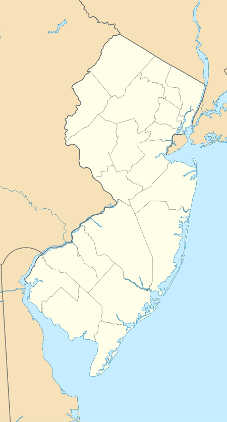 Hightstown Location in New Jersey  Hightstown Location in the United States | |
| Coordinates: 40.268457°N 74.525804°W[1][2] | |
| Country | |
| State | |
| County | Mercer |
| Incorporated | March 5, 1853 |
| Named for | Hight family |
| Government | |
| • Type | Borough |
| • Body | Borough Council |
| • Mayor | Lawrence D. "Larry" Quattrone (D, term ends December 31, 2022)[4][5] |
| • Administrator / Municipal clerk | Debra L. Sopronyi[6] |
| Area | |
| • Total | 1.242 sq mi (3.218 km2) |
| • Land | 1.211 sq mi (3.137 km2) |
| • Water | 0.031 sq mi (0.081 km2) 2.52% |
| Area rank | 479th of 565 in state 10th of 12 in county[1] |
| Elevation | 92 ft (28 m) |
| Population | |
| • Total | 5,494 |
| • Estimate (2019)[11] | 5,304 |
| • Rank | 364th of 565 in state 10th of 12 in county[12] |
| • Density | 4,536.0/sq mi (1,751.4/km2) |
| • Density rank | 125th of 565 in state 2nd of 12 in county[12] |
| Time zone | UTC−05:00 (Eastern (EST)) |
| • Summer (DST) | UTC−04:00 (Eastern (EDT)) |
| ZIP Code | |
| Area code(s) | 609[15] |
| FIPS code | 3402131620[1][16][17] |
| GNIS feature ID | 0885254[1][18] |
| Website | www |
Hightstown was incorporated as a borough by an act of the New Jersey Legislature on March 5, 1853, within portions of East Windsor Township. The borough became fully independent c. 1894. Additional portions of East Windsor Township were annexed in 1913, 1915 and 1927.[20] The traditional explanation is that the borough was named for John and Mary Hight, who established a tavern in the area in the 1750s.[21][22][23][24]
Geography
According to the United States Census Bureau, the borough had a total area of 1.242 square miles (3.218 km2), including 1.211 square miles (3.137 km2) of land and 0.031 square miles (0.081 km2) of water (2.52%).[1][2]
The borough is an independent municipality surrounded entirely by East Windsor Township,[25] making it part one of 21 pairs of "doughnut towns" in the state, where one municipality entirely surrounds another.[26][27][28]
Hightstown is at the central-most point of New Jersey and is roughly equidistant from Philadelphia and New York City.[29]
Climate
According to the Köppen climate classification system, Hightstown, New Jersey has a hot-summer, wet all year, humid continental climate (Dfa). Dfa climates are characterized by at least one month having an average mean temperature ≤ 32.0 °F (≤ 0.0 °C), at least four months with an average mean temperature ≥ 50.0 °F (≥ 10.0 °C), at least one month with an average mean temperature ≥ 71.6 °F (≥ 22.0 °C), and no significant precipitation difference between seasons. During the summer months, episodes of extreme heat and humidity can occur with heat index values ≥ 100 °F (≥ 38 °C). On average, the wettest month of the year is July which corresponds with the annual peak in thunderstorm activity. During the winter months, episodes of extreme cold and wind can occur with wind chill values < 0 °F (< -18 °C). The plant hardiness zone is 7a with an average annual extreme minimum air temperature of 0.0 °F (-17.8 °C).[30] The average seasonal (November–April) snowfall total is 24 to 30 inches (610 to 760 mm), and the average snowiest month is February which corresponds with the annual peak in nor'easter activity.
| Climate data for Hightstown, Mercer County, NJ (1981-2010 Averages) | |||||||||||||
|---|---|---|---|---|---|---|---|---|---|---|---|---|---|
| Month | Jan | Feb | Mar | Apr | May | Jun | Jul | Aug | Sep | Oct | Nov | Dec | Year |
| Record high °F (°C) | 73 (23) |
77 (25) |
88 (31) |
95 (35) |
97 (36) |
100 (38) |
105 (41) |
102 (39) |
103 (39) |
95 (35) |
82 (28) |
76 (24) |
105 (41) |
| Average high °F (°C) | 39.6 (4.2) |
42.9 (6.1) |
51.0 (10.6) |
62.5 (16.9) |
72.4 (22.4) |
81.5 (27.5) |
85.9 (29.9) |
84.2 (29.0) |
77.4 (25.2) |
66.2 (19.0) |
55.5 (13.1) |
44.3 (6.8) |
63.7 (17.6) |
| Daily mean °F (°C) | 31.2 (−0.4) |
33.9 (1.1) |
41.2 (5.1) |
51.5 (10.8) |
61.2 (16.2) |
70.6 (21.4) |
75.3 (24.1) |
73.7 (23.2) |
66.5 (19.2) |
55.1 (12.8) |
45.7 (7.6) |
35.9 (2.2) |
53.6 (12.0) |
| Average low °F (°C) | 22.8 (−5.1) |
24.9 (−3.9) |
31.4 (−0.3) |
40.6 (4.8) |
49.9 (9.9) |
59.6 (15.3) |
64.6 (18.1) |
63.2 (17.3) |
55.6 (13.1) |
44.0 (6.7) |
35.9 (2.2) |
27.5 (−2.5) |
43.4 (6.3) |
| Record low °F (°C) | −16 (−27) |
−11 (−24) |
2 (−17) |
10 (−12) |
28 (−2) |
35 (2) |
42 (6) |
40 (4) |
28 (−2) |
22 (−6) |
0 (−18) |
−12 (−24) |
−16 (−27) |
| Average precipitation inches (mm) | 3.38 (86) |
2.63 (67) |
4.10 (104) |
4.02 (102) |
4.08 (104) |
4.31 (109) |
5.01 (127) |
4.13 (105) |
4.17 (106) |
3.73 (95) |
3.56 (90) |
3.83 (97) |
46.95 (1,193) |
| Average precipitation days (≥ 0.01 in) | 10.2 | 9.3 | 11.0 | 12.0 | 12.3 | 11.4 | 10.7 | 9.7 | 8.7 | 9.4 | 9.7 | 10.1 | 124.5 |
| Average relative humidity (%) | 65.8 | 62.7 | 58.9 | 58.9 | 63.2 | 67.7 | 67.7 | 70.5 | 71.5 | 70.3 | 68.4 | 68.1 | 66.2 |
| Average dew point °F (°C) | 21.1 (−6.1) |
22.5 (−5.3) |
27.9 (−2.3) |
37.6 (3.1) |
48.6 (9.2) |
59.4 (15.2) |
63.9 (17.7) |
63.5 (17.5) |
57.0 (13.9) |
45.6 (7.6) |
35.9 (2.2) |
26.4 (−3.1) |
42.5 (5.8) |
| Source 1: NOAA [31] | |||||||||||||
| Source 2: PRISM Climate Group[32] | |||||||||||||
Ecology
According to the A. W. Kuchler U.S. potential natural vegetation types, Hightstown, New Jersey would have an Appalachian Oak (104) vegetation type with an Eastern Hardwood Forest (25) vegetation form.[33]
Demographics
| Historical population | |||
|---|---|---|---|
| Census | Pop. | %± | |
| 1860 | 970 | — | |
| 1870 | 1,347 | 38.9% | |
| 1880 | 1,355 | 0.6% | |
| 1890 | 1,875 | 38.4% | |
| 1900 | 1,749 | −6.7% | |
| 1910 | 1,879 | 7.4% | |
| 1920 | 2,674 | 42.3% | |
| 1930 | 3,012 | 12.6% | |
| 1940 | 3,486 | 15.7% | |
| 1950 | 3,712 | 6.5% | |
| 1960 | 4,317 | 16.3% | |
| 1970 | 5,431 | 25.8% | |
| 1980 | 4,581 | −15.7% | |
| 1990 | 5,126 | 11.9% | |
| 2000 | 5,216 | 1.8% | |
| 2010 | 5,494 | 5.3% | |
| Est. 2019 | 5,304 | [11][34][35] | −3.5% |
| Population sources:1860-1920[36] 1870[37] 1880-1890[38] 1890-1910[39] 1910-1930[40] 1930-1990[41] 2000[42][43] 2010[8][9][10] | |||
2010 Census
The 2010 United States Census counted 5,494 people, 1,976 households, and 1,351.584 families in the borough. The population density was 4,536.0 per square mile (1,751.4/km2). There were 2,108 housing units at an average density of 1,740.4 per square mile (672.0/km2). The racial makeup of the borough was 69.44% (3,815) White, 8.05% (442) Black or African American, 0.56% (31) Native American, 4.08% (224) Asian, 0.15% (8) Pacific Islander, 13.56% (745) from other races, and 4.17% (229) from two or more races. Hispanic or Latino of any race were 30.29% (1,664) of the population.[8]
The 1,976 households accounted 32.0% with children under the age of 18 living with them; 51.2% were married couples living together; 11.2% had a female householder with no husband present, and 31.6% were non-families. Of all households, 24.6% were made up of individuals, and 6.7% had someone living alone who was 65 years of age or older. The average household size was 2.73 and the average family size was 3.23.[8]
In the borough, the population age was spread out with 23.9% under the age of 18, 8.6% from 18 to 24, 31.1% from 25 to 44, 26.7% from 45 to 64, and 9.6% who were 65 years of age or older. The median age was 36.9 years. For every 100 females, the population had 99.5 males. For every 100 females ages 18 and older there were 100.1 males.[8]
The Census Bureau's 2006-2010 American Community Survey showed that (in 2010 inflation-adjusted dollars) median household income was $66,250 (with a margin of error of ± $8,281) and the median family income was $72,583 (± $13,355). Males had a median income of $49,861 (± $9,561) versus $42,361 (± $14,837) for females. The per capita income for the borough was $32,976 (± $3,402). About 8.2% of families and 8.7% of the population were below the poverty line, including 17.2% of those under age 18 and 1.1% of those age 65 or over.[44]
2000 Census
As of the 2000 United States Census[16] there were 5,216 people, 2,001 households, and 1,300 families residing in the borough. The population density was 4,251.9 people per square mile (1,637.3/km2). There were 2,081 housing units at an average density of 1,696.4 per square mile (653.2/km2). The racial makeup of the borough was 76.53% White, 8.51% African American, 0.36% Native American, 2.28% Asian, 0.08% Pacific Islander, 9.64% from other races, and 2.59% from two or more races. Hispanic or Latino of any race were 20.05% of the population.[42][43]
There were 2,001 households, out of which 30.3% had children under the age of 18 living with them, 51.7% were married couples living together, 8.5% had a female householder with no husband present, and 35.0% were non-families. 27.9% of all households were made up of individuals, and 9.6% had someone living alone who was 65 years of age or older. The average household size was 2.60 and the average family size was 3.15.[42][43]
In the borough the population was spread out, with 22.5% under the age of 18, 8.0% from 18 to 24, 36.8% from 25 to 44, 21.9% from 45 to 64, and 10.8% who were 65 years of age or older. The median age was 36 years. For every 100 females, there were 103.4 males. For every 100 females age 18 and over, there were 101.2 males.[42][43]
The median income for a household in the borough was $64,299, and the median income for a family was $72,092. Males had a median income of $46,375 versus $35,428 for females. The per capita income for the borough was $28,605. About 4.3% of families and 7.3% of the population were below the poverty line, including 9.1% of those under age 18 and 4.4% of those age 65 or over.[42][43]
As of the 2000 Census, 6.31% of Hightstown's residents identified themselves as being of Ecuadorian ancestry, which was the second highest of any municipality in New Jersey and the sixth highest percentage of Ecuadorian people in any place in the United States with 1,000 or more residents identifying their ancestry.[45]
Government
Local government
Hightstown is governed under the Borough form of New Jersey municipal government, which is used in 218 municipalities statewide, making it the most common form of government in New Jersey.[46] The governing body consists of a Mayor and a Borough Council, with all positions elected at-large on a partisan basis as part of the November general election. A Mayor is elected directly by the voters to a four-year term of office. The Borough Council has six members elected to serve three-year terms on a staggered basis, with two seats coming up for election each year in a three-year cycle.[3] The Borough form of government used by Hightstown is a "weak mayor / strong council" government in which council members act as the legislative body with the mayor presiding at meetings and voting only in the event of a tie. The mayor can veto ordinances subject to an override by a two-thirds majority vote of the council. The mayor makes committee and liaison assignments for council members, and most appointments are made by the mayor with the advice and consent of the council.[47][48][49]
As of 2020, the Mayor of the Borough of Hightstown is Democrat Lawrence D. Quattrone, whose term of office ends on December 31, 2022. Borough Council members are Council President Dimitri Musing (D, 2021), Susan Bluth (D, 2021), Joseph Cicalese (D, 2020; elected to serve an unexpired term), Joshua Jackson (D, 2022), Steven Misiura (D, 2022) and Charles "Lee" Stults (R, 2020).[4][50][51][52][53][54]
In January 2019, the Borough Council selected Patricia Egan from a list of three candidates nominated by the Republican municipal committee to fill the seat expiring in December 2020 that became vacant the previous month following the resignation of Connor Montferrat. At that same meeting, the council chose Joshua Jackson from a list of three Democrats to fill the seat scheduled to expire in December 2019 that had been held by Denise "Denny" Hansen until she resigned from office in December 2018.[55] In the November 2019 general election, Democrat Joseph Cicalese was elected to serve the balance of the term of office through December 2020.[52]
In January 2015, the council selected former council president Susan Bluth to fill the vacant council seat expiring in December 2015 of Larry Quattrone, who left office when he was sworn in as mayor.[56]
Seth Kurs was appointed in April 2014 from among three prospective candidates to fill the vacant seat expiring in 2015 of Gail Doran, who had resigned earlier in the month, citing personal reasons. The term of the appointment ran through November 14, 2014, after which Seth Kurs was elected in the general election to complete the remaining unexpired term through December 31, 2015.[57]
Federal, state and county representation
Hightstown is located in the 12th Congressional District[58] and is part of New Jersey's 14th state legislative district.[9][59][60] Prior to the 2011 reapportionment following the 2010 Census, Hightstown had been in the 12th state legislative district.[61] Prior to the 2010 Census, Hightstown had been part of the 4th Congressional District, a change made by the New Jersey Redistricting Commission that took effect in January 2013, based on the results of the November 2012 general elections.[61]
For the 116th United States Congress, New Jersey's Twelfth Congressional District is represented by Bonnie Watson Coleman (D, Ewing Township).[62][63] New Jersey is represented in the United States Senate by Democrats Cory Booker (Newark, term ends 2021)[64] and Bob Menendez (Paramus, term ends 2025).[65][66]
For the 2018–2019 session (Senate, General Assembly), the 14th Legislative District of the New Jersey Legislature is represented in the State Senate by Linda R. Greenstein (D, Plainsboro Township) and in the General Assembly by Daniel R. Benson (D, Hamilton Township, Mercer County) and Wayne DeAngelo (D, Hamilton Township, Mercer County).[67][68]
Mercer County is governed by a County Executive who oversees the day-to-day operations of the county and by a seven-member Board of Chosen Freeholders that acts in a legislative capacity, setting policy. All officials are chosen at-large in partisan elections, with the executive serving a four-year term of office while the freeholders serve three-year terms of office on a staggered basis, with either two or three seats up for election each year.[69] As of 2014, the County Executive is Brian M. Hughes (D, term ends December 31, 2015; Princeton).[70] Mercer County's Freeholders are Freeholder Chair Andrew Koontz (D, 2016; Princeton),[71] Freeholder Vice Chair Samuel T. Frisby, Sr. (2015; Trenton),[72] Ann M. Cannon (2015; East Windsor Township),[73] Anthony P. Carabelli (2016; Trenton),[74] John A. Cimino (2014, Hamilton Township),[75] Pasquale "Pat" Colavita, Jr. (2015; Lawrence Township)[76] and Lucylle R. S. Walter (2014; Ewing Township)[77][78][79] Mercer County's constitutional officers are County Clerk Paula Sollami-Covello (D, 2015),[80] Sheriff John A. Kemler (D, 2014)[81] and Surrogate Diane Gerofsky (D, 2016).[82][83]
Politics
As of March 23, 2011, there were a total of 2,891 registered voters in Hightstown, of which 1,105 (38.2%) were registered as Democrats, 542 (18.7%) were registered as Republicans and 1,241 (42.9%) were registered as Unaffiliated. There were 3 voters registered to other parties.[84]
| Year | Republican | Democratic | Third Parties |
|---|---|---|---|
| 2016[85] | 32.1% 729 | 63.4% 1,438 | 4.5% 101 |
| 2012[86] | 33.4% 707 | 64.6% 1,369 | 2.0% 42 |
| 2008[87] | 30.4% 685 | 66.8% 1,504 | 1.6% 36 |
| 2004[88] | 36.4% 771 | 59.3% 1,254 | 0.9% 25 |
In the 2012 presidential election, Democrat Barack Obama received 64.6% of the vote (1,369 cast), ahead of Republican Mitt Romney with 33.4% (707 votes), and other candidates with 2.0% (42 votes), among the 2,308 ballots cast by the borough's 3,062 registered voters (190 ballots were spoiled), for a turnout of 75.4%.[86][89] In the 2008 presidential election, Democrat Barack Obama received 66.8% of the vote (1,504 cast), ahead of Republican John McCain with 30.4% (685 votes) and other candidates with 1.6% (36 votes), among the 2,253 ballots cast by the borough's 2,962 registered voters, for a turnout of 76.1%.[87] In the 2004 presidential election, Democrat John Kerry received 59.3% of the vote (1,254 ballots cast), outpolling Republican George W. Bush with 36.4% (771 votes) and other candidates with 0.9% (25 votes), among the 2,116 ballots cast by the borough's 2,776 registered voters, for a turnout percentage of 76.2.[88]
| Year | Republican | Democratic | Third Parties |
|---|---|---|---|
| 2017[90] | 38.7% 493 | 58.4% 744 | 2.8% 36 |
| 2013[91] | 57.9% 765 | 38.8% 512 | 3.3% 44 |
| 2009[92] | 46.2% 700 | 44.8% 679 | 8.2% 123 |
| 2005[93] | 41.2% 582 | 53.1% 750 | 5.7% 80 |
In the 2013 gubernatorial election, Republican Chris Christie received 57.9% of the vote (765 cast), ahead of Democrat Barbara Buono with 38.8% (512 votes), and other candidates with 3.3% (44 votes), among the 1,341 ballots cast by the borough's 2,961 registered voters (20 ballots were spoiled), for a turnout of 45.3%. In the 2009 gubernatorial election, Republican Chris Christie received 46.2% of the vote (700 ballots cast), ahead of Democrat Jon Corzine with 44.8% (679 votes), Independent Chris Daggett with 7.1% (107 votes) and other candidates with 1.1% (16 votes), among the 1,514 ballots cast by the borough's 2,908 registered voters, yielding a 52.1% turnout.[92]
Education
Students in public school for kindergarten through twelfth grade attend the East Windsor Regional School District.[94] The comprehensive school district serves students from East Windsor Township and Hightstown, along with students in grades 7 - 12 from Roosevelt (in Monmouth County) who attend as part of a sending/receiving relationship.[95] As of the 2017–18 school year, the district and its six schools had an enrollment of 5,231 students and 427.9 classroom teachers (on an FTE basis), for a student–teacher ratio of 12.2:1.[96]
Schools in the district (with 2017-18 enrollment data from the National Center for Education Statistics[97]) are Walter C. Black Elementary School[98] (557; K-2), Ethel McKnight Elementary School[99] (493; K-2), Perry L. Drew Elementary School[100] (659; 3-5), Grace N. Rogers Elementary School[101] (594; PreK-5), Melvin H. Kreps Middle School[102] (1,228; 6-8) and Hightstown High School[103] (1,616, 9-12).[104]
Eighth grade students from all of Mercer County are eligible to apply to attend the high school programs offered by the Mercer County Technical Schools, a county-wide vocational school district that offers full-time career and technical education at its Health Sciences Academy, STEM Academy and Academy of Culinary Arts, with no tuition charged to students for attendance.[105][106]
Hightstown is also home to the Peddie School, a coeducational, independent high school founded in 1864.[107]
Transportation
Roads and highways
_at_Academy_Street_in_Hightstown_Borough%2C_Mercer_County%2C_New_Jersey.jpg)
As of May 2010, the borough had a total of 16.74 miles (26.94 km) of roadways, of which 12.70 miles (20.44 km) were maintained by the municipality, 2.74 miles (4.41 km) by Mercer County and 1.30 miles (2.09 km) by the New Jersey Department of Transportation.[108]
Hightstown is located at the cross-roads of several major roads. The main highway through the borough is Route 33 (which is also concurrent with County Route 539 and County Route 571).[109] A small portion of U.S. Route 130 passes through the northwest corner and is accessible by Route 33, CR 571 and CR 539. Highways located just outside the borough include the New Jersey Turnpike (Interstate 95) and New Jersey Route 133, which both intersect with Route 33 at Exit 8 of the turnpike.[110]
Public transportation
The Greater Mercer Transportation Management Association offers service on the Route 130 Connection between the Trenton Transit Center and South Brunswick.[111] The Princeton Junction Shuttle connects East Windsor Township and Hightstown with the Princeton Junction Rail Station.[112]
There is also direct service to New York, as well as other New Jersey communities on the Suburban Coach route 300 to and from the Port Authority Bus Terminal, Grand Central Terminal and other destinations in Midtown Manhattan and the 600 route to and from Downtown Manhattan / Wall Street.[113]
Railroads
Hightstown was formerly served by the Camden & Amboy Railroad (C&A), the first chartered railway company in the state and the third-oldest in the United States. Service to Hightstown began in December 1831 using the British-built John Bull locomotive. C&A was acquired by the Pennsylvania Railroad (PRR) in 1871 after consolidating it with the United New Jersey Railroad and Canal Company. Ownership was later transferred to Penn Central (PC) in 1968, following by Conrail in 1976 after PC went bankrupt.[114][115]
In early 1982, Conrail ended freight service to Hightstown on what was known as the Hightstown Industrial Track and filed for abandonment that fall. Trackage was removed in March 1983.
Notable people
People who were born in, residents of, or otherwise closely associated with Hightstown include:
- Kay B. Barrett (1902–1995), Hollywood talent scout who acquired the movie rights to the book Gone with the Wind.[116]
- Estelle Brodman (1914–2007), medical librarian and academic, lived in Hightstown after her retirement.[117][118]
- Hilly Kristal (1931–2007), founder and owner of the New York City music club CBGB.[119]
- Larry Kelley (1915–2000), football player who won the Heisman Trophy in 1936.[120]
- Desiree Lubovska (1893–1974), founded the American National Ballet School at Hightstown in 1921.[121]
- Worrall Frederick Mountain (1909–1992), Justice of the New Jersey Supreme Court from 1971 to 1979.[122]
- Elizabeth Greenleaf Pattee (1893–1991), architect, landscape architect and architecture professor.[123]
- Randal Pinkett (born 1971), business consultant who in 2005 was the winner of season four of the reality television show, The Apprentice.[124]
- Jonathan Sprout (born 1952), songwriter, performer and recording artist.[125]
- Martin Waldron (1925–1981), winner of the 1964 Pulitzer Prize for reporting on unchecked spending on the Florida Turnpike.[126]
- Charles L. Walters (c. 1862–1894), politician who served in the New Jersey General Assembly.[127]
- Paul Watkins (born 1964), novelist.[128]
- John Archibald Wheeler (1911–2008), physicist.[129]
- Nick Williams (born 1990), wide receiver who has played in the NFL for the Washington Redskins.[130]
- John Woodruff (1915–2007), Gold Medalist at 800 metres at the 1936 Summer Olympics in Berlin.[131]
References
- 2010 Census Gazetteer Files: New Jersey County Subdivisions, United States Census Bureau. Accessed May 21, 2015.
- US Gazetteer files: 2010, 2000, and 1990, United States Census Bureau. Accessed September 4, 2014.
- 2012 New Jersey Legislative District Data Book, Rutgers University Edward J. Bloustein School of Planning and Public Policy, March 2013, p. 63.
- Mayor and Council, Hightstown Borough. Accessed May 4, 2020.
- 2020 New Jersey Mayors Directory, New Jersey Department of Community Affairs. Accessed February 1, 2020.
- Administration, Borough of Hightstown. Accessed May 4, 2020.
- U.S. Geological Survey Geographic Names Information System: Borough of Hightstown, Geographic Names Information System. Accessed March 5, 2013.
- DP-1 - Profile of General Population and Housing Characteristics: 2010 for Hightstown borough, Mercer County, New Jersey Archived February 12, 2020, at Archive.today, United States Census Bureau. Accessed March 14, 2012.
- Municipalities Sorted by 2011-2020 Legislative District, New Jersey Department of State. Accessed February 1, 2020.
- Profile of General Demographic Characteristics: 2010 for Hightstown borough Archived August 30, 2014, at the Wayback Machine, New Jersey Department of Labor and Workforce Development. Accessed March 14, 2012.
- QuickFacts for Hightstown borough, New Jersey; Mercer County, New Jersey; New Jersey from Population estimates, July 1, 2019, (V2019), United States Census Bureau. Accessed May 21, 2020.
- GCT-PH1 Population, Housing Units, Area, and Density: 2010 - State -- County Subdivision from the 2010 Census Summary File 1 for New Jersey Archived February 12, 2020, at Archive.today, United States Census Bureau. Accessed September 23, 2012.
- Look Up a ZIP Code for Hightstown, NJ, United States Postal Service. Accessed March 14, 2012.
- Zip Codes, State of New Jersey. Accessed August 28, 2013.
- Area Code Lookup - NPA NX for Hightstown, NJ, Area-Codes.com. Accessed August 28, 2013.
- U.S. Census website , United States Census Bureau. Accessed September 4, 2014.
- Geographic codes for New Jersey, Missouri Census Data Center. Accessed September 1, 2019.
- US Board on Geographic Names, United States Geological Survey. Accessed September 4, 2014.
- Table 7. Population for the Counties and Municipalities in New Jersey: 1990, 2000 and 2010, New Jersey Department of Labor and Workforce Development, February 2011. Accessed September 23, 2012.
- Snyder, John P. The Story of New Jersey's Civil Boundaries: 1606-1968, Bureau of Geology and Topography; Trenton, New Jersey; 1969. p. 162. Accessed March 14, 2012.
- Hutchinson, Richard S. "Hightstown, New Jersey And Some Hight Family Connections", Hightstown-East Windsor, New Jersey Historical Society News, November–December 2003. Accessed November 27, 2019.
- Gannett, Henry. The Origin of Certain Place Names in the United States, p. 156. United States Government Printing Office, 1905. Accessed January 1, 2015.
- Hutchinson, Viola L. The Origin of New Jersey Place Names, New Jersey Public Library Commission, May 1945. Accessed September 1, 2015.
- Mulvaney, Nicole. "Virginia woman and her mother to travel to N.J. to confirm lineage to Hightstown's founders", NJ.com, October 7, 2014. Accessed September 1, 2015. "John Hight was the first tavern keeper in town between the 1750s and 1770s. It was during those years, in the 1760s, that the name 'Hightstown' was established, Craig said.... 'John and Mary Hight were the namesake founders of the village of Hightstown, which later grew into the borough of Hightstown,' he said."
- Areas touching Hightstown, MapIt. Accessed February 24, 2020.
- DeMarco, Megan. "Voters to decide whether to merge two Princetons into one", The Star-Ledger, November 3, 2011. Accessed January 8, 2017. "There are 22 sets of 'doughnut towns' in New Jersey, those where one town wraps around the other town". Note that following voter approval of the Princeton, New Jersey merger, 21 pairs of "doughnut towns" remain.
- Municipalities within Mercer County, NJ, Delaware Valley Regional Planning Commission. Accessed November 15, 2019.
- New Jersey Municipal Boundaries, New Jersey Department of Transportation. Accessed November 15, 2019.
- Serzan, Kerry. "Borough of Hightstown boasts small-town charm, rich history and quaint lakeside business district", NJ.com, August 28, 2015, updated September 30, 2016. Accessed January 9, 2017. "Geographically and culturally, the Borough of Hightstown is 'at the center of it all'.... The small-yet-significant Mercer County borough lies at the central-most point of New Jersey and is roughly equidistant from New York City and Philadelphia."
- USDA Interactive Plant Hardiness Map, United States Department of Agriculture. Accessed November 26, 2019.
- NowData - NOAA Online Weather Data, National Oceanic and Atmospheric Administration. Accessed March 4, 2012.
- PRISM Climate Group, Oregon State University. Accessed November 26, 2019.
- U.S. Potential Natural Vegetation, Original Kuchler Types, v2.0 (Spatially Adjusted to Correct Geometric Distortions), Data Basin. Accessed November 26, 2019.
- Annual Estimates of the Resident Population for Minor Civil Divisions in New Jersey: April 1, 2010 to July 1, 2019, United States Census Bureau. Accessed May 21, 2020.
- Census Estimates for New Jersey April 1, 2010 to July 1, 2019, United States Census Bureau. Accessed May 21, 2020.
- Compendium of censuses 1726-1905: together with the tabulated returns of 1905, New Jersey Department of State, 1906. Accessed July 12, 2013.
- Staff. A compendium of the ninth census, 1870, p. 260. United States Census Bureau, 1872. Accessed November 19, 2012.
- Porter, Robert Percival. Preliminary Results as Contained in the Eleventh Census Bulletins: Volume III - 51 to 75, p. 98. United States Census Bureau, 1890. Accessed September 23, 2012.
- Thirteenth Census of the United States, 1910: Population by Counties and Minor Civil Divisions, 1910, 1900, 1890, United States Census Bureau, p. 337. Accessed September 23, 2012.
- Fifteenth Census of the United States : 1930 - Population Volume I, United States Census Bureau, p. 716. Accessed March 14, 2012.
- Table 6. New Jersey Resident Population by Municipality: 1930 - 1990, New Jersey Department of Labor and Workforce Development. Accessed June 28, 2015.
- Census 2000 Profiles of Demographic / Social / Economic / Housing Characteristics for Hightstown borough, New Jersey Archived August 16, 2014, at the Wayback Machine, United States Census Bureau. Accessed September 23, 2012.
- DP-1: Profile of General Demographic Characteristics: 2000 - Census 2000 Summary File 1 (SF 1) 100-Percent Data for Hightstown borough, Mercer County, New Jersey Archived February 12, 2020, at Archive.today, United States Census Bureau. Accessed September 23, 2012.
- DP03: Selected Economic Characteristics from the 2006-2010 American Community Survey 5-Year Estimates for Hightstown borough, Mercer County, New Jersey Archived February 12, 2020, at Archive.today, United States Census Bureau. Accessed March 14, 2012.
- Ecuadorian Communities Archived November 10, 2006, at the Wayback Machine, EPodunk. Accessed June 28, 2006.
- Inventory of Municipal Forms of Government in New Jersey, Rutgers University Center for Government Studies, July 1, 2011. Accessed November 18, 2019.
- Cerra, Michael F. "Forms of Government: Everything You've Always Wanted to Know, But Were Afraid to Ask" Archived September 24, 2014, at the Wayback Machine, New Jersey State League of Municipalities. Accessed November 30, 2014.
- "Forms of Municipal Government in New Jersey", p. 6. Rutgers University Center for Government Studies. Accessed June 3, 2015.
- Government, Borough of Hightstown. Accessed May 4, 2020. "The Borough of Hightstown was incorporated on March 5, 1853, and operates under the Borough form of government, the largest single form of municipal government in use in New Jersey. Under this form, the Mayor, elected directly by the voters, is the head of Borough government and recommends to council such measures as he deems necessary for the welfare of the Borough. The governing body consists of six elected Councilmembers, each serving a three-year term, and one elected Mayor who serves a four-year term."
- 2019 Municipal User Friendly Budget, Borough of Hightstown. Accessed May 4, 2020.
- Mercer County Elected Officials, Mercer County, New Jersey, as of January 6, 2020. Accessed May 4, 2020.
- General Election November 5, 2019 Official Results, Mercer County, New Jersey, updated December 9, 2019. Accessed January 1, 2020.
- General Election November 6, 2018 Official Results, Mercer County, New Jersey, updated November 13, 2018. Accessed January 1, 2018.
- General Election November 7, 2017 Official Results, Mercer County, New Jersey, updated November 17, 2017. Accessed January 1, 2018.
- Meeting Minutes for January 22, 2019, Hightstown Borough. Accessed November 27, 2019. "Patricia Egan is hereby appointed to serve in the position of Councilmember to fill the vacancy until the General Election on November 5, 2019 when a successor will be elected by the voters to fulfill the vacant unexpired term of Councilmember Connor Montferrat ending December 31, 2020.... Whereas, there exists a vacancy in the office of Councilmember due to the resignation of Denise (Denny) Hansen effective December 31, 2018... Joshua Jackson is hereby appointed to serve in the position of Councilmember to fill the vacancy of the unexpired term ending December 31, 2019."
- Mulvaney, Nicole. "Former Hightstown council president who lost election is appointed councilwoman", The Times (Trenton), January 7, 2015. Accessed February 20, 2015. "Former Hightstown council president Susan Bluth was appointed to the governing body Monday to fill the unexpired term of Mayor Larry Quattrone, who was sworn in Jan. 1. Quattrone, a Democrat, beat out former Councilman Rob Thibault, who filed to run as an independent, and Republican newcomer Douglas Mair in the November election. Quattrone's term was set to expire Dec. 31, 2015."
- Clerkin, Bridget. "Hightstown fills vacant borough council seat with local lawyer", The Times (Trenton), April 29, 2014. Accessed September 4, 2014. "Local attorney Seth Kurs will fill the vacancy created by an unexpected resignation from the Hightstown Borough Council.Kurs was sworn in by the council Monday night to occupy the seat left open by Gail Doran, who submitted her letter of resignation on April 7."
- Plan Components Report, New Jersey Redistricting Commission, December 23, 2011. Accessed February 1, 2020.
- 2019 New Jersey Citizen's Guide to Government, New Jersey League of Women Voters. Accessed October 30, 2019.
- Districts by Number for 2011-2020, New Jersey Legislature. Accessed January 6, 2013.
- 2011 New Jersey Citizen's Guide to Government Archived June 4, 2013, at the Wayback Machine, p. 59, New Jersey League of Women Voters. Accessed May 22, 2015.
- Directory of Representatives: New Jersey, United States House of Representatives. Accessed January 3, 2019.
- Biography, Congresswoman Bonnie Watson Coleman. Accessed January 3, 2019. "Watson Coleman and her husband William reside in Ewing Township and are blessed to have three sons; William, Troy, and Jared and three grandchildren; William, Kamryn and Ashanee."
- About Cory Booker, United States Senate. Accessed January 26, 2015. "He now owns a home and lives in Newark's Central Ward community."
- Biography of Bob Menendez, United States Senate, January 26, 2015. "He currently lives in Paramus and has two children, Alicia and Robert."
- Senators of the 116th Congress from New Jersey. United States Senate. Accessed April 17, 2019. "Booker, Cory A. - (D - NJ) Class II; Menendez, Robert - (D - NJ) Class I"
- Legislative Roster 2018-2019 Session, New Jersey Legislature. Accessed January 22, 2018.
- District 14 Legislators, New Jersey Legislature. Accessed January 22, 2018.
- Elected Officials, Mercer County, New Jersey. Accessed September 6, 2014.
- Brian M. Hughes, County Executive, Mercer County, New Jersey. Accessed September 6, 2014.
- Andrew Koontz, Mercer County. Accessed September 6, 2014.
- Samuel T. Frisby, Sr., Mercer County. Accessed September 6, 2014.
- Ann M. Cannon, Mercer County. Accessed September 6, 2014.
- Anthony P. Carabelli, Mercer County. Accessed September 6, 2014.
- John A. Cimono, Mercer County. Accessed September 6, 2014.
- Pasquale "Pat" Colavita, Jr., Mercer County. Accessed September 6, 2014.
- Lucylle R. S. Walter, Mercer County. Accessed September 6, 2014.
- Meet the Freeholders, Mercer County. Accessed September 6, 2014.
- 2014 County Data Sheet, Mercer County. Accessed September 6, 2014.
- County Clerk, Mercer County. Accessed September 6, 2014.
- Sheriff, Mercer County. Accessed September 6, 2014.
- County Surrogate, Mercer County. Accessed September 6, 2014.
- Elected Officials for Mercer County, State of New Jersey. Accessed September 6, 2014.
- Voter Registration Summary - Mercer, New Jersey Department of State Division of Elections, March 23, 2011. Accessed November 21, 2012.
- "Presidential General Election Results - November 8, 2016 - Mercer County" (PDF). New Jersey Department of Elections. Retrieved December 31, 2017.
- "Presidential General Election Results - November 6, 2012 - Mercer County" (PDF). New Jersey Department of Elections. March 15, 2013. Retrieved December 23, 2014.
- 2008 Presidential General Election Results: Mercer County, New Jersey Department of State Division of Elections, December 23, 2008. Accessed November 21, 2012.
- 2004 Presidential Election: Mercer County, New Jersey Department of State Division of Elections, December 13, 2004. Accessed November 21, 2012.
- "Number of Registered Voters and Ballots Cast - November 6, 2012 - General Election Results - Mercer County" (PDF). New Jersey Department of Elections. March 15, 2013. Retrieved December 23, 2014.
- "Governor - Mercer County" (PDF). New Jersey Department of Elections. Archived from the original (PDF) on January 1, 2018. Retrieved December 31, 2017.
- "Governor - Mercer County" (PDF). New Jersey Department of Elections. January 29, 2014. Retrieved December 24, 2014.
- 2009 Governor: Mercer County Archived August 22, 2012, at the Wayback Machine, New Jersey Department of State Division of Elections, December 31, 2009. Accessed November 21, 2012.
- 2005 Governor: Mercer County Archived July 7, 2016, at the Wayback Machine, New Jersey Department of State Division of Elections. Accessed December 31, 2017.
- 2017-2018 Mercer County Charter and Public Schools Directory, Mercer County, New Jersey. Accessed November 15, 2019.
- East Windsor Regional School District 2015 Report Card Narrative, New Jersey Department of Education. Accessed July 11, 2016. "The East Windsor Regional School District, located in central New Jersey at New Jersey Turnpike Exit 8, is a stable K-12 public school district serving the communities of the East Windsor Township and the Borough of Hightstown as well as Roosevelt Borough students' grades 7 through 12."
- District information for East Windsor Regional School District, National Center for Education Statistics. Accessed November 1, 2019.
- School Data for the East Windsor Regional School District, National Center for Education Statistics. Accessed November 1, 2019.
- Walter C. Black Elementary School, East Windsor Regional School District. Accessed November 25, 2019.
- Ethel McKnight Elementary School, East Windsor Regional School District. Accessed November 25, 2019.
- Perry L. Drew Elementary School, East Windsor Regional School District. Accessed November 25, 2019.
- Grace N. Rogers Elementary School, East Windsor Regional School District. Accessed November 25, 2019.
- Melvin H. Kreps Middle School, East Windsor Regional School District. Accessed November 25, 2019.
- Hightstown High School, East Windsor Regional School District. Accessed November 25, 2019.
- New Jersey School Directory for the East Windsor Regional School District, New Jersey Department of Education. Accessed December 29, 2016.
- Heyboer, Kelly. "How to get your kid a seat in one of N.J.'s hardest-to-get-into high schools", NJ Advance Media for NJ.com, May 2017. Accessed November 18, 2019. "Mercer County has a stand-alone specialized high school for top students: a Health Sciences Academy at the district's Assunpink Center campus. The district also offers a STEM Academy at Mercer County Community College. How to apply: Students can apply online in the fall of their 8th grade year."
- High School Programs, Mercer County Technical Schools. Accessed November 18, 2019.
- History, Peddie School. Accessed March 14, 2012.
- Mercer County Mileage by Municipality and Jurisdiction, New Jersey Department of Transportation, May 2010. Accessed July 18, 2014.
- Route 33 Straight Line Diagram, New Jersey Department of Transportation, updated March 2017. Accessed November 27, 2019.
- Mercer County Road Map, New Jersey Department of Transportation. Accessed November 27, 2019.
- Mercer County Bus Service, Greater Mercer Transportation Management Association. Accessed November 27, 2019.
- Princeton Junction Shuttle, East Windsor Township, New Jersey. Accessed November 27, 2019.
- Available schedules from Hightstown, NJ to New York, NY., Coach USA. Accessed September 4, 2014.
- The Camden And Amboy Railroad, American-Rails.com. Accessed February 6, 2018.
- History of the Camden & Amboy, Jersey Central Railway Historical Society. Accessed February 6, 2018.
- Van Gelder, Lawrence. "Kay B. Barrett, Talent Scout And Entertainment Agent, 93", The New York Times, January 19, 1995. Accessed December 3, 2012. "Kay Brown Barrett, who bought Gone With the Wind for the movie producer David O. Selznick after discovering the novel as his New York representative, died yesterday at the Meadow Lakes retirement community in Hightstown, N.J., where she had lived for the last 14 years. She was 93."
- Estelle Brodman (1914-) (finding aid), Columbia University. Accessed November 27, 2019.
- Messerele, Judith. "Estelle Brodman, AHIP, FMLA, 1914–2007", Journal of the Medical Library Association, 2010 January; 98(1): 6–8. Accessed November 27, 2019. "On March 1, 2007, the Medical Library Association (MLA) lost a towering figure of the profession. Estelle Brodman, AHIP, FMLA, died at Meadow Lake Estates in Hightstown, NJ, of natural causes."
- Sisario, Ben. "Hilly Kristal, 75, Catalyst for Punk at CBGB, Dies", The New York Times, August 30, 2007. Accessed August 17, 2013. "Hillel Kristal grew up on a farm in Hightstown, N.J., and studied classical violin as a child."
- Goldstein, Harold. "Larry Kelley, 85, a Yale End Who Won the Heisman, Dies", The New York Times, June 29, 2000. Accessed September 4, 2014. "Larry Kelley, the Yale University end who won the Heisman Trophy in 1936, then found himself back in the public eye six months ago when he sold the statuette at auction for $328,100, died Tuesday at his home in Hightstown, N.J., of an apparent self-inflicted gunshot wound."
- Mitchell, Hannah. "Social Leaders Back Plan for an American Ballet School" New-York Tribune, February 20, 1921: 68. via Newspapers.com

- Daniels, Lee A. "Justice Worrall F. Mountain, 83; Served on New Jersey High Court", The New York Times, August 26, 1992. Accessed June 15, 2016. "Worrall F. Mountain, a retired justice of the New Jersey Supreme Court, died on Monday at the Princeton Medical Center in Princeton, N.J. He was 83 years old and lived in Hightstown, N.J."
- Staff. "Elizabeth G. Pattee, 97 Was an architect and professor", The Boston Globe, March 1, 1991. Accessed October 17, 2015. "Elizabeth Greenleaf Pattee, an architect who taught at the Rhode Island School of Design from 1945 to 1962, died Wednesday at the Meadow Lakes retirement community in Hightstown, N.J. She was 97 and a former resident of Providence and Warwick, R.I."
- Staff. "Randal Is Hired!", Rutgers University Alumni Association. Accessed September 4, 2014. "Growing up in Hightstown, Pinkett says he learned at an early age that 'to whom much is given, much is expected. I therefore place great emphasis on using my God-given talents to give back to the community,' he says."
- Ollestead, Berit. "It’s all about R-E-S-P-E-C-T at Alfred Vail School in Morris Plains", Morristown Green, October 15, 2013. Accessed July 23, 2019. "Growing up in Hightstown, Sprout set out to sing for grown-ups."
- Staff. "Martin O. Waldron Is Dead At 56; Reporting Led To A Pulitzer Prize", The New York Times, May 28, 1981. Accessed May 12, 2011. "Martin O. Waldron, chief of the Trenton bureau of The New York Times, whose investigative reporting for The St. Petersburg (Fla.) Times led to a Pulitzer Prize for Public Service for the newspaper, died of heart disease yesterday at his home in Hightstown, N.J."
- Staff. "Obituary Notes", The New York Times, June 21, 1894. Accessed May 29, 2017. "Assemblyman Charles L. Walters of the Second Assembly District of Monmouth County died yesterday afternoon at his home, in Seabright, N.J., aged thirty-four years. He was born at Hightstown, that state."
- Walczak, Danielle. "Novelist draws on Maine backcountry for inspiration in new book", Bangor Daily News, August 7, 2014. Accessed September 4, 2014. "For Paul Watkins, Maine is that place. It's the area he can't get out of his mind, even in the shadow of New York City in Hightstown, N.J."
- MacPherson, Kitta. "Leading physicist John Wheeler dies at age 96" Archived January 30, 2017, at the Wayback Machine, News at Princeton, April 14, 2008. Accessed March 14, 2012. "Wheeler, the Joseph Henry Professor of Physics Emeritus at Princeton University, was 96. He succumbed to pneumonia on Sunday, April 13, at his home in Hightstown, N.J."
- O'Gorman, George. "Four Mercer County players make NFL rosters", The Trentonian, August 31, 2013. Accessed December 3, 2013. "Hightstown's Williams, who played at UConn, had seven preseason catches for 51 yards for the 'Skins."
- Litsky, Frank. "A Victory That's Still Memorable 70 Years Later", The New York Times, August 1, 2006. Accessed November 10, 2012. "He spoke from Fountain Hills, Ariz., near Phoenix, where he and Rose have lived in a two-bedroom apartment in a senior housing complex for five years since moving from Hightstown, N.J."
External links
| Wikimedia Commons has media related to Hightstown, New Jersey. |
| Wikivoyage has a travel guide for Hightstown. |
- Hightstown Borough website
- Downtown Hightstown
- East Windsor Regional School District
- East Windsor Regional School District's 2015–16 School Report Card from the New Jersey Department of Education
- School Data for the East Windsor Regional School District, National Center for Education Statistics
| Authority control |
|
|---|