Isfara
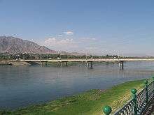
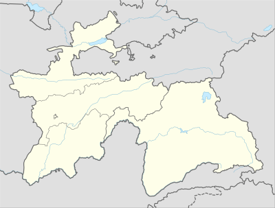
Isfara (Tajik: Исфара, Persian: اسفره) is a city in Sughd Province in northern Tajikistan, situated on the border with Kyrgyzstan. The city is the capital of the Isfara district.
Isfara Исфара | |
|---|---|
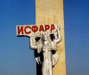 A sign welcoming travellers to Isfara | |
 Isfara | |
| Coordinates: 40°07′N 70°38′E | |
| Country | |
| Province | Sughd |
| District | Isfara |
| Incorporated | 1933 |
| Government | |
| • Mayor | Dilshod Rasulzoda |
| Area | |
| • Total | 832 km2 (321 sq mi) |
| Elevation | 863 m (2,831 ft) |
| Population (2019)[1] | |
| • Total | 59,500 |
| Time zone | UTC+5 |
| Postcode | 735920 |
| Website | http://isfara.tj |
There are currently territorial disputes between Tajikistan and Kyrgyzstan over the area of Isfara Valley.[2]
History
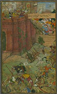
The first author who mentions Esfara as a town, is Bābor. He praised the orchards and fruits of Isfara, especially its almonds. The 16th century saw the construction of large public buildings, notably mosques and medreseh. In the 18th century Isfara was the seat of the Khan of Ḵoqand whose wars with Bokhara resulted in the destruction of some historical monuments.[3]
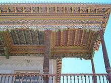
Around 20 km south, in the village of Chorku, the mausoleum Hazrati Shoh Mausoleum, is carved from wood, partly dating back to the 8th century,[4] a structure that is unique in Central Asia.
Demographics
The population of Isfara is mostly Tajik.
| Year | Population | Type |
|---|---|---|
| 1989 | 34,500 | census |
| 2000 | 37,000 | census |
| 2008 | 40,600 | estimate[5] |
Geography
Isfara is situated near the border junction of three independent states Tajikistan, Uzbekistan and Kyrgyzstan, at a height of 863m above sea level. Its territory is 832 km².
Climate
The Köppen Climate Classification sub-type classification for Isfara is "Bwk" or a Tropical and Subtropical Desert Climate. The average temperature is 11.8 °C (53.2 °F) with the warmest month being July with an average temperature of 25 °C (77 °F) and the coldest month being January with an average temperature of -2.7 °C (27.1 °F). The average amount of precipitation is 544.6mm (21.4") and there are on average 74.3 days of participation.[6]
| Climate data for Isfara | |||||||||||||
|---|---|---|---|---|---|---|---|---|---|---|---|---|---|
| Month | Jan | Feb | Mar | Apr | May | Jun | Jul | Aug | Sep | Oct | Nov | Dec | Year |
| Daily mean °C (°F) | −2.7 (27.1) |
−0.6 (30.9) |
6.2 (43.2) |
13.6 (56.5) |
18.3 (64.9) |
22.9 (73.2) |
25.0 (77.0) |
23.2 (73.8) |
18.4 (65.1) |
11.9 (53.4) |
5.4 (41.7) |
0.1 (32.2) |
11.8 (53.2) |
| Average precipitation mm (inches) | 56.9 (2.24) |
62.6 (2.46) |
89.9 (3.54) |
83.8 (3.30) |
68.3 (2.69) |
18.7 (0.74) |
10.8 (0.43) |
3.0 (0.12) |
5.4 (0.21) |
43.7 (1.72) |
47.1 (1.85) |
54.4 (2.14) |
544.6 (21.44) |
| Average precipitation days (≥ 0.1 mm) | 7.9 | 8.5 | 10.1 | 9.7 | 9.0 | 4.3 | 2.6 | 1.5 | 1.9 | 5.3 | 6.1 | 7.4 | 74.3 |
| Average relative humidity (%) | 74.2 | 72.3 | 65.0 | 58.6 | 51.4 | 40.5 | 39.9 | 43.0 | 45.9 | 55.9 | 65.1 | 73.2 | 57.1 |
| Source: "The Climate of Karakol". Weatherbase. Retrieved 31 July 2014. | |||||||||||||
Economy
Some 20 industrial companies in Isfara produce electrical equipment, chemical and metallurgical products, construction materials, food products and others.
Isfara is famous for its apricot orchards.[7]
See also
References
- "Population size, Republic of Tajikistan on January 1, 2019" (PDF) (in Tajik). Tajikistan Statistics Agency. 2019. p. 17. Retrieved 28 March 2020.
- "Central Asia :: Kyrgyzstan". The World Factbook. Central Intelligence Agency. 15 March 2020. Retrieved 28 April 2020.
- "ESFARA – Encyclopaedia Iranica". www.iranicaonline.org. Retrieved 2019-12-09.
- p181 Middleton & Thomas, Tajikistan (Odyssey Guide)
- Population in the Republic of Tajikistan as of 1 January 2008, State Statistical Committee, Dushanbe, 2008
- "Weatherbase.com". weatherbase.com. Retrieved 1 August 2014.
- "Isfara: a travel guide". Caravanistan. Retrieved 2019-12-09.
| Wikimedia Commons has media related to Isfara. |