Shaki District
Shaki or Şeki (Azerbaijani: Şəki rayonu) is a rayon of Azerbaijan. Its administrative capital is Sheki. It is located on the southern slope of the Greater Caucasus. Sheki borders by Dagestan in the north-east. Yevlakh-Balakan railway and highways pass through Shaki.
Shaki Şəki | |
|---|---|
.jpg) Looking north from the Sheki Rayon | |
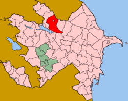 Map of Azerbaijan showing Shaki Rayon (in red) | |
| Country | Azerbaijan |
| Established | 8 August 1930 |
| Capital | Sheki |
| Government | |
| • Chief Executive | Elxan Zabir oğlu Usubov (New Azerbaijan Party) |
| Area | |
| • Total | 2,430 km2 (940 sq mi) |
| Population (2018)[1] | |
| • Total | 184,500 |
| • Density | 76/km2 (200/sq mi) |
| Postal code | 5500 |
| Telephone code | 0117 |
| Website | sheki-ih |
History
Sheki is one of the oldest cities in Azerbaijan. In medieval sources, its name is called Shaki, Shaki, Shakki, and etc. The city of Sheki was called "Nuxa" for a long time. One of the oldest authors, Ptolemy, noted that there was a settlement called "Niga" among Albanian cities.[2]
After the Ilkhanate collapsed, along with the Shirvanshahs state Shaki gained autonomy and the Orlat nobility came to power, in the first half of the XIV century. In 1551 Shaki's autonomy ended by Shah Tahmasib and Sheki joined the Safavid Empire. In 1743, Shaki Khanate was established.
In 1772 because of the overthrow of the Kish River, the historical city of Shaki was completely destroyed, some parts of the city's population had been harassed, some people had moved to other places, and some had settled in the present place of the city.[3]
Historical monuments
There are Palace of Shaki Khans (inscribed in UNESCO’s World Heritage List[4]) dating back to the XVIII century, Tower fortress, minaret of Gileyli mosque, Lower Caravanserai belonging to the XVIII-XIX centuries, Upper Caravanserai, Aghvanlar baths dating back to the 19th century in the city. "Gavur" fortress belonging to VI century, Gudula fortress of the Middle Ages, Aghcagala Mosque in Aydinbulag village, Kish temple belonging to the medieval era near the Kish village, and "Gələrsən görərsən" fortress (in English "See if you come") dating back to the 15th century are preserved in the district.
Demographics
Shaki has 65 settlements, with the majority of residents living in the cities (66,900) and a minority in villages (32,600).[1] The official languages are Azerbaijani.
According to the State Statistics Committee, as of 2018, the population of city was 185,400 persons, which increased by 26,700 persons (about 16.8 percent) from 158,700 persons in 2000.[5] 92,700 of total population are men, 92,700 are women.[6] More than 25.1 percent of the population (about 46,600 persons) consists of young people and teenagers aged 14–29.[7]
| Territory | 2000 | 2001 | 2002 | 2003 | 2004 | 2005 | 2006 | 2007 | 2008 | 2009 | 2010 | 2011 | 2012 | 2013 | 2014 | 2015 | 2016 | 2017 | 2018 |
|---|---|---|---|---|---|---|---|---|---|---|---|---|---|---|---|---|---|---|---|
| Shaki town | 158,7 | 159,9 | 160,9 | 162,1 | 163,2 | 164,6 | 165,8 | 167,3 | 169,0 | 170,4 | 171,8 | 173,5 | 175,7 | 177,5 | 179,1 | 181,0 | 182,7 | 184,2 | 185,4 |
| urban population | 63,5 | 63,6 | 63,7 | 63,8 | 64,0 | 64,3 | 64,6 | 64,7 | 65,1 | 65,3 | 65,6 | 65,9 | 66,1 | 66,4 | 66,6 | 66,9 | 67,3 | 67,4 | 67,6 |
| rural population | 95,2 | 96,3 | 97,2 | 98,3 | 99,2 | 100,3 | 101,2 | 102,6 | 103,9 | 105,1 | 106,2 | 107,6 | 109,6 | 111,1 | 112,5 | 114,1 | 115,4 | 116,8 | 117,8 |
Economy
There are 1 city, 2 settlements, 68 villages, and 31 rural executive offices, 1 city municipality and 39 rural municipalities in the district. There are 343 managerial and organizational departments, 17 bank branches, 14 hotels, 1 communication and 1 post office. The largest enterprise according to the number of employees is Shaki-Ipek OJSC.
Shaki is part of the Shaki-Zaqatala economic region. The Shaki region, one of the largest agricultural and industrial districts of the Republic, has a total area of 2.43 thousand km2 and a population of 184,172. At present 29 industrial enterprises operate in the region, of which 21 are small enterprises.
Population
| Ethnic group | 1999[8] | 2009[9] | ||
|---|---|---|---|---|
| Number | % | Number | % | |
| Total | 157 353 | 100.00 | 170 733 | 100.00 |
| Azerbaijanis | 148 862 | 94.60 | 163 092 | 95.52 |
| Lezgins | 7 469 | 4.75 | 7 152 | 4.19 |
| Russians | 231 | 0.15 | 121 | 0.07 |
| Turkish people | 45 | 0.03 | 26 | 0.02 |
| Kurds | 47 | 0.03 | 26 | 0.02 |
| Avars | 15 | 0.01 | 14 | 0.01 |
| Tatars | 61 | 0.04 | 10 | 0.01 |
| Ukrainians | 128 | 0.08 | 6 | 0.00 |
| Georgians | 13 | 0.01 | ... | ... |
| Others | 475 | 0.30 | 286 | 0.17 |
Climate
The annual sum of sunny hours is 2350 hours. Approximately 40 percents of sunny hours are observed in summer. The climate in Shaki is influenced by various air masses, cyclones and anticyclones, and local winds. Arctic and mild air masses enter Shaki with causing the temperature rise in the winter. Mountain winds form local winds in Sheki in the summer. It is because of a contrast in pressure between the mountain and the valley. The cold winds are moderated by the Great Caucasus from the north. Thus, the temperature in Sheki is 0.5 C in January. The average annual temperature is 12 C in Sheki. The average temperature ranges from 20 to 25 C in June and August.
In Sheki solid winds (over 15m / s) are hardly ever seen, with as 10–12 days a solid wind. Less than 1 meter per second the speed of the wind in Sheki is often observed. The average sum of rainfall is 730 mm. 50% of it falls in May, June, September and October. In Kish village the least precipitation is in August (35 mm), January (29 mm) and February (36 mm), 775 mm, over 1000 mm rainfall in Khan Lowland. Floods, storm, and hail are characteristic for the mountain and the fields encompassing Sheki and its urban places.
The flood event is observed frequently. The Kish Waterway basin is located in the western portion of the city and it is considered one of the most powerful flood areas in the world. In the place called Guruchay were collected sand, stone, and mud from the mountains for a long time and its middle part is higher than the city Dodo settlement. The atmosphere events such as the storm and the hail have a great deal of effect here. High relief, strong heat in the summer and high evaporation are the essential reasons of hail in Shaki.
The elevation of 500–850 m above sea level, the mountain woodlands encompassing it prevents the city from overheating. The city is secured from floods by mountain woodlands. It makes the view of the city even more beautiful. The mountainous grassland, brown mountain woodlands, meadow-forest, gray brown soils cover the city. Oak, peanuts, hornbeam trees are spacious in the woodlands. The animal world is rich.
The main streams of the city are Kish and Gurcana rivers. Kish is the right arm of Eyrichay, it is 33 km long, and the basin area is 265 km2. It starts at 2900 meters above the southern slope of the main Caucasian Range. It is one of the most flooded rivers of Transcaucasia. The upper axis is called Damarchin.[11]
Notable persons
Mirza Fatali Akhundov - writer, public figure
Bakhtiyar Vahabzadeh - poet
Molla Cümə - poet
Ahmadiyya Jabrayilov - World War II participant, partisan
See also
References
- "Population by sex, economic and administrative regions, urban settlements of the Republic of Azerbaijan at the beginning of the 2015". The State Statistical Committee of the Azerbaijan Republic. Archived from the original on 20 August 2015. Retrieved 9 August 2015.
- "TERRITORIAL AND ADMINISTRATIVE UNITS - District of Shaki" (PDF).
- "History of Sheki". Sheki Regional Cultural Department (in Azerbaijani).
- Centre, UNESCO World Heritage. "Historic Centre of Sheki with the Khan's Palace". UNESCO World Heritage Centre. Retrieved 8 July 2019.
- "Political division, population size and structure: Population by towns and regions of the Republic of Azerbaijan". The State Statistical Committee of the Republic of Azerbaijan. Retrieved 18 December 2018.
- "Political division, population size and structure: Population by sex, towns and regions, urban settlements of the Republic of Azerbaijan at the beginning of the 2018". The State Statistical Committee of the Republic of Azerbaijan. Retrieved 18 December 2018.
- "Political division, population size and structure: Population at age 14-29 by towns and regions of the Republic of Azerbaijan at the beginning of the 2018". The State Statistical Committee of the Republic of Azerbaijan. Retrieved 18 December 2018.
- Population statistics of Eastern Europe: Ethnic composition of Azerbaijan by 1999 census
- Population statistics of Eastern Europe: Ethnic composition of Azerbaijan by 2009 census
- "Угрозы национальной безопасности России на Северном Кавказе: этноконфессиональный аспект". 2004.
- "Sheki district". The National Library of Azerbaijan.
External links
| Wikimedia Commons has media related to Shaki Rayon. |
.svg.png)