Alleghany County, Virginia
Alleghany County is an American county located on the far western edge of Commonwealth of Virginia. It is bordered by the Allegheny Mountains, from which the county derives its name, and it is the northernmost part of the Roanoke Region. The county seat is Covington.[1]
Alleghany County | |
|---|---|
| Alleghany County | |
 The Alleghany Courthouse in Covington. | |
 Seal | |
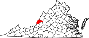 Location within the U.S. state of Virginia | |
 Virginia's location within the U.S. | |
| Coordinates: 37°47′N 80°01′W | |
| Country | |
| State | |
| Founded | 1822 |
| Named for | Alleghany Mountains |
| Seat | Covington |
| Largest town | Covington |
| Area | |
| • Total | 449 sq mi (1,160 km2) |
| • Land | 445 sq mi (1,150 km2) |
| • Water | 3.3 sq mi (9 km2) 0.7% |
| Population (2010) | |
| • Total | 16,250 |
| • Estimate (2018) | 14,910 |
| • Density | 36/sq mi (14/km2) |
| Time zone | UTC−5 (Eastern) |
| • Summer (DST) | UTC−4 (EDT) |
| Congressional district | 9th |
| Website | www |
The county was created in 1822 from parts of Botetourt County, Bath County, and Monroe County (now in West Virginia). At the time, the majority of the population lived around Covington, and the primary cash crop then was hemp, which was used for rope production.
As of the 2010 census, the population was 16,250, which is an increase of more than twenty-five percent from the 2000 census.[2] The majority of that growth, however, can be attributed to the reincorporation of the formerly independent city of Clifton Forge back into Alleghany County in 2001.
History
Alleghany County was established on January 5, 1822, by an act of the Virginia General Assembly. The new county was formed from parts of Botetourt, Bath, and Monroe (now West Virginia) counties, with most of the population centered in the new county seat in Covington.[3] Alleghany County was named for the Allegheny Mountains, which border the western edge of the County.[4]
When the county was established, the principal export was hemp, used for rope production in Richmond. However, as hemp demand and prices declined, the farmers of Alleghany switched to grain, hay and livestock production.[3]
During the American Civil War, the iron for the CSS Virginia (Merrimac) came from Longdale Furnace in the county. Regiments from Alleghany County were at the surrender at Appomattox.
Geography
According to the U.S. Census Bureau, the county has a total area of 449 square miles (1,160 km2), of which 445 square miles (1,150 km2) is land and 3.3 square miles (8.5 km2) (0.7%) is water.[5]
Adjacent counties
- Bath County – north
- Rockbridge County – east
- Botetourt County – southeast
- Craig County – south
- Monroe County, West Virginia – southwest
- Greenbrier County, West Virginia – west
National protected areas
- George Washington National Forest (part)
- United States National Radio Quiet Zone (part)
Demographics
| Historical population | |||
|---|---|---|---|
| Census | Pop. | %± | |
| 1830 | 2,816 | — | |
| 1840 | 2,749 | −2.4% | |
| 1850 | 3,515 | 27.9% | |
| 1860 | 6,765 | 92.5% | |
| 1870 | 3,674 | −45.7% | |
| 1880 | 5,586 | 52.0% | |
| 1890 | 9,283 | 66.2% | |
| 1900 | 16,330 | 75.9% | |
| 1910 | 14,173 | −13.2% | |
| 1920 | 15,332 | 8.2% | |
| 1930 | 20,188 | 31.7% | |
| 1940 | 22,688 | 12.4% | |
| 1950 | 23,139 | 2.0% | |
| 1960 | 12,128 | −47.6% | |
| 1970 | 12,461 | 2.7% | |
| 1980 | 14,333 | 15.0% | |
| 1990 | 13,176 | −8.1% | |
| 2000 | 12,926 | −1.9% | |
| 2010 | 16,250 | 25.7% | |
| Est. 2018 | 14,910 | [6] | −8.2% |
| U.S. Decennial Census[7] 1790–1960[8] 1900–1990[9] 1990–2000[10] 2010–2013[2] | |||
As of the census[11] of 2000, there were 12,926 people, 5,149 households, and 3,866 families residing in the county. The population density was 29 people per square mile (11/km²). There were 5,812 housing units at an average density of 13 per square mile (5/km²). The racial makeup of the county was 96.35% White, 2.45% Black or African American, 0.21% Native American, 0.24% Asian, 0.02% Pacific Islander, 0.20% from other races, and 0.53% from two or more races. 0.36% of the population were Hispanic or Latino of any race. 42.9% were of American, 11.6% German, 11.0% English and 9.8% Irish ancestry according to Census 2000.
There were 5,149 households out of which 29.90% had children under the age of 18 living with them, 63.20% were married couples living together, 8.10% had a female householder with no husband present, and 24.90% were non-families. 22.20% of all households were made up of individuals and 10.50% had someone living alone who was 65 years of age or older. The average household size was 2.46 and the average family size was 2.85.
The age distribution is 22.80% under the age of 18, 6.20% from 18 to 24, 26.80% from 25 to 44, 28.50% from 45 to 64, and 15.70% who were 65 years of age or older. The median age was 41 years. For every 100 females there were 99.60 males. For every 100 females age 18 and over, there were 95.30 males.
The median income for a household in the county was $38,545, and the median income for a family was $45,843. Males had a median income of $35,120 versus $20,855 for females. The per capita income for the county was $19,635. About 4.90% of families and 7.10% of the population were below the poverty line, including 8.60% of those under age 18 and 10.80% of those age 65 or over.
In 2000, Clifton Forge was an independent city separate from the county. However, in 2001, Clifton Forge relinquished its city charter and reincorporated as a town; as a town, it is now a part of Alleghany County. The 2000 population of what is now Alleghany County (including Clifton Forge) was 17,215. The article includes geographic data from before and after the reincorporation of Clifton Forge into the county.
Government
Board of Supervisors
- Boiling Springs district: Shannon P. Cox (I)
- Clifton Forge East district: Suzanne T. Adcock (I)
- Clifton Forge West district: Richard Shull (I)
- Covington district: James M. Griffith (I)
- Falling Spring district: G. Matt Garten (I)
- Jackson River district: Stephen A. Bennett (I)
- Sharon district: Cletus W. Nicely (I)
Constitutional officers
- Clerk of the Circuit Court: Debra N. Byer (I)
- Commissioner of the Revenue: Valerie N. Bruffey (I)
- Commonwealth's Attorney: Ann Gardner(I)
- Sheriff: Kevin W. Hall (I)
- Treasurer: Teresa Brown (I)
Alleghany County is represented by Democrat R. Creigh Deeds in the Virginia Senate, Republican Terry Austin in the Virginia House of Delegates, and Republican H. Morgan Griffith in the U.S. House of Representatives.
Economy
The county economy is dominated by WestRock, which operates a paperboard mill in Covington, the second largest on the East Coast and an extrusion and converting facility in Low Moor. Both Alleghany County and Covington, VA are known for the low cost of its housing market and close proximity to The Homestead in Bath County, VA, Lexington, VA, The Greenbrier in White Sulphur Springs, Lewisburg, West Virginia, a 45-minute drive in any direction and Roanoke, VA about an hour away. Covington has a team in the Valley Baseball League called the Lumberjacks.
Transportation
Amtrak, the national passenger rail service, provides service to the Clifton Forge station (12 miles (19 km) away from Covington) with the Cardinal route. Also Clifton Forge serves a major locomotive fuel facility for CSX Transportation.
The area is serviced by Interstate 64 ( east west) and Route 220 a (north south) offering interstate truck access to the area.
Education
Alleghany County is serviced by one high school, Alleghany High School (grades 9–12); one middle school, Clifton Middle School (grades 6–8), and three pre-kindergarten to grade 5 elementary schools: Callaghan Elementary, Mountain View Elementary and Sharon Elementary. The county also contains one Virginia state governors school, the Jackson River Governor's School; one technical center, the Jackson River Technical Center; and the Dabney S. Lancaster Community College.
Politics
| Year | Republican | Democratic | Third parties |
|---|---|---|---|
| 2016 | 66.5% 4,874 | 29.6% 2,166 | 3.9% 285 |
| 2012 | 50.1% 3,595 | 47.4% 3,403 | 2.4% 175 |
| 2008 | 50.4% 3,715 | 48.2% 3,553 | 1.4% 101 |
| 2004 | 55.1% 3,962 | 44.5% 3,203 | 0.4% 30 |
| 2000 | 54.8% 2,808 | 43.2% 2,214 | 2.0% 101 |
| 1996 | 39.7% 2,015 | 47.3% 2,398 | 13.0% 661 |
| 1992 | 40.6% 2,294 | 42.4% 2,396 | 17.1% 967 |
| 1988 | 51.9% 2,555 | 47.0% 2,316 | 1.1% 55 |
| 1984 | 60.9% 3,067 | 38.4% 1,932 | 0.8% 38 |
| 1980 | 45.9% 2,185 | 50.7% 2,411 | 3.4% 160 |
| 1976 | 41.2% 1,756 | 57.7% 2,462 | 1.1% 47 |
| 1972 | 67.5% 2,584 | 27.9% 1,069 | 4.6% 177 |
| 1968 | 43.5% 1,649 | 26.1% 988 | 30.5% 1,156 |
| 1964 | 41.1% 1,104 | 58.9% 1,580 | 0.0% 1 |
| 1960 | 48.8% 1,214 | 50.8% 1,265 | 0.4% 9 |
| 1956 | 55.3% 1,135 | 40.0% 822 | 4.7% 97 |
| 1952 | 52.9% 2,564 | 46.9% 2,274 | 0.2% 11 |
| 1948 | 37.0% 1,425 | 58.5% 2,253 | 4.5% 172 |
| 1944 | 39.6% 1,308 | 60.2% 1,985 | 0.2% 7 |
| 1940 | 35.0% 1,164 | 64.7% 2,153 | 0.4% 12 |
| 1936 | 39.4% 1,319 | 60.2% 2,013 | 0.4% 13 |
| 1932 | 45.3% 1,095 | 53.5% 1,293 | 1.2% 29 |
| 1928 | 72.5% 1,642 | 27.5% 622 | |
| 1924 | 52.5% 856 | 36.1% 589 | 11.4% 186 |
| 1920 | 51.9% 736 | 46.8% 663 | 1.3% 18 |
| 1916 | 43.5% 432 | 54.8% 544 | 1.7% 17 |
| 1912 | 15.5% 125 | 48.7% 394 | 35.9% 290 |
Communities
Though it is the county seat, Covington is an independent city, and thus is not part of Alleghany County.
Towns
Other unincorporated communities
- Alleghany
- Backbone
- Boiling Spring
- Clearwater Park
- Clifdale
- Cliftondale Park
- Crows
- Earlehurst
- Fairview Heights
- Falling Spring
- Griffith
- Harrington
- Hematite
- Hooks Mill
- Intervale
- Iron Hill Springs
- Jordan Mines
- Kincaid
- Longdale
- Longdale Furnace
- Mallow
- Moss Run
- Nicelytown
- Oakwood Forest
- Potts Creek
- Rayon Terrace
- Rich Patch
- Rich Patch Mines
- Stonewall
- Sweet Chalybeate
- Valley View
- Westwood Place
References
- "Find a County". National Association of Counties. Archived from the original on May 31, 2011. Retrieved 2011-06-07.
- "State & County QuickFacts". United States Census Bureau. Archived from the original on June 7, 2011. Retrieved December 31, 2013.
- "Alleghany County; a Concise History". The County of Alleghany, Virginia. Retrieved 2 July 2014.
- Salmon, Edited by Emily J.; Jr, Edward D.C. Campbell (1994). The hornbook of Virginia history : a ready-reference guide to the Old Dominion's people, places, and past (4th ed.). Richmond: Library of Virginia. p. 159. ISBN 0884901777.CS1 maint: extra text: authors list (link)
- "US Gazetteer files: 2010, 2000, and 1990". United States Census Bureau. 2011-02-12. Retrieved 2011-04-23.
- "Population and Housing Unit Estimates". Retrieved July 14, 2019.
- "U.S. Decennial Census". United States Census Bureau. Retrieved December 31, 2013.
- "Historical Census Browser". University of Virginia Library. Retrieved December 31, 2013.
- "Population of Counties by Decennial Census: 1900 to 1990". United States Census Bureau. Retrieved December 31, 2013.
- "Census 2000 PHC-T-4. Ranking Tables for Counties: 1990 and 2000" (PDF). United States Census Bureau. Retrieved December 31, 2013.
- "U.S. Census website". United States Census Bureau. Retrieved 2011-05-14.
- Leip, David. "Dave Leip's Atlas of U.S. Presidential Elections". uselectionatlas.org. Retrieved 2018-08-17.
External links
- “Powerlessness and Pollution in Alleghany County, Virginia: A Historical Analysis of Paternalism and Economic Coercion in Appalachia and its Relationship with Environmental Degradation″
- History and Photographs of the Alleghany Highlands
- Alleghany Highlands Genealogy Society
- Alleghany County, Virginia
- Travel & Tourism
Places adjacent to Alleghany County, Virginia | ||||||||||
|---|---|---|---|---|---|---|---|---|---|---|
| ||||||||||
Municipalities and communities of Alleghany County, Virginia, United States | ||
|---|---|---|
| Towns | Map of Virginia highlighting Alleghany County | |
| CDPs | ||
| Unincorporated communities |
| |

| Authority control |
|
|---|