Hopewell, New Jersey
Hopewell is a borough in Mercer County, New Jersey, United States. As of the 2010 United States Census, the borough's population was 1,922,[9][10][11] reflecting a decline of 113 (-5.6%) from the 2,035 counted in the 2000 Census, which had in turn increased by 67 (+3.4%) from the 1,968 counted in the 1990 Census.[20]
Hopewell, New Jersey | |
|---|---|
| Borough of Hopewell | |
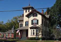 House in Hopewell | |
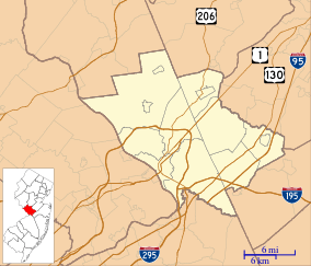
 Location in Mercer County and the state of New Jersey. | |
 Census Bureau map of Hopewell, New Jersey | |
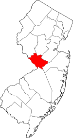
 Hopewell Location in Mercer County  Hopewell Location in New Jersey  Hopewell Location in the United States | |
| Coordinates: 40.389009°N 74.763861°W[1][2] | |
| Country | |
| State | |
| County | Mercer |
| Incorporated | April 14, 1891 |
| Government | |
| • Type | Borough |
| • Body | Borough Council |
| • Mayor | Paul Anzano (D, term ends December 31, 2023)[4][5] |
| • Administrator | Michele Hovan[6] |
| • Municipal clerk | Michele Hovan[7] |
| Area | |
| • Total | 0.703 sq mi (1.820 km2) |
| • Land | 0.703 sq mi (1.820 km2) |
| • Water | 0.000 sq mi (0.000 km2) 0.00% |
| Area rank | 529th of 565 in state 12th of 12 in county[1] |
| Elevation | 197 ft (60 m) |
| Population | |
| • Total | 1,922 |
| • Estimate (2019)[12] | 1,906 |
| • Rank | 488th of 565 in state 12th of 12 in county[13] |
| • Density | 2,735.2/sq mi (1,056.1/km2) |
| • Density rank | 227th of 565 in state 3rd of 12 in county[13] |
| Time zone | UTC−05:00 (Eastern (EST)) |
| • Summer (DST) | UTC−04:00 (Eastern (EDT)) |
| ZIP Code | |
| Area code(s) | 609[16] |
| FIPS code | 3402133150[1][17][18] |
| GNIS feature ID | 885260[1][19] |
| Website | www |
Hopewell was incorporated as a borough by an act of the New Jersey Legislature on April 14, 1891, from portions of Hopewell Township, based on the results of a referendum held on March 21, 1891. Additional portions of Hopewell Township were annexed in 1915 and the borough was reincorporated in 1924.[21]
History
Colonial era
The Lenape Native Americans were the original inhanitants of the area that would later become Hopewell.[22] The first Colonial influence in Hopewell by European settlers was the purchase of a 30,000-acre (120 km2) tract of land by Daniel Coxe a Royal British governor of West Jersey, in the latter half of the 17th century. All land in Hopewell can be traced back to this purchase.[23] In 1691 Coxe, transferred his land to a company called The West Jersey Society of England, who intended to sell the land.[24] The society appointed an agent, Thomas Revell, to preside over the land and sell it to prospective buyers.[25] Revell then attracted settlers from New England, Long Island, and New Jersey falsely claiming that the land was fertile, and tame. However, the families that arrived in Hopewell only found vast stretches of wilderness.[26] The first settler in Hopewell Valley was Thomas Tindall who on November 10, 1699, bought a 300-acre (1.2 km2) tract of land from The West Jersey Society of England through Revell, for "ten pounds per hundred acres".[27] Other early settlers in Hopewell are said to be the Stouts, who immigrated from Holmdel to Hopewell in 1706, including Jonathan Stout, who had hunted in the area together with the Lenape.[22][28] Perhaps the first conflict between colonists in Hopewell was the dispute between Revell and the early inhabitants of Hopewell, who realized that their deeds were worthless due to Revell's false claims. Fifty settlers then organized a class action lawsuit against Revell and the West Jersey Society. A lengthy trial was held in Burlington and the court ultimately ruled against the settlers, who were forced to repurchase their land or relocate. Many settlers weren't able to repay and moved north into North Jersey and New York.[29]
On April 23, 1715, the settlers who stayed in Hopewell, most notably the Stout family, organized the Old School Baptist Church, and what is now known as Hopewell was then referred to as "Baptist Meetinghouse".[30][31] One of the most valued members of the meeting house was Declaration of Independence signer John Hart who in 1740 purchased 193 acres (0.78 km2) of land in the north of current day Hopewell, and in 1747 as a sign of Hart's devotion to the Church, donated a plot of his land to the Baptists.[32][33] The next year the Baptists made good use of this land and in 1748 erected their Old School Baptist Church meeting house on West Broad Street. The meeting house brought in Baptists from miles around to Hopewell and encouraged Hopewell's early growth.[34]

Numerous lumber mills were established in and around Hopewell at this time to process the lumber that was generated from the clearing of forests for farms.
In 1756, Isaac Eaton the first pastor of the Old School Baptist Church established the Hopewell Academy. One of his students, James Manning, would go on to establish Brown University in 1765.[35]
Frog war
The first railroad to reach Hopewell was the Mercer and Somerset Railway, which was backed by the Pennsylvania Railroad. It was created largely to protect the monopoly the Pennsylvania Railroad had on New Jersey, by cutting off the first separately owned railroad in New Jersey, the Delaware and Bound Brook Railroad, by being built in the way of it. It was completed in 1874. The Delaware and Bound Brook reached Hopewell in 1876, but the railroad had to cross the Mercer and Somerset's track just to the northwest of Hopewell. A dispute occurred at the crossing, known as a frog, and escalated into each company parking locomotives over the crossing to prevent the other company from moving trains over it. Eventually militia had to be called in to keep the peace, and the Delaware and Bound Brook prevailed.[36] Soon after the Frog War the Mercer and Somerset was liquidated having failed at its purpose. Some of the abandoned right of way for the Mercer and Somerset in Hopewell became Model Avenue. The Delaware and Bound Brook was leased by the Philadelphia and Reading in 1879 for 999 years, and has become the CSX Trenton Line and is still in use today. The Frog is also what gives Hopewell Elementary school its mascot, "Freddy the Frog" in honor of the Hopewell frog war.[37]
Geography
According to the United States Census Bureau, the borough had a total area of 0.703 square miles (1.820 km2), all of which was land.[1][2]
The borough is an independent municipality surrounded entirely by Hopewell Township,[38] making it part one of 21 pairs of "doughnut towns" in the state, where one municipality entirely surrounds another.[39][40][41]
Climate
According to the Köppen climate classification system, Hopewell Borough, New Jersey has a hot-summer, wet all year, humid continental climate (Dfa). Dfa climates are characterized by at least one month having an average mean temperature ≤ 32.0 °F (≤ 0.0 °C), at least four months with an average mean temperature ≥ 50.0 °F (≥ 10.0 °C), at least one month with an average mean temperature ≥ 71.6 °F (≥ 22.0 °C), and no significant precipitation difference between seasons. During the summer months, episodes of extreme heat and humidity can occur with heat index values ≥ 100 °F (≥ 38 °C). On average, the wettest month of the year is July which corresponds with the annual peak in thunderstorm activity. During the winter months, episodes of extreme cold and wind can occur with wind chill values < 0 °F (< -18 °C). The plant hardiness zone at the Hopewell Borough Municipal Court is 6b with an average annual extreme minimum air temperature of -1.2 °F (-18.4 °C).[42] The average seasonal (November–April) snowfall total is 24 to 30 inches (610 to 760 mm), and the average snowiest month is February which corresponds with the annual peak in nor'easter activity.
| Climate data for Hopewell Borough Municipal Court, Mercer County, NJ (1981-2010 Averages) | |||||||||||||
|---|---|---|---|---|---|---|---|---|---|---|---|---|---|
| Month | Jan | Feb | Mar | Apr | May | Jun | Jul | Aug | Sep | Oct | Nov | Dec | Year |
| Average high °F (°C) | 38.9 (3.8) |
42.4 (5.8) |
50.7 (10.4) |
62.7 (17.1) |
72.4 (22.4) |
81.5 (27.5) |
85.9 (29.9) |
84.0 (28.9) |
77.1 (25.1) |
65.6 (18.7) |
54.8 (12.7) |
43.5 (6.4) |
63.4 (17.4) |
| Daily mean °F (°C) | 30.4 (−0.9) |
33.2 (0.7) |
40.7 (4.8) |
51.3 (10.7) |
60.9 (16.1) |
70.3 (21.3) |
75.1 (23.9) |
73.3 (22.9) |
66.1 (18.9) |
54.5 (12.5) |
45.1 (7.3) |
35.2 (1.8) |
53.1 (11.7) |
| Average low °F (°C) | 21.9 (−5.6) |
23.9 (−4.5) |
30.6 (−0.8) |
40.0 (4.4) |
49.4 (9.7) |
59.1 (15.1) |
64.2 (17.9) |
62.7 (17.1) |
55.0 (12.8) |
43.3 (6.3) |
35.3 (1.8) |
26.9 (−2.8) |
42.8 (6.0) |
| Average precipitation inches (mm) | 3.48 (88) |
2.69 (68) |
4.00 (102) |
4.21 (107) |
4.33 (110) |
4.36 (111) |
5.35 (136) |
4.06 (103) |
4.40 (112) |
4.04 (103) |
3.75 (95) |
4.02 (102) |
48.69 (1,237) |
| Average relative humidity (%) | 66.3 | 62.6 | 58.6 | 58.4 | 63.2 | 67.7 | 67.2 | 70.4 | 70.9 | 70.2 | 68.4 | 68.0 | 66.0 |
| Average dew point °F (°C) | 20.5 (−6.4) |
21.8 (−5.7) |
27.3 (−2.6) |
37.2 (2.9) |
48.3 (9.1) |
59.1 (15.1) |
63.5 (17.5) |
63.1 (17.3) |
56.4 (13.6) |
45.0 (7.2) |
35.3 (1.8) |
25.7 (−3.5) |
42.0 (5.6) |
| Source: PRISM Climate Group[43] | |||||||||||||
Ecology
According to the A. W. Kuchler U.S. potential natural vegetation types, Hopewell Borough, New Jersey would have an Appalachian Oak (104) vegetation type with an Eastern Hardwood Forest (25) vegetation form.[44]
Demographics
| Historical population | |||
|---|---|---|---|
| Census | Pop. | %± | |
| 1900 | 980 | — | |
| 1910 | 1,073 | 9.5% | |
| 1920 | 1,339 | 24.8% | |
| 1930 | 1,467 | 9.6% | |
| 1940 | 1,678 | 14.4% | |
| 1950 | 1,869 | 11.4% | |
| 1960 | 1,928 | 3.2% | |
| 1970 | 2,271 | 17.8% | |
| 1980 | 2,001 | −11.9% | |
| 1990 | 1,968 | −1.6% | |
| 2000 | 2,035 | 3.4% | |
| 2010 | 1,922 | −5.6% | |
| Est. 2019 | 1,906 | [12][45][46] | −0.8% |
| Population sources:1900-1920[47] 1900-1910[48] 1910-1930[49] 1930-1990[50] 2000[51][52] 2010[9][10][11] | |||
Census 2010
The 2010 United States Census counted 1,922 people, 778 households, and 532.152 families in the borough. The population density was 2,735.2 per square mile (1,056.1/km2). There were 817 housing units at an average density of 1,162.7 per square mile (448.9/km2). The racial makeup of the borough was 95.06% (1,827) White, 1.51% (29) Black or African American, 0.10% (2) Native American, 0.68% (13) Asian, 0.05% (1) Pacific Islander, 1.51% (29) from other races, and 1.09% (21) from two or more races. Hispanic or Latino of any race were 3.69% (71) of the population.[9]
The 778 households accounted 33.5% with children under the age of 18 living with them; 54.6% were married couples living together; 10.9% had a female householder with no husband present, and 31.6% were non-families. Of all households, 25.4% were made up of individuals, and 7.3% had someone living alone who was 65 years of age or older. The average household size was 2.47 and the average family size was 3.00.[9]
In the borough, the population age was spread out with 24.0% under the age of 18, 6.4% from 18 to 24, 22.2% from 25 to 44, 36.3% from 45 to 64, and 11.1% who were 65 years of age or older. The median age was 42.8 years. For every 100 females, the population had 91.8 males. For every 100 females ages 18 and older there were 87.7 males.[9]
The Census Bureau's 2006-2010 American Community Survey showed that (in 2010 inflation-adjusted dollars) median household income was $105,417 (with a margin of error of +/- $8,866) and the median family income was $125,066 (+/- $15,420). Males had a median income of $91,375 (+/- $14,302) versus $55,357 (+/- $11,473) for females. The per capita income for the borough was $50,910 (+/- $5,465). About none of families and 0.5% of the population were below the poverty line, including none of those under age 18 and none of those age 65 or over.[53]
Census 2000
As of the 2000 United States Census[17] there were 2,035 people, 813 households, and 561 families residing in the borough. The population density was 2,963.7 people per square mile (1,138.7/km2). There were 836 housing units at an average density of 1,217.5 per square mile (467.8/km2). The racial makeup of the borough was 95.43% White, 1.08% African American, 0.49% Native American, 0.98% Asian, 1.23% from other races, and 0.79% from two or more races. Hispanic or Latino of any race were 2.31% of the population.[51][52]
There were 813 households, out of which 36.2% had children under the age of 18 living with them, 55.0% were married couples living together, 11.8% had a female householder with no husband present, and 30.9% were non-families. 25.1% of all households were made up of individuals, and 8.6% had someone living alone who was 65 years of age or older. The average household size was 2.50 and the average family size was 3.01.[51][52]
In the borough the population was spread out, with 26.1% under the age of 18, 4.7% from 18 to 24, 30.7% from 25 to 44, 27.9% from 45 to 64, and 10.6% who were 65 years of age or older. The median age was 40 years. For every 100 females, there were 94.0 males. For every 100 females age 18 and over, there were 89.3 males.[51][52]
The median income for a household in the borough was $77,270, and the median income for a family was $91,205. Males had a median income of $52,656 versus $47,315 for females. The per capita income for the borough was $38,413. None of the families and 2.1% of the population were living below the poverty line, including no under eighteens and 5.2% of those over 64.[51][52]
Government
Local government
Hopewell is governed under the Borough form of New Jersey municipal government, which is used in 218 municipalities statewide, making it the most common form of government in New Jersey.[54] The governing body consists of a Mayor and a Borough Council, with all positions elected at-large on a partisan basis as part of the November general election. A Mayor is elected directly by the voters to a four-year term of office. The Borough Council has six members elected to serve three-year terms on a staggered basis, with two seats coming up for election each year in a three-year cycle.[3] The Borough form of government used by Hopewell is a "weak mayor / strong council" government in which council members act as the legislative body with the mayor presiding at meetings and voting only in the event of a tie. The mayor can veto ordinances subject to an override by a two-thirds majority vote of the council. The mayor makes committee and liaison assignments for council members, and most appointments are made by the mayor with the advice and consent of the council.[55][56] All legislative powers of the Borough of Hopewell are exercised by the Borough Council in the form of a resolution, ordinance or proclamation.[57]
As of 2020, the Mayor of Hopewell is Democrat Paul Anzano, whose term expires December 31, 2023. Members of the Borough Council are Council President Charles Schuyler Morehouse (R, 2020), Chris M. Fossell (D, 2022), Ryan Kennedy (D, 2020), David Mackie (D, 2022), Samara McAuliffe (D, 2021) and Debra Stuhler (D, 2021).[4][58][59][60][61][62]
Public library

The Hopewell Public Library was founded March 14, 1914, and was originally located at Broad and Mercer Streets in an old harness shop. The Hopewell Post Office had replaced the old bank building in 1915 and the Hopewell Public Library moved to its current location in the old Hopewell National Bank building in 1965.[63]
In 2014, the library began looking for a new space, citing the lack of a parking lot and non-ADA compliant steps an issue with serving the general public.[63] The library estimated that it needed to raise $1.2 million to cover the cost of the new building.[64]
Federal, state and county representation
Hopewell Borough is located in the 12th Congressional District[65] and is part of New Jersey's 15th state legislative district.[10][66][67]
For the 116th United States Congress, New Jersey's Twelfth Congressional District is represented by Bonnie Watson Coleman (D, Ewing Township).[68][69] New Jersey is represented in the United States Senate by Democrats Cory Booker (Newark, term ends 2021)[70] and Bob Menendez (Paramus, term ends 2025).[71][72]
For the 2018–2019 session (Senate, General Assembly), the 15th Legislative District of the New Jersey Legislature is represented in the State Senate by Shirley Turner (D, Lawrence Township, Mercer County) and in the General Assembly by Reed Gusciora (D, Trenton) and Verlina Reynolds-Jackson (D, Trenton).[73][74] Reynolds-Jackson was sworn into office on February 15, 2018 to fill the seat of Elizabeth Maher Muoio, who had resigned from office on January 15, 2018 to serve as Treasurer of New Jersey.[75][76]
Mercer County is governed by a County Executive who oversees the day-to-day operations of the county and by a seven-member Board of Chosen Freeholders that acts in a legislative capacity, setting policy. All officials are chosen at-large in partisan elections, with the executive serving a four-year term of office while the freeholders serve three-year terms of office on a staggered basis, with either two or three seats up for election each year.[77] As of 2014, the County Executive is Brian M. Hughes (D, term ends December 31, 2015; Princeton).[78] Mercer County's Freeholders are Freeholder Chair Andrew Koontz (D, 2016; Princeton),[79] Freeholder Vice Chair Samuel T. Frisby, Sr. (2015; Trenton),[80] Ann M. Cannon (2015; East Windsor Township),[81] Anthony P. Carabelli (2016; Trenton),[82] John A. Cimino (2014, Hamilton Township),[83] Pasquale "Pat" Colavita, Jr. (2015; Lawrence Township)[84] and Lucylle R. S. Walter (2014; Ewing Township)[85][86][87] Mercer County's constitutional officers are County Clerk Paula Sollami-Covello (D, 2015),[88] Sheriff John A. Kemler (D, 2014)[89] and Surrogate Diane Gerofsky (D, 2016).[90][91]
Politics
As of March 23, 2011, there were a total of 1,473 registered voters in Hopewell Borough, of which 664 (45.1%) were registered as Democrats, 264 (17.9%) were registered as Republicans and 544 (36.9%) were registered as Unaffiliated. There was one voter registered to the Green Party.[92]
| Year | Republican | Democratic | Third Parties |
|---|---|---|---|
| 2016[93] | 22.6% 274 | 72.3% 879 | 5.1% 62 |
| 2012[94] | 27.4% 313 | 71.4% 815 | 1.1% 13 |
| 2008[95] | 26.0% 305 | 71.7% 841 | 1.3% 15 |
| 2004[96] | 32.6% 395 | 65.0% 789 | 0.6% 9 |
In the 2012 presidential election, Democrat Barack Obama received 71.4% of the vote (815 cast), ahead of Republican Mitt Romney with 27.4% (313 votes), and other candidates with 1.1% (13 votes), among the 1,256 ballots cast by the borough's 1,530 registered voters (115 ballots were spoiled), for a turnout of 82.1%.[94][97] In the 2008 presidential election, Democrat Barack Obama received 71.7% of the vote (841 cast), ahead of Republican John McCain with 26.0% (305 votes) and other candidates with 1.3% (15 votes), among the 1,173 ballots cast by the borough's 1,493 registered voters, for a turnout of 78.6%.[95] In the 2004 presidential election, Democrat John Kerry received 65.0% of the vote (789 ballots cast), outpolling Republican George W. Bush with 32.6% (395 votes) and other candidates with 0.6% (9 votes), among the 1,213 ballots cast by the borough's 1,437 registered voters, for a turnout percentage of 84.4.[96]
| Year | Republican | Democratic | Third Parties |
|---|---|---|---|
| 2017[98] | 23.3% 188 | 75.5% 609 | 1.2% 10 |
| 2013[99] | 44.0% 344 | 53.3% 416 | 2.7% 21 |
| 2009[100] | 32.3% 291 | 56.7% 511 | 10.6% 95 |
| 2005[101] | 31.8% 265 | 65.1% 542 | 3.0% 25 |
In the 2013 gubernatorial election, Democrat Barbara Buono received 53.3% of the vote (416 cast), ahead of Republican Chris Christie with 44.0% (344 votes), and other candidates with 2.7% (21 votes), among the 792 ballots cast by the borough's 1,518 registered voters (11 ballots were spoiled), for a turnout of 52.2%.[99][102] In the 2009 gubernatorial election, Democrat Jon Corzine received 56.7% of the vote (511 ballots cast), ahead of Republican Chris Christie with 32.3% (291 votes), Independent Chris Daggett with 10.0% (90 votes) and other candidates with 0.6% (5 votes), among the 902 ballots cast by the borough's 1,466 registered voters, yielding a 61.5% turnout.[100]
Education
Public school students in pre-kindergarten through twelfth grade attend the Hopewell Valley Regional School District.[103] The comprehensive regional public school district serves students from Hopewell Borough, Hopewell Township and Pennington Borough.[104][105] As of the 2017–18 school year, the district and its six schools had an enrollment of 3,572 students and 347.5 classroom teachers (on an FTE basis), for a student–teacher ratio of 10.3:1.[106] Schools in the district (with 2017-18 enrollment data from the National Center for Education Statistics[107]) are Bear Tavern Elementary School[108] (439 students; in grades PreK-5), Hopewell Elementary School[109] (436; PreK-5), Stony Brook Elementary School[110] (393; K-5), Toll Gate Grammar School[111] (273; K-5), Timberlane Middle School[112] with 841 students in grades 6-8 and Hopewell Valley Central High School[113] with an enrollment of 1,153 students in grades 9 - 12.[114] Elementary school students from Hopewell Borough attend Hopewell Elementary School. The district's Board of Education is composed of nine members allocated to each of the three municipalities based on population, with Hopewell assigned a single seat.[115]
Eighth grade students from all of Mercer County are eligible to apply to attend the high school programs offered by the Mercer County Technical Schools, a county-wide vocational school district that offers full-time career and technical education at its Health Sciences Academy, STEM Academy and Academy of Culinary Arts, with no tuition charged to students for attendance.[116][117]
Transportation
Roads and highways
_at_Greenwood_Avenue_in_Hopewell_Borough%2C_Mercer_County%2C_New_Jersey.jpg)
As of May 2010, the borough had a total of 9.35 miles (15.05 km) of roadways, of which 7.56 miles (12.17 km) were maintained by the municipality and 1.79 miles (2.88 km) by Mercer County.[118]
Hopewell has four major roads that travel through it.[119]
- Route 518 enters Hopewell from due west having come from Lambertville and then turns slightly northward, joining West Broad Street. Route 518 then runs through Hopewell and exits Hopewell in the East and heads towards Rocky Hill.[120]
- Pennington Hopewell Road (County Route 654) enters Hopewell from roughly the southwest, and immediately becomes West Broad Street when it enters Hopewell. It connects Hopewell with Pennington to the south.[121]
- Princeton Avenue, Route 569 starts at Broad Street and continues south and becomes Hopewell-Princeton Road, and connects Hopewell with Princeton.[122]
- Greenwood Avenue runs north out of Hopewell and connects Hopewell with East Amwell Township.
Route 31 is accessible via Route 518 and Route 654.
Rail
NJ Transit is planning to restore passenger commuter rail service to Hopewell on the West Trenton Line. NJ Transit plans to use the existing one-track right of way that CSX owns through Hopewell, the former four-track Reading Company Trenton Line. The proposed plan includes double tracking most of the CSX line to increase capacity and construction of a new rail station on Somerset Street. The use of the historic Hopewell Station is not under consideration in this current proposal. The line would connect Hopewell with New York City, as well as Philadelphia via a SEPTA connection in West Trenton and restore service to Hopewell, which ended in 1982.[123][124]
Notable people
People who were born in, residents of, or otherwise closely associated with Hopewell include:
- Danielia Cotton (born 1967), singer-songwriter.[125]
- John Hart (c. 1711-1779), signer of the United States Declaration of Independence. His grave is located in the First Baptist Church graveyard on Broad Street.[126]
- Amy Locane (born 1971), television and film actress who appeared in John Waters' 1990 musical comedy Cry-Baby and in the first season of the prime time soap opera Melrose Place.[127]
- Josiah Lincoln Lowe (1905-1997), mycologist who served as President of the Mycological Society of America.[128]
- Leo Halpin Mahony (born 1931), architect of Mahony & Zvosec.[129]
- James W. Marshall (1810-1885), sawmill operator, whose 1848 find of gold in the American River in California was the impetus for the California Gold Rush.[130]
- Richard Preston (born 1954), author of The Hot Zone.[131]
- Keith Robertson (1914-1991), author of children's literature.[132]
References
- 2010 Census Gazetteer Files: New Jersey County Subdivisions, United States Census Bureau. Accessed May 21, 2015.
- US Gazetteer files: 2010, 2000, and 1990, United States Census Bureau. Accessed September 4, 2014.
- 2012 New Jersey Legislative District Data Book, Rutgers University Edward J. Bloustein School of Planning and Public Policy, March 2013, p. 73.
- Mayor & Council, Hopewell Borough. Accessed May 4, 2020.
- 2020 New Jersey Mayors Directory, New Jersey Department of Community Affairs. Accessed February 1, 2020.
- Administrator, Hopewell Borough. Accessed May 4, 2020.
- Clerk's Office, Hopewell Borough. Accessed May 4, 2020.
- U.S. Geological Survey Geographic Names Information System: Borough of Hopewell, Geographic Names Information System. Accessed March 6, 2013.
- DP-1 - Profile of General Population and Housing Characteristics: 2010 for Hopewell borough, Mercer County, New Jersey Archived February 12, 2020, at Archive.today, United States Census Bureau. Accessed November 19, 2012.
- Municipalities Sorted by 2011-2020 Legislative District, New Jersey Department of State. Accessed February 1, 2020.
- Profile of General Demographic Characteristics: 2010 for Hopewell borough Archived August 11, 2014, at the Wayback Machine, New Jersey Department of Labor and Workforce Development. Accessed November 19, 2012.
- QuickFacts for Hopewell borough, New Jersey; Mercer County, New Jersey; New Jersey from Population estimates, July 1, 2019, (V2019), United States Census Bureau. Accessed May 21, 2020.
- GCT-PH1 Population, Housing Units, Area, and Density: 2010 - State -- County Subdivision from the 2010 Census Summary File 1 for New Jersey Archived February 12, 2020, at Archive.today, United States Census Bureau. Accessed November 19, 2012.
- Look Up a ZIP Code for Hopewell, NJ, United States Postal Service. Accessed November 19, 2012.
- Zip Codes, State of New Jersey. Accessed August 28, 2013.
- Area Code Lookup - NPA NXX for Hopewell, NJ, Area-Codes.com. Accessed August 28, 2013.
- U.S. Census website , United States Census Bureau. Accessed September 4, 2014.
- Geographic Codes for New Jersey, Missouri Census Data Center. Accessed September 1, 2019.
- US Board on Geographic Names, United States Geological Survey. Accessed September 4, 2014.
- Table 7. Population for the Counties and Municipalities in New Jersey: 1990, 2000 and 2010, New Jersey Department of Labor and Workforce Development, February 2011. Accessed November 19, 2012.
- Snyder, John P. The Story of New Jersey's Civil Boundaries: 1606-1968, Bureau of Geology and Topography; Trenton, New Jersey; 1969. p. 162. Accessed October 26, 2012.
- History and Historic Sits, Hopewell Borough. Accessed November 27, 2019.
- Seabrook, Jack and Lorraine. Images of America Hopewell Valley, Arcadia Publishing, Charleston, SC, 2000. ISBN 0-7385-0431-9, pg. 19. "This and all other farms in Hopewell Valley could be traced all the way back to Daniel Coxe, original owner of the 30,000-acre (120 km2) tract that was to become Hopewell Township."
- Ege, Ralph Pioneers of Old Hopewell (1908), Race & Savidge, Hopewell, NJ, pg. 15. "In the year 1691, Dr. Daniel Coxe transferred the right of government of West Jersey to a company of proprietaries called 'The West Jersey Society of England,' for a valuable consideration."
- Ege, Ralph. Pioneers of Old Hopewell (1908), Race & Savidge, Hopewell, NJ, p. 15. "This society appointed Thomas Revell their agent, and he claimed the right to sell lands and give deeds for the same in the name of the society."
- Ege, Ralph Pioneers of Old Hopewell (1908), Race & Savidge, Hopewell, NJ, pg 15. "Great inducements were held out to the New England and Long Island settlers as well as to those of the older portions of this state… to avail themselves of the cheap and fertile lands of the 30,000-acre (120 km2) tract, and scores of them were induced to come and settle, only to find that after they had subdued the wilderness and established their homes, that their titles were utterly worthless."
- Ege, Ralph Pioneers of Old Hopewell (1908), Race & Savidge, Hopewell, NJ, pg 13-14. "This Houghton tract was surveyed by Thomas Revell, agent for the West Jersey Society, for Thomas Tindall, on February 27, 1696, and was without doubt the first farm located in the Hopewell Valley. On November 10, 1699, a deed was given by Thomas Revell, agent for 'Ye Honorable The West Jersey Society in England' of the one part, and Thomas Tindall of the other part, for the above tract, the consideration being 'ten pounds per hundred acres,' or fifty cents per acre in US currency, which was the regulation price for all the societies lands of the 30,000 acre tract. The above deed describes the 300 acres (1.2 km2) as a part of the 30,000 acre tract 'lying above ye fialls of ye Delaware.'"
- Griffiths, Thomas Sharp, 'A History of Baptists in New Jersey'(1904), Barr Press Publishing Company, Hightstown, New Jersey, Ch. 5, pg 67, "Jonathan Stout, third son of Richard Stout, of Holmdel, a constituent of Middletown Church and who emigrated from Middletown (Holmdel) in 1706, the first settler of Hopewell"
- Ege, Ralph Pioneers of Old Hopewell (1908), Race & Savidge, Hopewell, NJ. "Fifty of these settlers (among whom is found the name of Thomas Houghton) entered into a solemn compact to stand by each other in a law suit with Dr. Coxe. After a long and tedious trial at Burlington, the case was decided against them, and this verdict caused the most distressing state of affairs in this township that was ever experienced in any community. Writs of ejectment had been served on them as 'tenants' of Dr. Coxe to pay for their lands the second time or 'quit.' Many of them went to the northern part of the county which at that time extended to the New York state line, the county of Hunterdon, including Warren, Morris and Sussex counties, and an examination of the records of those counties between 1735 and 1750, will reveal many names that are familiar to the people of old Hopewell."
- Griffiths, Thomas Sharp, 'A History of Baptists in New Jersey'(1904), Barr Press Publishing Company, Hightstown, New Jersey, Ch. 5, pg 67, "The Church was organized at Mr. Stout's house, April 23rd, 1715, and worshipped for thirty-two years in the homes of the Stouts"
- Valis, Glenn John Hart Signer of the Declaration of Independence', Accessed November 19, 2012. "Until well after the revolution, the area was thereafter call Baptist Meeting House."
- Valis, Glenn 'John Hart Signer of the Declaration of Independence', Accessed November 19, 2012. "Around 1739-1740 John Hart bought the "homestead plantation" of 193 acres (0.78 km2) on the north side of what is now the town of Hopewell.".
- History and Historic Sites, Hopewell Borough. Accessed January 9, 2017. "The first church (Baptist Church) was constructed in 1748".
- Seabrook, Jack and Lorraine. Images of America Hopewell Valley, Arcadia Publishing, Charleston, SC, 2000. ISBN 0-7385-0431-9, ISBN 0-7385-0431-9 pg 38, "The Old School Baptist Church... was a center for baptist from miles around.... Constructed in 1822, the building still stands... On West Broad Street"
- Capuzzo, Jill P. "It's in New Jersey, but It Screams Vermont", The New York Times, November 18, 2007. Accessed June 1, 2015. "In 1756, the country's first Baptist secondary school, Hopewell Baptist Academy, was started here. Its graduates went on to found what became Brown University in Rhode Island."
- Railroads of New Jersey Fragments of the past in the Garden State Landscape Lorett Treese 2006
- HVRSD Elementary Schools Welcome Students on First Day of School, Hopewell Valley Regional School District. Accessed September 2, 2015. "Hopewell Elementary School's mascot Freddie the Frog poses with kindergartener Chase Garrow."
- Areas touching Hopewell, MapIt. Accessed January 9, 2017.
- DeMarco, Megan. "Voters to decide whether to merge two Princetons into one", The Star-Ledger, November 3, 2011. Accessed January 8, 2017. "There are 22 sets of 'doughnut towns' in New Jersey, those where one town wraps around the other town". Note that following voter approval of the Princeton, New Jersey merger, 21 pairs of "doughnut towns" remain.
- Municipalities within Mercer County, NJ, Delaware Valley Regional Planning Commission. Accessed November 15, 2019.
- New Jersey Municipal Boundaries, New Jersey Department of Transportation. Accessed November 15, 2019.
- USDA Interactive Plant Hardiness Map, United States Department of Agriculture. Accessed November 26, 2019.
- PRISM Climate Group, Oregon State University. Accessed November 26, 2019.
- U.S. Potential Natural Vegetation, Original Kuchler Types, v2.0 (Spatially Adjusted to Correct Geometric Distortions), Data Basin, Accessed November 26, 2019.
- Annual Estimates of the Resident Population for Minor Civil Divisions in New Jersey: April 1, 2010 to July 1, 2019, United States Census Bureau. Accessed May 21, 2020.
- Census Estimates for New Jersey April 1, 2010 to July 1, 2019, United States Census Bureau. Accessed May 21, 2020.
- Compendium of censuses 1726-1905: together with the tabulated returns of 1905, New Jersey Department of State, 1906. Accessed October 15, 2013.
- Thirteenth Census of the United States, 1910: Population by Counties and Minor Civil Divisions, 1910, 1900, 1890, United States Census Bureau, p. 337. Accessed November 19, 2012.
- Fifteenth Census of the United States : 1930 - Population Volume I, United States Census Bureau, p. 716. Accessed November 19, 2012.
- Table 6. New Jersey Resident Population by Municipality: 1930 - 1990, New Jersey Department of Labor and Workforce Development. Accessed June 28, 2015.
- Census 2000 Profiles of Demographic / Social / Economic / Housing Characteristics for Hopewell borough, New Jersey Archived January 12, 2016, at the Wayback Machine, United States Census Bureau. Accessed November 19, 2012.
- DP-1: Profile of General Demographic Characteristics: 2000 - Census 2000 Summary File 1 (SF 1) 100-Percent Data for Hopewell borough, Mercer County, New Jersey Archived February 12, 2020, at Archive.today, United States Census Bureau. Accessed November 19, 2012.
- DP03: Selected Economic Characteristics from the 2006-2010 American Community Survey 5-Year Estimates for Hopewell borough, Mercer County, New Jersey Archived February 12, 2020, at Archive.today, United States Census Bureau. Accessed November 19, 2012.
- Inventory of Municipal Forms of Government in New Jersey, Rutgers University Center for Government Studies, July 1, 2011. Accessed November 18, 2019.
- Cerra, Michael F. "Forms of Government: Everything You've Always Wanted to Know, But Were Afraid to Ask" Archived September 24, 2014, at the Wayback Machine, New Jersey State League of Municipalities. Accessed November 30, 2014.
- "Forms of Municipal Government in New Jersey", p. 6. Rutgers University Center for Government Studies. Accessed June 3, 2015.
- Borough Government, Borough of Hopewell. Accessed October 10, 2006.
- 2019 Municipal Data Sheet, Hopewell Borough. Accessed May 4, 2020.
- Mercer County Elected Officials, Mercer County, New Jersey, as of January 6, 2020. Accessed May 4, 2020.
- General Election November 5, 2019 Official Results, Mercer County, New Jersey, updated December 9, 2019. Accessed January 1, 2020.
- General Election November 6, 2018 Official Results, Mercer County, New Jersey, updated November 13, 2018. Accessed January 1, 2018.
- General Election November 7, 2017 Official Results, Mercer County, New Jersey, updated November 17, 2017. Accessed January 1, 2018.
- Johnson, Kelley. "Hopewell library looks for a more compliant work space as it celebrates 100th birthday", The Times (Trenton), March 18, 2014, updated March 29, 2019. Accessed November 27, 2019. "The current red building was erected in 1890 and served as a home for the Hopewell National Bank. The library was founded inside an old harness shop on March 14, 1914, moved into a museum building in the 1920s and later moved to the current location in the old bank building."
- Galioto, Mary. "Hopewell Boro Library Expansion and Relocation Proposed", MercerMe, March 11, 2014, backed up by the Internet Archive as of March 11, 2014. Accessed November 27, 2019. "In order to fund such an undertaking, the HPL Board proposed a major multi-year capital fundraising campaign with a goal of $1.2 million for the construction and renovations, through private gifts, grants, and fundraising events."
- Plan Components Report, New Jersey Redistricting Commission, December 23, 2011. Accessed February 1, 2020.
- 2019 New Jersey Citizen's Guide to Government, New Jersey League of Women Voters. Accessed October 30, 2019.
- Districts by Number for 2011-2020, New Jersey Legislature. Accessed January 6, 2013.
- Directory of Representatives: New Jersey, United States House of Representatives. Accessed January 3, 2019.
- Biography, Congresswoman Bonnie Watson Coleman. Accessed January 3, 2019. "Watson Coleman and her husband William reside in Ewing Township and are blessed to have three sons; William, Troy, and Jared and three grandchildren; William, Kamryn and Ashanee."
- About Cory Booker, United States Senate. Accessed January 26, 2015. "He now owns a home and lives in Newark's Central Ward community."
- Biography of Bob Menendez, United States Senate, January 26, 2015. "He currently lives in Paramus and has two children, Alicia and Robert."
- Senators of the 116th Congress from New Jersey. United States Senate. Accessed April 17, 2019. "Booker, Cory A. - (D - NJ) Class II; Menendez, Robert - (D - NJ) Class I"
- Legislative Roster 2018-2019 Session, New Jersey Legislature. Accessed January 22, 2018.
- District 15 Legislators, New Jersey Legislature. Accessed January 22, 2018.
- Curran, Phillip Sean. "Assemblywoman Muoio resigns, creating vacancy in legislature", CentralJersey.com, January 17, 2018. "State Assemblywoman Liz Muoio, a Democrat who represented parts of Mercer and Hunterdon counties since 2015, resigned her seat to join the Murphy administration, thus creating a vacancy that many Democrats want to fill.... But she submitted her resignation to the Assembly clerk on Friday to become acting state Treasurer until she gets confirmed by the Democrat-controlled state Senate. Her resignation took effect at the end of business Monday, according to an aide. She also left her job as the Mercer County director of economic development."
- Johnson, Brent (February 15, 2018). "Meet N.J.'s newest Assembly member". NJ.com. Retrieved February 15, 2018.
- Elected Officials, Mercer County, New Jersey. Accessed September 6, 2014.
- Brian M. Hughes, County Executive, Mercer County, New Jersey. Accessed September 6, 2014.
- Andrew Koontz, Mercer County. Accessed September 6, 2014.
- Samuel T. Frisby, Sr., Mercer County. Accessed September 6, 2014.
- Ann M. Cannon, Mercer County. Accessed September 6, 2014.
- Anthony P. Carabelli, Mercer County. Accessed September 6, 2014.
- John A. Cimono, Mercer County. Accessed September 6, 2014.
- Pasquale "Pat" Colavita, Jr., Mercer County. Accessed September 6, 2014.
- Lucylle R. S. Walter, Mercer County. Accessed September 6, 2014.
- Meet the Freeholders, Mercer County. Accessed September 6, 2014.
- 2014 County Data Sheet, Mercer County. Accessed September 6, 2014.
- County Clerk, Mercer County. Accessed September 6, 2014.
- Sheriff, Mercer County. Accessed September 6, 2014.
- County Surrogate, Mercer County. Accessed September 6, 2014.
- Elected Officials for Mercer County, State of New Jersey. Accessed September 6, 2014.
- Voter Registration Summary - Mercer, New Jersey Department of State Division of Elections, March 23, 2011. Accessed November 21, 2012.
- "Presidential General Election Results - November 8, 2016 - Mercer County" (PDF). New Jersey Department of Elections. Retrieved December 31, 2017.
- "Presidential General Election Results - November 6, 2012 - Mercer County" (PDF). New Jersey Department of Elections. March 15, 2013. Retrieved December 23, 2014.
- 2008 Presidential General Election Results: Mercer County, New Jersey Department of State Division of Elections, December 23, 2008. Accessed November 21, 2012.
- 2004 Presidential Election: Mercer County, New Jersey Department of State Division of Elections, December 13, 2004. Accessed November 21, 2012.
- "Number of Registered Voters and Ballots Cast - November 6, 2012 - General Election Results - Mercer County" (PDF). New Jersey Department of Elections. March 15, 2013. Retrieved December 23, 2014.
- "Governor - Mercer County" (PDF). New Jersey Department of Elections. Archived from the original (PDF) on January 1, 2018. Retrieved December 31, 2017.
- "Governor - Mercer County" (PDF). New Jersey Department of Elections. January 29, 2014. Retrieved December 24, 2014.
- 2009 Governor: Mercer County Archived August 22, 2012, at the Wayback Machine, New Jersey Department of State Division of Elections, December 31, 2009. Accessed November 21, 2012.
- 2005 Governor: Mercer County Archived July 7, 2016, at the Wayback Machine, New Jersey Department of State Division of Elections. Accessed December 31, 2017.
- "Number of Registered Voters and Ballots Cast - November 5, 2013 - General Election Results - Mercer County" (PDF). New Jersey Department of Elections. January 31, 2014. Retrieved December 23, 2014.
- 2017-2018 Mercer County Charter and Public Schools Directory, Mercer County, New Jersey. Accessed November 15, 2019.
- Hopewell Valley Regional School District 2016 Report Card Narrative, New Jersey Department of Education. Accessed September 25, 2017. "Hopewell Valley serves the two boroughs of Pennington and Hopewell and the much larger Hopewell Township, and encompasses a total area of nearly 60 square miles with a population that exceeds 20,000. There are six schools that comprise the district. (Four elementary schools, a middle school, and a high school.) District enrollment is currently 3,750 students."
- About Us, Hopewell Valley Regional High School. Accessed September 25, 2017. "Hopewell Valley Regional School District, as it functions today, has been a regionalized operation since 1965 when voters of Hopewell Township, Hopewell Borough and Pennington Borough approved a plan to consolidate their schools. But the first consolidation of local schools actually occurred in 1894 when the 14 separate districts, operating one-room schoolhouses throughout the valley, agreed to merge and be governed by a single school board."
- District information for Hopewell Valley Regional School District, National Center for Education Statistics. Accessed November 1, 2019.
- School Data for the Hopewell Valley Regional School District, National Center for Education Statistics. Accessed November 1, 2019.
- Bear Tavern Elementary School, Hopewell Valley Regional School District. Accessed November 27, 2019.
- Hopewell Elementary School, Hopewell Valley Regional School District. Accessed November 27, 2019.
- Stony Brook Elementary School, Hopewell Valley Regional School District. Accessed November 27, 2019.
- Toll Gate Grammar School, Hopewell Valley Regional School District. Accessed November 27, 2019.
- Timberlane Middle School, Hopewell Valley Regional School District. Accessed November 27, 2019.
- Hopewell Valley Central High School, Hopewell Valley Regional School District. Accessed November 27, 2019.
- New Jersey School Directory for the Hopewell Valley Regional School District, New Jersey Department of Education. Accessed December 29, 2016.
- About the Hopewell Valley Regional Board of Education, Hopewell Valley Regional School District. Accessed November 27, 2019. "The Hopewell Valley Regional Board of Education is a nine-member body elected by the residents of Hopewell Township, Hopewell Borough and Pennington Borough. Seats are apportioned by population. Hopewell Township has seven representatives; each borough is represented by one seat.... The Hopewell Valley Regional School District is comprised of all the area within the municipal boundaries of the Borough of Pennington, Hopewell Borough, and Hopewell Township."
- Heyboer, Kelly. "How to get your kid a seat in one of N.J.'s hardest-to-get-into high schools", NJ Advance Media for NJ.com, May 2017. Accessed November 18, 2019. "Mercer County has a stand-alone specialized high school for top students: a Health Sciences Academy at the district's Assunpink Center campus. The district also offers a STEM Academy at Mercer County Community College. How to apply: Students can apply online in the fall of their 8th grade year."
- High School Programs, Mercer County Technical Schools. Accessed November 18, 2019.
- Mercer County Mileage by Municipality and Jurisdiction, New Jersey Department of Transportation, May 2010. Accessed July 18, 2014.
- Mercer County Road and Highway Map, New Jersey Department of Transportation. Accessed November 27, 2019.
- County Route 518 Straight Line Diagram, New Jersey Department of Transportation, updated October 2012. Accessed November 27, 2019.
- Mercer County Route 654 Straight Line Diagram, New Jersey Department of Transportation, updated May 2011. Accessed November 27, 2019.
- County Route 569 Straight Line Diagram, New Jersey Department of Transportation, updated October 2012. Accessed November 27, 2019.
- System Expansion Projects - West Trenton Line, NJ Transit. Accessed November 27, 2019.
- Proposed Restoration of Passenger Service on the West Trenton Line, NJ Transit. Accessed November 27, 2019.
- LaGorce, Tammy. "Music Preview; Not Quite Yasgur's Farm, But Close", The New York Times, May 28, 2006. Accessed October 10, 2018. "It's also why Danielia Cotton, a blues-rocker from Hopewell, will stomp around with an electric guitar not far from where the Philadelphia techno-dobro artist Slo-Mo will transmit Beck-like musical signals."
- John Hart: Signer Of The Declaration Of Independence for New Jersey - A Biography, accessed April 17, 2007. "John Hart lived in Hopewell Township, in what is now the town of Hopewell, which was then known locally as Baptist Meeting House, for the church there."
- Abdur-Rahman, Sulaiman. "Former Melrose Place actress Amy Locane-Bovenizer of Hopewell indicted in fatal crash", The Trentonian, December 16, 2010. Accessed November 12, 2017. "A Somerset County grand jury indicted the former Melrose Place soap star on first degree aggravated manslaughter and third degree assault by automobile charges, county Prosecutor Geoffrey Soriano said. Locane-Bovenizer, 39, of Hopewell, crashed her 2007 Chevy Tahoe into the passenger's side of a 2010 Mercury Milan driven by 60-year-old Fred Seeman as he pulled into a driveway in Montgomery Township, according to the Somerset County Prosecutor's Office."
- Ginns, J.; and Worrall, J. "Josiah Lincoln Lowe, 1905–1997", Mycologia, March/April 2003 vol. 95 no. 2 374-378. Accessed September 2, 2015. "Born February 13, 1905, to Josiah A. and Anna Case Lowe in Hopewell, New Jersey, Lowe was one of 13 children."
- Mahony & Zvosec Archived July 24, 2011, at the Wayback Machine, American Architects Directory, Third Edition (New York City: R. R. Bowker LLC, 1970), p.589.
- From Mexican Days to Gold Rush: Memoirs of...Who Grew Up with California. Edited by Doyce B. Nunis, Jr by Marshall, James Wilson & Edward Gould Buffum, accessed April 17, 2007. "Marshall was born at Hopewell, NJ, went to California in 1845, participated in the 1846 Bear Flag Revolt, and discovered gold at Sutter's Mill in 1848."
- Donahue, Deirdre. "Richard Preston will press your buttons in 'Panic in Level 4'", USA Today, June 16, 2008. Accessed February 15, 2011. "Author Richard Preston at the 75-acre farm where he lives in Hopewell, N.J."
- via Associated Press. "Keith Robertson, author", Bangor Daily News, October 1, 1991. Accessed February 15, 2011. "Keith Carlton Robertson, who wrote the Henry Reed series of children's books, has died of cancer. He was 77. He died Sept. 23 at his home in Hopewell."
External links
| Wikimedia Commons has media related to Hopewell, New Jersey. |
- Hopewell Borough web site
- Hopewell Valley School District
- Hopewell Valley Regional School District's 2015–16 School Report Card from the New Jersey Department of Education
- School Data for the Hopewell Valley Regional School District, National Center for Education Statistics
| Authority control |
|---|