Éleu-dit-Leauwette
| Éleu-dit-Leauwette | ||
|---|---|---|
| Commune | ||
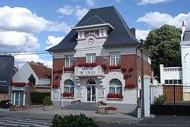 Town hall | ||
| ||
 Éleu-dit-Leauwette Location within Hauts-de-France region  Éleu-dit-Leauwette | ||
| Coordinates: 50°25′18″N 2°48′43″E / 50.4217°N 2.8119°ECoordinates: 50°25′18″N 2°48′43″E / 50.4217°N 2.8119°E | ||
| Country | France | |
| Region | Hauts-de-France | |
| Department | Pas-de-Calais | |
| Arrondissement | Lens | |
| Canton | Liévin | |
| Intercommunality | CA Lens-Liévin | |
| Government | ||
| • Mayor (2008–2014) | Bernard Pruneau | |
| Area1 | 1.17 km2 (0.45 sq mi) | |
| Population (2004)2 | 3,135 | |
| • Density | 2,700/km2 (6,900/sq mi) | |
| Time zone | UTC+1 (CET) | |
| • Summer (DST) | UTC+2 (CEST) | |
| INSEE/Postal code | 62291 /62300 | |
| Elevation |
31–66 m (102–217 ft) (avg. 44 m or 144 ft) | |
|
1 French Land Register data, which excludes lakes, ponds, glaciers > 1 km2 (0.386 sq mi or 247 acres) and river estuaries. 2 Population without double counting: residents of multiple communes (e.g., students and military personnel) only counted once. | ||

Éleu-dit-Leauwette is a commune in the Pas-de-Calais department in the Hauts-de-France region of France.
Geography
A suburban township, situated just 1 mile (1.6 km) south of the centre of Lens, at the junction of the D55, D58 and the A211 autoroute.
History
Completely destroyed during World War I and awarded the Croix de Guerre in 1920, this town was once home to many coal miners but is now a light industrial area and bedroom community.
Population
| Year | 1962 | 1968 | 1975 | 1982 | 1990 | 1999 | 2004 |
|---|---|---|---|---|---|---|---|
| Population | 2813 | 2967 | 2878 | 3710 | 3402 | 3107 | 3135 |
| From the year 1962 on: No double counting—residents of multiple communes (e.g. students and military personnel) are counted only once. | |||||||
Places of interest
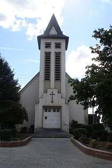
The church of St.Pierre
- The church of St.Pierre, rebuilt after the First World War.
- Parts of the walls of an old castle.
- The war memorial.
See also
References
External links
| Wikimedia Commons has media related to Éleu-dit-Leauwette. |
- Official town website (in French)
- The community of communes website (in French)
- Éleu-dit-Leauwette on the Quid website (in French)
This article is issued from
Wikipedia.
The text is licensed under Creative Commons - Attribution - Sharealike.
Additional terms may apply for the media files.