Gomiécourt
| Gomiécourt | ||
|---|---|---|
| Commune | ||
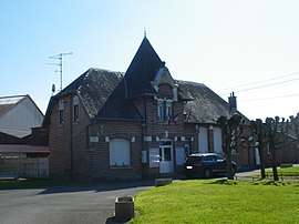 The town hall of Gomiécourt | ||
| ||
 Gomiécourt Location within Hauts-de-France region  Gomiécourt | ||
| Coordinates: 50°09′04″N 2°48′02″E / 50.1511°N 2.8006°ECoordinates: 50°09′04″N 2°48′02″E / 50.1511°N 2.8006°E | ||
| Country | France | |
| Region | Hauts-de-France | |
| Department | Pas-de-Calais | |
| Arrondissement | Arras | |
| Canton | Bapaume | |
| Intercommunality | CC Sud-Artois | |
| Government | ||
| • Mayor (2008–2014) | Hervé Copin | |
| Area1 | 3.62 km2 (1.40 sq mi) | |
| Population (1999)2 | 169 | |
| • Density | 47/km2 (120/sq mi) | |
| Time zone | UTC+1 (CET) | |
| • Summer (DST) | UTC+2 (CEST) | |
| INSEE/Postal code | 62374 /62121 | |
| Elevation |
94–122 m (308–400 ft) (avg. 117 m or 384 ft) | |
|
1 French Land Register data, which excludes lakes, ponds, glaciers > 1 km2 (0.386 sq mi or 247 acres) and river estuaries. 2 Population without double counting: residents of multiple communes (e.g., students and military personnel) only counted once. | ||

Gomiécourt is a commune in the Pas-de-Calais department in the Hauts-de-France region of France.
Geography
A small farming village situated 10 miles (16.1 km) south of Arras, at the junction of the D9 and the C9 roads.
Population
| Year | 1962 | 1968 | 1975 | 1982 | 1990 | 1999 |
|---|---|---|---|---|---|---|
| Population | 206 | 210 | 170 | 166 | 172 | 169 |
| From the year 1962 on: No double counting—residents of multiple communes (e.g. students and military personnel) are counted only once. | ||||||
Places of interest
- The church of St.Pierre, rebuilt, as was most of the village, after World War I.
- The Commonwealth War Graves Commission cemetery.
See also
References
External links
| Wikimedia Commons has media related to Gomiécourt. |
- The CWGC cemetery
- Gomiécourt on the Quid website (in French)
This article is issued from
Wikipedia.
The text is licensed under Creative Commons - Attribution - Sharealike.
Additional terms may apply for the media files.