Bernieulles
| Bernieulles | ||
|---|---|---|
| Commune | ||
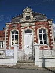 The town hall of Bernieulles | ||
| ||
 Bernieulles Location within Hauts-de-France region  Bernieulles | ||
| Coordinates: 50°33′20″N 1°46′29″E / 50.5556°N 1.7747°E / 50.5556; 1.7747Coordinates: 50°33′20″N 1°46′29″E / 50.5556°N 1.7747°E / 50.5556; 1.7747 | ||
| Country | France | |
| Region | Hauts-de-France | |
| Department | Pas-de-Calais | |
| Arrondissement | Montreuil | |
| Canton | Berck | |
| Intercommunality | CA Deux Baies en Montreuillois | |
| Government | ||
| • Mayor (2001–2008) | Jean-Marie Mocq | |
| Area1 | 5.74 km2 (2.22 sq mi) | |
| Population (2009)2 | 193 | |
| • Density | 34/km2 (87/sq mi) | |
| Time zone | UTC+1 (CET) | |
| • Summer (DST) | UTC+2 (CEST) | |
| INSEE/Postal code | 62116 /62170 | |
| Elevation |
41–120 m (135–394 ft) (avg. 60 m or 200 ft) | |
|
1 French Land Register data, which excludes lakes, ponds, glaciers > 1 km2 (0.386 sq mi or 247 acres) and river estuaries. 2 Population without double counting: residents of multiple communes (e.g., students and military personnel) only counted once. | ||

Bernieulles is a commune in the Pas-de-Calais department in the Hauts-de-France region in northern France.
Geography
A small village situated some 8 miles(13 km) north of Montreuil-sur-Mer, on the D147 road.
Population
| Historical population | ||
|---|---|---|
| Year | Pop. | ±% |
| 1962 | 213 | — |
| 1968 | 234 | +9.9% |
| 1975 | 192 | −17.9% |
| 1982 | 185 | −3.6% |
| 1990 | 201 | +8.6% |
| 1999 | 207 | +3.0% |
| 2009 | 193 | −6.8% |
See also
References
External links
| Wikimedia Commons has media related to Bernieulles. |
- Bernieulles on the Quid website (in French)
This article is issued from
Wikipedia.
The text is licensed under Creative Commons - Attribution - Sharealike.
Additional terms may apply for the media files.