Rémy
For the saint called "Saint Rémi" or "Saint Rémy" in French, see Saint Remigius. For the name, see Remy (name). For other uses, see Remy (disambiguation).
| Rémy | ||
|---|---|---|
| Commune | ||
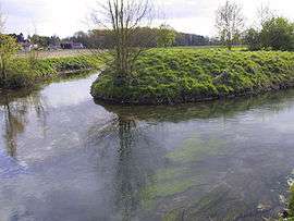 The Sensée | ||
| ||
 Rémy Location within Hauts-de-France region  Rémy | ||
| Coordinates: 50°15′16″N 2°57′24″E / 50.2544°N 2.9567°E / 50.2544; 2.9567Coordinates: 50°15′16″N 2°57′24″E / 50.2544°N 2.9567°E / 50.2544; 2.9567 | ||
| Country | France | |
| Region | Hauts-de-France | |
| Department | Pas-de-Calais | |
| Arrondissement | Arras | |
| Canton | Brebières | |
| Intercommunality | CC Osartis Marquion | |
| Government | ||
| • Mayor (2008–2014) | Annick Danel | |
| Area1 | 3.59 km2 (1.39 sq mi) | |
| Population (2006)2 | 253 | |
| • Density | 70/km2 (180/sq mi) | |
| Time zone | UTC+1 (CET) | |
| • Summer (DST) | UTC+2 (CEST) | |
| INSEE/Postal code | 62703 /62156 | |
| Elevation |
42–71 m (138–233 ft) (avg. 45 m or 148 ft) | |
|
1 French Land Register data, which excludes lakes, ponds, glaciers > 1 km2 (0.386 sq mi or 247 acres) and river estuaries. 2 Population without double counting: residents of multiple communes (e.g., students and military personnel) only counted once. | ||

Rémy is a commune in the department of Pas-de-Calais in the Hauts-de-France region of France.
Geography
Rémy lies in the valley of the Sensée river, some 10 miles (16 km) southeast of Arras, on the D9 road.
Population
| 1962 | 1968 | 1975 | 1982 | 1990 | 1999 | 2006 |
|---|---|---|---|---|---|---|
| 126 | 151 | 178 | 213 | 254 | 265 | 253 |
| Census count starting from 1962: Population without duplicates | ||||||
Places of interest
- The church of St-Léger, rebuilt, along with the rest of the village, after the First World War.
- A watermill.
See also
References
External links
| Wikimedia Commons has media related to Rémy (Pas-de-Calais). |
- Rémy on the Quid website (in French)
| Authority control |
|---|
This article is issued from
Wikipedia.
The text is licensed under Creative Commons - Attribution - Sharealike.
Additional terms may apply for the media files.