Lacres
| Lacres | ||
|---|---|---|
| Commune | ||
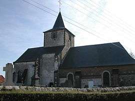 The church of Lacres | ||
| ||
 Lacres Location within Hauts-de-France region  Lacres | ||
| Coordinates: 50°35′43″N 1°45′07″E / 50.5953°N 1.7519°ECoordinates: 50°35′43″N 1°45′07″E / 50.5953°N 1.7519°E | ||
| Country | France | |
| Region | Hauts-de-France | |
| Department | Pas-de-Calais | |
| Arrondissement | Boulogne-sur-Mer | |
| Canton | Desvres | |
| Intercommunality | CC Desvres-Samer | |
| Government | ||
| • Mayor (2008–2014) | Henri Malliard | |
| Area1 | 8.23 km2 (3.18 sq mi) | |
| Population (2006)2 | 213 | |
| • Density | 26/km2 (67/sq mi) | |
| Time zone | UTC+1 (CET) | |
| • Summer (DST) | UTC+2 (CEST) | |
| INSEE/Postal code | 62483 /62830 | |
| Elevation |
75–193 m (246–633 ft) (avg. 100 m or 330 ft) | |
|
1 French Land Register data, which excludes lakes, ponds, glaciers > 1 km2 (0.386 sq mi or 247 acres) and river estuaries. 2 Population without double counting: residents of multiple communes (e.g., students and military personnel) only counted once. | ||

Lacres is a commune in the Pas-de-Calais department in the Hauts-de-France region of France.
Geography
Lacres is situated about 12 miles (19 km) south east of Boulogne, at the junction of the D901 (formerly the N1 Paris-Calais highway) with the D125 and D125e roads.
Population
| Year | 1962 | 1968 | 1975 | 1982 | 1990 | 1999 | 2006 |
|---|---|---|---|---|---|---|---|
| Population | 197 | 211 | 194 | 193 | 190 | 161 | 167 |
| From the year 1962 on: No double counting—residents of multiple communes (e.g. students and military personnel) are counted only once. | |||||||
Places of interest
- The church of St. Martin, dating from the fifteenth century.
- A seventeenth century manorhouse and farmhouse.
See also
References
External links
| Wikimedia Commons has media related to Lacres. |
- Lacres on the Quid website (in French)
| Authority control |
|---|
This article is issued from
Wikipedia.
The text is licensed under Creative Commons - Attribution - Sharealike.
Additional terms may apply for the media files.