Avesnes-lès-Bapaume
| Avesnes-lès-Bapaume | ||
|---|---|---|
| Commune | ||
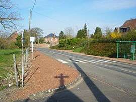 A general view of Avesnes-lès-Bapaume | ||
| ||
 Avesnes-lès-Bapaume Location within Hauts-de-France region  Avesnes-lès-Bapaume | ||
| Coordinates: 50°06′19″N 2°50′29″E / 50.1053°N 2.8414°E / 50.1053; 2.8414Coordinates: 50°06′19″N 2°50′29″E / 50.1053°N 2.8414°E / 50.1053; 2.8414 | ||
| Country | France | |
| Region | Hauts-de-France | |
| Department | Pas-de-Calais | |
| Arrondissement | Arras | |
| Canton | Bapaume | |
| Intercommunality | CC Sud-Artois | |
| Government | ||
| • Mayor (2014-2020) | Bernard Dobœuf | |
| Area1 | 3.09 km2 (1.19 sq mi) | |
| Population (2014)2 | 154 | |
| • Density | 50/km2 (130/sq mi) | |
| Time zone | UTC+1 (CET) | |
| • Summer (DST) | UTC+2 (CEST) | |
| INSEE/Postal code | 62064 /62450 | |
| Elevation |
102–132 m (335–433 ft) (avg. 114 m or 374 ft) | |
|
1 French Land Register data, which excludes lakes, ponds, glaciers > 1 km2 (0.386 sq mi or 247 acres) and river estuaries. 2 Population without double counting: residents of multiple communes (e.g., students and military personnel) only counted once. | ||

Avesnes-lès-Bapaume is a commune in the Pas-de-Calais department in northern France.
Geography
A small farming suburb (of Bapaume), located 11 miles (17 km) south of Arras at the junction of the D7 and D929 roads.
Population
| Historical population | ||
|---|---|---|
| Year | Pop. | ±% |
| 1962 | 148 | — |
| 1968 | 170 | +14.9% |
| 1975 | 179 | +5.3% |
| 1982 | 193 | +7.8% |
| 1990 | 163 | −15.5% |
| 1999 | 164 | +0.6% |
| 2009 | 136 | −17.1% |
| 2014 | 154 | +13.2% |
See also
References
External links
| Wikimedia Commons has media related to Avesnes-lès-Bapaume. |
- Avesnes-lès-Bapaume on the Quid website (in French)
This article is issued from
Wikipedia.
The text is licensed under Creative Commons - Attribution - Sharealike.
Additional terms may apply for the media files.