Béthonsart
| Béthonsart | ||
|---|---|---|
| Commune | ||
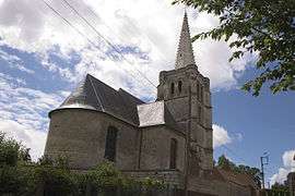 The church of Béthonsart | ||
| ||
 Béthonsart Location within Hauts-de-France region  Béthonsart | ||
| Coordinates: 50°22′36″N 2°33′04″E / 50.3767°N 2.5511°E / 50.3767; 2.5511Coordinates: 50°22′36″N 2°33′04″E / 50.3767°N 2.5511°E / 50.3767; 2.5511 | ||
| Country | France | |
| Region | Hauts-de-France | |
| Department | Pas-de-Calais | |
| Arrondissement | Arras | |
| Canton | Avesnes-le-Comte | |
| Intercommunality | CC Campagnes de l'Artois | |
| Government | ||
| • Mayor (2008–2014) | Richard Juras | |
| Area1 | 4.21 km2 (1.63 sq mi) | |
| Population (2009)2 | 167 | |
| • Density | 40/km2 (100/sq mi) | |
| Time zone | UTC+1 (CET) | |
| • Summer (DST) | UTC+2 (CEST) | |
| INSEE/Postal code | 62118 /62690 | |
| Elevation |
119–157 m (390–515 ft) (avg. 144 m or 472 ft) | |
|
1 French Land Register data, which excludes lakes, ponds, glaciers > 1 km2 (0.386 sq mi or 247 acres) and river estuaries. 2 Population without double counting: residents of multiple communes (e.g., students and military personnel) only counted once. | ||

Béthonsart is a commune in the Pas-de-Calais department in the Hauts-de-France region in northern France.
Geography
A small farming village located 12 miles (20 km) northwest of Arras on the D74.
Population
| Historical population | ||
|---|---|---|
| Year | Pop. | ±% |
| 1962 | 167 | — |
| 1968 | 152 | −9.0% |
| 1975 | 127 | −16.4% |
| 1982 | 126 | −0.8% |
| 1990 | 141 | +11.9% |
| 1999 | 131 | −7.1% |
| 2009 | 167 | +27.5% |
Sights
- A seventeenth-century farmhouse.
- The church of St. Elizabeth, dating from the sixteenth century
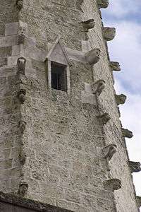
Detail of the spire
See also
References
External links
| Wikimedia Commons has media related to Béthonsart. |
- Béthonsart on the Quid website (in French)
This article is issued from
Wikipedia.
The text is licensed under Creative Commons - Attribution - Sharealike.
Additional terms may apply for the media files.