Maresquel-Ecquemicourt
| Maresquel-Ecquemicourt | ||
|---|---|---|
| Commune | ||
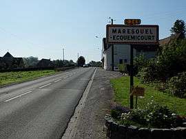 The road into Maresquel-Ecquemicourt | ||
| ||
 Maresquel-Ecquemicourt Location within Hauts-de-France region  Maresquel-Ecquemicourt | ||
| Coordinates: 50°24′40″N 1°55′41″E / 50.4111°N 1.9281°ECoordinates: 50°24′40″N 1°55′41″E / 50.4111°N 1.9281°E | ||
| Country | France | |
| Region | Hauts-de-France | |
| Department | Pas-de-Calais | |
| Arrondissement | Montreuil | |
| Canton | Auxi-le-Château | |
| Intercommunality | CC Sept Vallées | |
| Government | ||
| • Mayor (2001–2008) | Alain Decaudin | |
| Area1 | 7.89 km2 (3.05 sq mi) | |
| Population (2006)2 | 862 | |
| • Density | 110/km2 (280/sq mi) | |
| Time zone | UTC+1 (CET) | |
| • Summer (DST) | UTC+2 (CEST) | |
| INSEE/Postal code | 62552 /62990 | |
| Elevation |
13–104 m (43–341 ft) (avg. 26 m or 85 ft) | |
|
1 French Land Register data, which excludes lakes, ponds, glaciers > 1 km2 (0.386 sq mi or 247 acres) and river estuaries. 2 Population without double counting: residents of multiple communes (e.g., students and military personnel) only counted once. | ||

Maresquel-Ecquemicourt is a commune in the Pas-de-Calais department in the Hauts-de-France region of France.
Geography
Maresquel-Ecquemicourt is situated 8 miles (13 km) southeast of Montreuil-sur-Mer, on the D349 road.
Population
| 1962 | 1968 | 1975 | 1982 | 1990 | 1999 | 2006 |
|---|---|---|---|---|---|---|
| 848 | 934 | 1005 | 1037 | 900 | 847 | 862 |
| Census count starting from 1962: Population without duplicates | ||||||
Places of interest
- The church of Saint-Pierre, dating from the seventeenth century.
See also
References
External links
| Wikimedia Commons has media related to Maresquel-Ecquemicourt. |
- Maresquel-Ecquemicourt on the Quid website (in French)
| Authority control |
|---|
This article is issued from
Wikipedia.
The text is licensed under Creative Commons - Attribution - Sharealike.
Additional terms may apply for the media files.