Billy-Montigny
| Billy-Montigny | ||
|---|---|---|
| Commune | ||
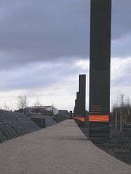 Survivors Way that links the necropolis of Méricourt to pit no. 2 at Billy-Montigny | ||
| ||
 Billy-Montigny Location within Hauts-de-France region  Billy-Montigny | ||
| Coordinates: 50°27′07″N 2°54′46″E / 50.4519°N 2.9128°ECoordinates: 50°27′07″N 2°54′46″E / 50.4519°N 2.9128°E | ||
| Country | France | |
| Region | Hauts-de-France | |
| Department | Pas-de-Calais | |
| Arrondissement | Lens | |
| Canton | Harnes | |
| Intercommunality | CA Lens-Liévin | |
| Government | ||
| • Mayor (2008–2014) | Bruno Troni | |
| Area1 | 2.71 km2 (1.05 sq mi) | |
| Population (2009)2 | 8,104 | |
| • Density | 3,000/km2 (7,700/sq mi) | |
| Time zone | UTC+1 (CET) | |
| • Summer (DST) | UTC+2 (CEST) | |
| INSEE/Postal code | 62133 /62420 | |
| Elevation | 24–45 m (79–148 ft) | |
|
1 French Land Register data, which excludes lakes, ponds, glaciers > 1 km2 (0.386 sq mi or 247 acres) and river estuaries. 2 Population without double counting: residents of multiple communes (e.g., students and military personnel) only counted once. | ||

Billy-Montigny is a commune in the Pas-de-Calais department in the Hauts-de-France region in northern France.
Geography
An ex-coalmining industrial town situated just 4 miles (6.4 km) east of the centre of Lens at the junction of the N43 and D46 roads. The coal lasted just over 100 years, the last pits closing in the 1960s.
Population
| Historical population | ||
|---|---|---|
| Year | Pop. | ±% |
| 1962 | 9,510 | — |
| 1968 | 10,077 | +6.0% |
| 1975 | 8,834 | −12.3% |
| 1982 | 7,682 | −13.0% |
| 1990 | 8,126 | +5.8% |
| 1999 | 8,396 | +3.3% |
| 2005 | 8,449 | +0.6% |
| 2009 | 8,104 | −4.1% |
Sights
- The church of St. Martin, dating from the nineteenth century.
- The Commonwealth War Graves Commission cemetery.
History
The history of the area remains marked by the Courrières mine disaster which resulted in 1,099 casualties on 10 March 1906 in the area of the communes of Billy-Montigny, Méricourt and Sallaumines.
Personalities
Georges Lech and Bernard Lech, footballers.
International relations
The commune is twinned with:
See also
References
External links
| Wikimedia Commons has media related to Billy-Montigny. |
- Official town website (in French)
- The CWGC graves in the commune cemetery
- Billy-Montigny on the Quid website (in French)
| Authority control |
|---|
This article is issued from
Wikipedia.
The text is licensed under Creative Commons - Attribution - Sharealike.
Additional terms may apply for the media files.