Bajus, Pas-de-Calais
| Bajus | ||
|---|---|---|
| Commune | ||
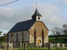 The church of Bajus | ||
| ||
 Bajus Location within Hauts-de-France region  Bajus | ||
| Coordinates: 50°25′19″N 2°28′51″E / 50.4219°N 2.4808°E / 50.4219; 2.4808Coordinates: 50°25′19″N 2°28′51″E / 50.4219°N 2.4808°E / 50.4219; 2.4808 | ||
| Country | France | |
| Region | Hauts-de-France | |
| Department | Pas-de-Calais | |
| Arrondissement | Béthune | |
| Canton | Bruay-la-Buissière | |
| Intercommunality | CA Béthune-Bruay, Artois-Lys Romane | |
| Government | ||
| • Mayor (2008–2014) | Jean-Pierre Clément | |
| Area1 | 2.94 km2 (1.14 sq mi) | |
| Population (2009)2 | 303 | |
| • Density | 100/km2 (270/sq mi) | |
| Time zone | UTC+1 (CET) | |
| • Summer (DST) | UTC+2 (CEST) | |
| INSEE/Postal code | 62077 /62150 | |
| Elevation |
87–158 m (285–518 ft) (avg. 100 m or 330 ft) | |
|
1 French Land Register data, which excludes lakes, ponds, glaciers > 1 km2 (0.386 sq mi or 247 acres) and river estuaries. 2 Population without double counting: residents of multiple communes (e.g., students and military personnel) only counted once. | ||

Bajus is a commune in the Pas-de-Calais department in the Hauts-de-France region in northern France.
Geography
A farming village located 20 miles (32 km) northwest of Arras at the junction of the D86E and D86E1 roads.
Population
| Historical population | ||
|---|---|---|
| Year | Pop. | ±% |
| 1962 | 191 | — |
| 1968 | 205 | +7.3% |
| 1975 | 202 | −1.5% |
| 1982 | 280 | +38.6% |
| 1990 | 290 | +3.6% |
| 1999 | 273 | −5.9% |
| 2009 | 303 | +11.0% |
Sights
See also
References
External links
| Wikimedia Commons has media related to Bajus. |
- Bajus on the Quid website (in French)
This article is issued from
Wikipedia.
The text is licensed under Creative Commons - Attribution - Sharealike.
Additional terms may apply for the media files.