Regnauville
| Regnauville | ||
|---|---|---|
| Commune | ||
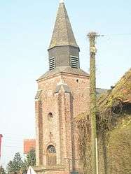 The church of Regnauville | ||
| ||
 Regnauville Location within Hauts-de-France region  Regnauville | ||
| Coordinates: 50°18′52″N 2°00′44″E / 50.3144°N 2.0122°E / 50.3144; 2.0122Coordinates: 50°18′52″N 2°00′44″E / 50.3144°N 2.0122°E / 50.3144; 2.0122 | ||
| Country | France | |
| Region | Hauts-de-France | |
| Department | Pas-de-Calais | |
| Arrondissement | Montreuil | |
| Canton | Auxi-le-Château | |
| Intercommunality | CC Sept Vallées | |
| Government | ||
| • Mayor | Paulette Hetroy | |
| Area1 | 4.17 km2 (1.61 sq mi) | |
| Population (2006)2 | 230 | |
| • Density | 55/km2 (140/sq mi) | |
| Time zone | UTC+1 (CET) | |
| • Summer (DST) | UTC+2 (CEST) | |
| INSEE/Postal code | 62700 /62140 | |
| Elevation |
32–125 m (105–410 ft) (avg. 115 m or 377 ft) | |
|
1 French Land Register data, which excludes lakes, ponds, glaciers > 1 km2 (0.386 sq mi or 247 acres) and river estuaries. 2 Population without double counting: residents of multiple communes (e.g., students and military personnel) only counted once. | ||

Regnauville is a commune in the Pas-de-Calais department in the Hauts-de-France region of France.
Geography
Regnauville is located 18 miles (29 km) southeast of Montreuil-sur-Mer on the D928 road.
Population
| 1962 | 1968 | 1975 | 1982 | 1990 | 1999 | 2006 |
|---|---|---|---|---|---|---|
| 223 | 231 | 213 | 224 | 210 | 210 | 230 |
| Census count starting from 1962: Population without duplicates | ||||||
Places of interest
- The church of St.Jacques, dating from the sixteenth century.
- A cheesemakers
See also
References
External links
| Wikimedia Commons has media related to Regnauville. |
- Regnauville on the Quid website (in French)
| Authority control |
|---|
This article is issued from
Wikipedia.
The text is licensed under Creative Commons - Attribution - Sharealike.
Additional terms may apply for the media files.