Wierre-au-Bois
| Wierre-au-Bois | |
|---|---|
| Commune | |
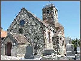 The church of Wierre-au-Bois | |
 Wierre-au-Bois Location within Hauts-de-France region  Wierre-au-Bois | |
| Coordinates: 50°38′42″N 1°45′47″E / 50.645°N 1.7631°ECoordinates: 50°38′42″N 1°45′47″E / 50.645°N 1.7631°E | |
| Country | France |
| Region | Hauts-de-France |
| Department | Pas-de-Calais |
| Arrondissement | Boulogne-sur-Mer |
| Canton | Desvres |
| Intercommunality | CC Desvres-Samer |
| Government | |
| • Mayor (2014-2020) | Bertrand Flahaut |
| Area1 | 3.83 km2 (1.48 sq mi) |
| Population (2014)2 | 228 |
| • Density | 60/km2 (150/sq mi) |
| Time zone | UTC+1 (CET) |
| • Summer (DST) | UTC+2 (CEST) |
| INSEE/Postal code | 62888 /62830 |
| Elevation |
28–91 m (92–299 ft) (avg. 170 m or 560 ft) |
|
1 French Land Register data, which excludes lakes, ponds, glaciers > 1 km2 (0.386 sq mi or 247 acres) and river estuaries. 2 Population without double counting: residents of multiple communes (e.g., students and military personnel) only counted once. | |
Wierre-au-Bois is a commune in the Pas-de-Calais department in the Hauts-de-France region of France.
Geography
Wierre-au-Bois is situated some 8 miles (13 km) southeast of Boulogne, on the D215 just to the east of Samer.
Population
| Year | 1962 | 1968 | 1975 | 1982 | 1990 | 1999 | 2006 |
|---|---|---|---|---|---|---|---|
| Population | 192 | 217 | 195 | 193 | 203 | 242 | 216 |
| From the year 1962 on: No double counting—residents of multiple communes (e.g. students and military personnel) are counted only once. | |||||||
Places of interest
- The church of St.Omer, dating from the fifteenth century.
- A seventeenth-century chateau.
- A medieval castle.
See also
References
External links
| Wikimedia Commons has media related to Wierre-au-Bois. |
- Wierre-au-Bois on the Quid website (in French)
This article is issued from
Wikipedia.
The text is licensed under Creative Commons - Attribution - Sharealike.
Additional terms may apply for the media files.