Linzeux
| Linzeux | ||
|---|---|---|
| Commune | ||
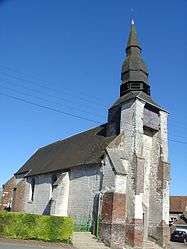 The church of Linzeux | ||
| ||
 Linzeux Location within Hauts-de-France region  Linzeux | ||
| Coordinates: 50°20′32″N 2°12′20″E / 50.3422°N 2.2056°E / 50.3422; 2.2056Coordinates: 50°20′32″N 2°12′20″E / 50.3422°N 2.2056°E / 50.3422; 2.2056 | ||
| Country | France | |
| Region | Hauts-de-France | |
| Department | Pas-de-Calais | |
| Arrondissement | Arras | |
| Canton | Saint-Pol-sur-Ternoise | |
| Intercommunality | CC Ternois | |
| Government | ||
| • Mayor (2008–2014) | Raymond Hochart | |
| Area1 | 4.71 km2 (1.82 sq mi) | |
| Population (2006)2 | 154 | |
| • Density | 33/km2 (85/sq mi) | |
| Time zone | UTC+1 (CET) | |
| • Summer (DST) | UTC+2 (CEST) | |
| INSEE/Postal code | 62518 /62270 | |
| Elevation |
63–121 m (207–397 ft) (avg. 100 m or 330 ft) | |
|
1 French Land Register data, which excludes lakes, ponds, glaciers > 1 km2 (0.386 sq mi or 247 acres) and river estuaries. 2 Population without double counting: residents of multiple communes (e.g., students and military personnel) only counted once. | ||

Linzeux is a commune in the Pas-de-Calais department in the Hauts-de-France region of France.
Geography
Linzeux is situated 26 miles (42 km) west of Arras, at the junction of the D101 and the D109 roads.
Population
| 1962 | 1968 | 1975 | 1982 | 1990 | 1999 | 2006 |
|---|---|---|---|---|---|---|
| 163 | 193 | 177 | 157 | 150 | 148 | 154 |
| Census count starting from 1962: Population without duplicates | ||||||
Places of interest
- The church of Notre-Dame, dating from the eighteenth century.
See also
References
External links
| Wikimedia Commons has media related to Linzeux. |
- Linzeux on the Quid website (in French)
This article is issued from
Wikipedia.
The text is licensed under Creative Commons - Attribution - Sharealike.
Additional terms may apply for the media files.