Bellebrune
| Bellebrune | ||
|---|---|---|
| Commune | ||
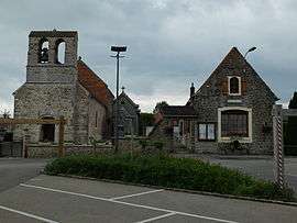 The church and town hall of Bellebrune | ||
| ||
 Bellebrune Location within Hauts-de-France region  Bellebrune | ||
| Coordinates: 50°43′40″N 1°46′31″E / 50.7278°N 1.7753°ECoordinates: 50°43′40″N 1°46′31″E / 50.7278°N 1.7753°E | ||
| Country | France | |
| Region | Hauts-de-France | |
| Department | Pas-de-Calais | |
| Arrondissement | Boulogne-sur-Mer | |
| Canton | Desvres | |
| Intercommunality | CC Desvres-Samer | |
| Government | ||
| • Mayor (2008–2014) | Brigitte De Premont (PCD) | |
| Area1 | 5.32 km2 (2.05 sq mi) | |
| Population (2009)2 | 342 | |
| • Density | 64/km2 (170/sq mi) | |
| Time zone | UTC+1 (CET) | |
| • Summer (DST) | UTC+2 (CEST) | |
| INSEE/Postal code | 62104 /62142 | |
| Elevation |
38–105 m (125–344 ft) (avg. 86 m or 282 ft) | |
|
1 French Land Register data, which excludes lakes, ponds, glaciers > 1 km2 (0.386 sq mi or 247 acres) and river estuaries. 2 Population without double counting: residents of multiple communes (e.g., students and military personnel) only counted once. | ||

Bellebrune is a commune in the Pas-de-Calais department in the Hauts-de-France region in northern France.
Geography
A small farming commune, some 8 miles (13 km) northeast of Boulogne, at the junction of the N42, D252 and the D238 roads.
Population
| Historical population | ||
|---|---|---|
| Year | Pop. | ±% |
| 1962 | 139 | — |
| 1968 | 150 | +7.9% |
| 1975 | 158 | +5.3% |
| 1982 | 171 | +8.2% |
| 1990 | 179 | +4.7% |
| 1999 | 246 | +37.4% |
| 2009 | 342 | +39.0% |
Sights
- The ruins of an 11th-century castle.
- The church of St. Leu, dating from the fifteenth century.
- The Château de La Villeneuve, dating from the seventeenth century.
See also
References
External links
| Wikimedia Commons has media related to Bellebrune. |
- Bellebrune on the Quid website (in French)
This article is issued from
Wikipedia.
The text is licensed under Creative Commons - Attribution - Sharealike.
Additional terms may apply for the media files.