Noyelles-sous-Bellonne
| Noyelles-sous-Bellonne | ||
|---|---|---|
| Commune | ||
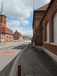 A road in Noyelles-sous-Bellonne | ||
| ||
 Noyelles-sous-Bellonne Location within Hauts-de-France region  Noyelles-sous-Bellonne | ||
| Coordinates: 50°18′31″N 3°01′41″E / 50.3086°N 3.0281°ECoordinates: 50°18′31″N 3°01′41″E / 50.3086°N 3.0281°E | ||
| Country | France | |
| Region | Hauts-de-France | |
| Department | Pas-de-Calais | |
| Arrondissement | Arras | |
| Canton | Brebières | |
| Intercommunality | CC Osartis Marquion | |
| Government | ||
| • Mayor (2008–2014) | Gilles Pintiaux | |
| Area1 | 4.21 km2 (1.63 sq mi) | |
| Population (2006)2 | 725 | |
| • Density | 170/km2 (450/sq mi) | |
| Time zone | UTC+1 (CET) | |
| • Summer (DST) | UTC+2 (CEST) | |
| INSEE/Postal code | 62627 /62490 | |
| Elevation |
31–71 m (102–233 ft) (avg. 40 m or 130 ft) | |
|
1 French Land Register data, which excludes lakes, ponds, glaciers > 1 km2 (0.386 sq mi or 247 acres) and river estuaries. 2 Population without double counting: residents of multiple communes (e.g., students and military personnel) only counted once. | ||

Noyelles-sous-Bellonne is a commune in the Pas-de-Calais department in the Hauts-de-France region of France.
Geography
Noyelles-sous-Bellonne is situated 14 miles (23 km) east of Arras, at the junction of the D44 and D44E roads.
Population
| 1962 | 1968 | 1975 | 1982 | 1990 | 1999 | 2006 |
|---|---|---|---|---|---|---|
| 384 | 391 | 383 | 379 | 515 | 568 | 725 |
| Census count starting from 1962: Population without duplicates | ||||||
Places of interest
- The church of St.Pétronille, rebuilt along with the rest of the village, after World War I.
See also
References
External links
| Wikimedia Commons has media related to Noyelles-sous-Bellonne. |
- Official website of the commune (in French)
- Noyelles-sous-Bellonne on the Quid website (in French)
| Authority control |
|---|
This article is issued from
Wikipedia.
The text is licensed under Creative Commons - Attribution - Sharealike.
Additional terms may apply for the media files.