Wambercourt
| Wambercourt | |
|---|---|
| Commune | |
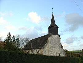 The church of Wambercourt | |
 Wambercourt Location within Hauts-de-France region  Wambercourt | |
| Coordinates: 50°25′46″N 2°01′26″E / 50.4294°N 2.024°E / 50.4294; 2.024Coordinates: 50°25′46″N 2°01′26″E / 50.4294°N 2.024°E / 50.4294; 2.024 | |
| Country | France |
| Region | Hauts-de-France |
| Department | Pas-de-Calais |
| Arrondissement | Montreuil |
| Canton | Auxi-le-Château |
| Intercommunality | Communauté de communes des Sept Vallées |
| Government | |
| • Mayor (2014-2020) | Bernard Taffin |
| Area1 | 6.06 km2 (2.34 sq mi) |
| Population (2014)2 | 253 |
| • Density | 42/km2 (110/sq mi) |
| Time zone | UTC+1 (CET) |
| • Summer (DST) | UTC+2 (CEST) |
| INSEE/Postal code | 62871 /62140 |
| Elevation |
35–118 m (115–387 ft) (avg. 39 m or 128 ft) |
|
1 French Land Register data, which excludes lakes, ponds, glaciers > 1 km2 (0.386 sq mi or 247 acres) and river estuaries. 2 Population without double counting: residents of multiple communes (e.g., students and military personnel) only counted once. | |
Wambercourt is a commune in the Pas-de-Calais department in the Nord-Pas de Calais region of France.
Geography
Wambercourt lies along the valley of the Planquette (a tributary of the Canche), in upper Artois.
Demography
| Year | 1962 | 1968 | 1975 | 1982 | 1990 | 1999 | 2006 | 2014 |
|---|---|---|---|---|---|---|---|---|
| Population | 167 | 173 | 154 | 172 | 181 | 198 | 218 | 253 |
| From the year 1962 on: No double counting—residents of multiple communes (e.g. students and military personnel) are counted only once. | ||||||||
See also
References
External links
| Wikimedia Commons has media related to Wambercourt. |
- Wambercourt on the Quid website (in French)
This article is issued from
Wikipedia.
The text is licensed under Creative Commons - Attribution - Sharealike.
Additional terms may apply for the media files.