Saint-Martin-sur-Cojeul
| Saint-Martin-sur-Cojeul | ||
|---|---|---|
| Commune | ||
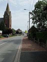 The main road of Saint-Martin-sur-Cojeul | ||
| ||
 Saint-Martin-sur-Cojeul Location within Hauts-de-France region  Saint-Martin-sur-Cojeul | ||
| Coordinates: 50°13′55″N 2°50′36″E / 50.2319°N 2.8433°ECoordinates: 50°13′55″N 2°50′36″E / 50.2319°N 2.8433°E | ||
| Country | France | |
| Region | Hauts-de-France | |
| Department | Pas-de-Calais | |
| Arrondissement | Arras | |
| Canton | Arras-3 | |
| Intercommunality | CU Arras | |
| Government | ||
| • Mayor (2008–2014) | Thérèse Lefrère | |
| Area1 | 3.41 km2 (1.32 sq mi) | |
| Population (2006)2 | 205 | |
| • Density | 60/km2 (160/sq mi) | |
| Time zone | UTC+1 (CET) | |
| • Summer (DST) | UTC+2 (CEST) | |
| INSEE/Postal code | 62761 /62128 | |
| Elevation |
61–108 m (200–354 ft) (avg. 64 m or 210 ft) | |
|
1 French Land Register data, which excludes lakes, ponds, glaciers > 1 km2 (0.386 sq mi or 247 acres) and river estuaries. 2 Population without double counting: residents of multiple communes (e.g., students and military personnel) only counted once. | ||

Saint-Martin-sur-Cojeul is a commune in the Pas-de-Calais department in the Hauts-de-France region of France.
Geography
Saint-Martin-sur-Cojeul lies 6 miles (10 km) southeast of Arras, on the D33 road. The A1 autoroute passes by half a mile to the east of the commune.
Population
| 1962 | 1968 | 1975 | 1982 | 1990 | 1999 | 2006 |
|---|---|---|---|---|---|---|
| 107 | 107 | 115 | 148 | 186 | 199 | 215 |
| Census count starting from 1962: Population without duplicates | ||||||
Places of interest
- The church of St.Martin, rebuilt, as was all of the village, after the First World War.
- The Commonwealth War Graves Commission cemetery.
See also
References
External links
| Wikimedia Commons has media related to Saint-Martin-sur-Cojeul. |
| Authority control |
|---|
This article is issued from
Wikipedia.
The text is licensed under Creative Commons - Attribution - Sharealike.
Additional terms may apply for the media files.