Escalles
| Escalles | ||
|---|---|---|
| Commune | ||
 Cape Blanc Nez | ||
| ||
 Escalles Location within Hauts-de-France region  Escalles | ||
| Coordinates: 50°55′04″N 1°42′53″E / 50.9178°N 1.7147°ECoordinates: 50°55′04″N 1°42′53″E / 50.9178°N 1.7147°E | ||
| Country | France | |
| Region | Hauts-de-France | |
| Department | Pas-de-Calais | |
| Arrondissement | Calais | |
| Canton | Calais-1 | |
| Intercommunality | CA Calaisis | |
| Government | ||
| • Mayor (2008–2014) | Marc Boutroy | |
| Area1 | 7.29 km2 (2.81 sq mi) | |
| Population (1999)2 | 321 | |
| • Density | 44/km2 (110/sq mi) | |
| Time zone | UTC+1 (CET) | |
| • Summer (DST) | UTC+2 (CEST) | |
| INSEE/Postal code | 62307 /62179 | |
| Elevation |
0–154 m (0–505 ft) (avg. 46 m or 151 ft) | |
|
1 French Land Register data, which excludes lakes, ponds, glaciers > 1 km2 (0.386 sq mi or 247 acres) and river estuaries. 2 Population without double counting: residents of multiple communes (e.g., students and military personnel) only counted once. | ||

Escalles is a commune in the Pas-de-Calais department in the Hauts-de-France region of France.
Geography
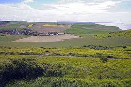
A small village located 13 kilometres (8 mi) west of Calais, at the junction of the D243 and D940 roads and at the foot of Mont d'Hubert (151 metres (495 ft)).
Population
| Year | 1962 | 1968 | 1975 | 1982 | 1990 | 1999 |
|---|---|---|---|---|---|---|
| Population | 182 | 199 | 149 | 286 | 320 | 321 |
| From the year 1962 on: No double counting—residents of multiple communes (e.g. students and military personnel) are counted only once. | ||||||
Places of interest
- The cliffs.
- An old windmill.
- The Dover Patrol Monument at the summit of Cap Blanc-Nez, dedicated to British and French sailors of World War I.
- The church of St. Maxime, dating from the sixteenth century.
- The Musée Transmanche.
See also
References
External links
| Wikimedia Commons has media related to Escalles. |
- Escalles on the Quid website (in French)
- http://www.escalles.fr/
| Authority control |
|---|
This article is issued from
Wikipedia.
The text is licensed under Creative Commons - Attribution - Sharealike.
Additional terms may apply for the media files.