Beuvrequen
| Beuvrequen | ||
|---|---|---|
| Commune | ||
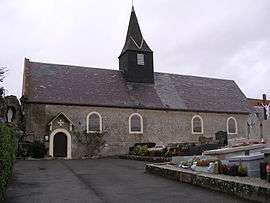 The church of Beuvrequen | ||
| ||
 Beuvrequen Location within Hauts-de-France region  Beuvrequen | ||
| Coordinates: 50°48′11″N 1°40′00″E / 50.8031°N 1.6667°ECoordinates: 50°48′11″N 1°40′00″E / 50.8031°N 1.6667°E | ||
| Country | France | |
| Region | Hauts-de-France | |
| Department | Pas-de-Calais | |
| Arrondissement | Boulogne-sur-Mer | |
| Canton | Desvres | |
| Intercommunality | CC Terre des Deux Caps | |
| Government | ||
| • Mayor (2008–2014) | Alain Barré | |
| Area1 | 4.75 km2 (1.83 sq mi) | |
| Population (2009)2 | 405 | |
| • Density | 85/km2 (220/sq mi) | |
| Time zone | UTC+1 (CET) | |
| • Summer (DST) | UTC+2 (CEST) | |
| INSEE/Postal code | 62125 /62250 | |
| Elevation |
3–93 m (9.8–305.1 ft) (avg. 57 m or 187 ft) | |
|
1 French Land Register data, which excludes lakes, ponds, glaciers > 1 km2 (0.386 sq mi or 247 acres) and river estuaries. 2 Population without double counting: residents of multiple communes (e.g., students and military personnel) only counted once. | ||

Beuvrequen is a commune in the Pas-de-Calais department in the Hauts-de-France region in northern France.
Geography
A farming commune, some 6 miles (9.7 km) northeast of Boulogne, at the junction of the D241 and the D241e roads, by the banks of the river Slack. The A16 autoroute passes through the commune, forming its southeastern border.
Population
| Historical population | ||
|---|---|---|
| Year | Pop. | ±% |
| 1962 | 234 | — |
| 1968 | 237 | +1.3% |
| 1975 | 313 | +32.1% |
| 1982 | 306 | −2.2% |
| 1990 | 322 | +5.2% |
| 1999 | 392 | +21.7% |
| 2009 | 405 | +3.3% |
Sights
- The windmill de René.
- The church of St. Maxime, dating from the sixteenth century.
See also
References
External links
| Wikimedia Commons has media related to Beuvrequen. |
- Beuvrequen on the Quid website (in French)
This article is issued from
Wikipedia.
The text is licensed under Creative Commons - Attribution - Sharealike.
Additional terms may apply for the media files.