Siracourt
| Siracourt | ||
|---|---|---|
| Commune | ||
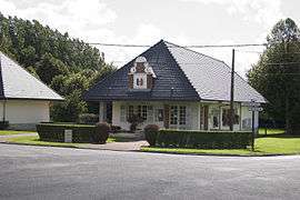 The town hall and school of Siracourt | ||
| ||
 Siracourt Location within Hauts-de-France region  Siracourt | ||
| Coordinates: 50°22′24″N 2°16′18″E / 50.3733°N 2.2717°ECoordinates: 50°22′24″N 2°16′18″E / 50.3733°N 2.2717°E | ||
| Country | France | |
| Region | Hauts-de-France | |
| Department | Pas-de-Calais | |
| Arrondissement | Arras | |
| Canton | Saint-Pol-sur-Ternoise | |
| Intercommunality | CC Ternois | |
| Government | ||
| • Mayor (2008–2014) | Freddy Bloquet | |
| Area1 | 3.14 km2 (1.21 sq mi) | |
| Population (2006)2 | 249 | |
| • Density | 79/km2 (210/sq mi) | |
| Time zone | UTC+1 (CET) | |
| • Summer (DST) | UTC+2 (CEST) | |
| INSEE/Postal code | 62797 /62130 | |
| Elevation | 124–154 m (407–505 ft) | |
|
1 French Land Register data, which excludes lakes, ponds, glaciers > 1 km2 (0.386 sq mi or 247 acres) and river estuaries. 2 Population without double counting: residents of multiple communes (e.g., students and military personnel) only counted once. | ||

Siracourt is a commune in the Pas-de-Calais department in the Hauts-de-France region of France.
Geography
Siracourt lies 27 miles (43.5 km) west of Arras and 3 miles (4.8 km) west of St.Pol, near the junction of the D100 and N39 roads.
Population
| 1962 | 1968 | 1975 | 1982 | 1990 | 1999 | 2006 |
|---|---|---|---|---|---|---|
| 143 | 158 | 163 | 140 | 223 | 228 | 249 |
| Census count starting in 1962: Population without duplicates | ||||||
Places of interest
- The modern church of St.Germain, rebuilt, along with the entire village after World War II.
- The Siracourt V-1 bunker, built during World War II.
See also
References
External links
| Wikimedia Commons has media related to Siracourt. |
- Siracourt on the Quid website (in French)
This article is issued from
Wikipedia.
The text is licensed under Creative Commons - Attribution - Sharealike.
Additional terms may apply for the media files.