Villers-lès-Cagnicourt
| Villers-lès-Cagnicourt | |
|---|---|
| Commune | |
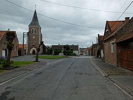 The centre of Villers-lès-Cagnicourt | |
 Villers-lès-Cagnicourt Location within Hauts-de-France region  Villers-lès-Cagnicourt | |
| Coordinates: 50°13′23″N 3°00′36″E / 50.2231°N 3.01°ECoordinates: 50°13′23″N 3°00′36″E / 50.2231°N 3.01°E | |
| Country | France |
| Region | Hauts-de-France |
| Department | Pas-de-Calais |
| Arrondissement | Arras |
| Canton | Brebières |
| Intercommunality | CC Osartis Marquion |
| Government | |
| • Mayor (2008–2014) | Michel Legros |
| Area1 | 4.4 km2 (1.7 sq mi) |
| Population (2006)2 | 225 |
| • Density | 51/km2 (130/sq mi) |
| Time zone | UTC+1 (CET) |
| • Summer (DST) | UTC+2 (CEST) |
| INSEE/Postal code | 62858 /62182 |
| Elevation |
47–79 m (154–259 ft) (avg. 54 m or 177 ft) |
|
1 French Land Register data, which excludes lakes, ponds, glaciers > 1 km2 (0.386 sq mi or 247 acres) and river estuaries. 2 Population without double counting: residents of multiple communes (e.g., students and military personnel) only counted once. | |
Villers-lès-Cagnicourt is a commune in the Pas-de-Calais department in the Hauts-de-France region of France.
Geography
Villers-lès-Cagnicourt is situated some 15 miles (24.1 km) southeast of Arras, at the junction of the D939 and D13 roads.
History
The village church has plaques dedicated to several Canadian soldiers decorated for valour in the fighting nearby in 1918, including Sergeant Arthur George Knight, VC, of the 10th Battalion, CEF.
Population
| Year | 1962 | 1968 | 1975 | 1982 | 1990 | 1999 | 2006 |
|---|---|---|---|---|---|---|---|
| Population | 245 | 224 | 225 | 207 | 201 | 212 | 225 |
| From the year 1962 on: No double counting—residents of multiple communes (e.g. students and military personnel) are counted only once. | |||||||
Places of interest
- The church of St.Martin, rebuilt, along with much of the village, after World War I.
See also
References
External links
| Wikimedia Commons has media related to Villers-lès-Cagnicourt. |
- Villers-lès-Cagnicourt on the Quid website (in French)
This article is issued from
Wikipedia.
The text is licensed under Creative Commons - Attribution - Sharealike.
Additional terms may apply for the media files.