Veauville-lès-Quelles
| Veauville-lès-Quelles | ||
|---|---|---|
| Commune | ||
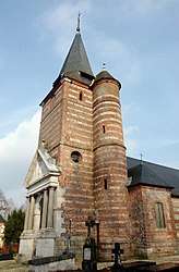 The church in Veauville-lès-Quelles | ||
| ||
 Veauville-lès-Quelles Location within Normandy region  Veauville-lès-Quelles | ||
| Coordinates: 49°44′24″N 0°42′24″E / 49.74°N 0.7067°ECoordinates: 49°44′24″N 0°42′24″E / 49.74°N 0.7067°E | ||
| Country | France | |
| Region | Normandy | |
| Department | Seine-Maritime | |
| Arrondissement | Dieppe | |
| Canton | Saint-Valery-en-Caux | |
| Intercommunality | CC Côte d'Albâtre | |
| Government | ||
| • Mayor | Gérard Colin | |
| Area1 | 3.21 km2 (1.24 sq mi) | |
| Population (2006)2 | 108 | |
| • Density | 34/km2 (87/sq mi) | |
| Time zone | UTC+1 (CET) | |
| • Summer (DST) | UTC+2 (CEST) | |
| INSEE/Postal code | 76730 /76560 | |
| Elevation |
75–145 m (246–476 ft) (avg. 125 m or 410 ft) | |
|
1 French Land Register data, which excludes lakes, ponds, glaciers > 1 km2 (0.386 sq mi or 247 acres) and river estuaries. 2 Population without double counting: residents of multiple communes (e.g., students and military personnel) only counted once. | ||
.svg.png)
Veauville-lès-Quelles is a commune in the Seine-Maritime department in the Normandy region in northern France.
Geography
A very small farming village in the Pays de Caux, situated some 33 miles (53 km) northeast of Le Havre, at the junction of the D88 and D109 roads.
Population
| Year | 1962 | 1968 | 1975 | 1982 | 1990 | 1999 | 2006 |
|---|---|---|---|---|---|---|---|
| Population | 130 | 148 | 99 | 98 | 86 | 102 | 108 |
| From the year 1962 on: No double counting—residents of multiple communes (e.g. students and military personnel) are counted only once. | |||||||
Places of interest
- The church of Notre-Dame, dating from the nineteenth century.
- The chateau de Mathonville.
See also
References
External links
| Wikimedia Commons has media related to Veauville-lès-Quelles. |
- Veauville-lès-Quelles on the Quid website (in French)
This article is issued from
Wikipedia.
The text is licensed under Creative Commons - Attribution - Sharealike.
Additional terms may apply for the media files.