Royville
| Royville | ||
|---|---|---|
| Commune | ||
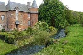 The Saâne river, at the border with Biville | ||
| ||
 Royville Location within Normandy region  Royville | ||
| Coordinates: 49°46′33″N 0°57′22″E / 49.7758°N 0.9561°ECoordinates: 49°46′33″N 0°57′22″E / 49.7758°N 0.9561°E | ||
| Country | France | |
| Region | Normandy | |
| Department | Seine-Maritime | |
| Arrondissement | Dieppe | |
| Canton | Luneray | |
| Intercommunality | CC Terroir de Caux | |
| Government | ||
| • Mayor | Didier Feron | |
| Area1 | 4.44 km2 (1.71 sq mi) | |
| Population (2006)2 | 237 | |
| • Density | 53/km2 (140/sq mi) | |
| Time zone | UTC+1 (CET) | |
| • Summer (DST) | UTC+2 (CEST) | |
| INSEE/Postal code | 76546 /76730 | |
| Elevation |
44–127 m (144–417 ft) (avg. 117 m or 384 ft) | |
|
1 French Land Register data, which excludes lakes, ponds, glaciers > 1 km2 (0.386 sq mi or 247 acres) and river estuaries. 2 Population without double counting: residents of multiple communes (e.g., students and military personnel) only counted once. | ||
Royville is a commune in the Seine-Maritime department in the Normandy region in northern France.
Geography
A small farming village situated by the banks of the Saâne river in the Pays de Caux at the junction of the D101, D107 and the D149 roads, some 16 miles (26 km) southwest of Dieppe.
Heraldry
 |
The arms of Royville are blazoned : Quarterly 1: Azure, a crowned lion argent; 2: Or, a martlet gules; 3: Or, a fleur de lys gules; 4: Azure, a tower argent open and pierced of the field. |
Population
| 1962 | 1968 | 1975 | 1982 | 1990 | 1999 | 2006 |
|---|---|---|---|---|---|---|
| 185 | 221 | 207 | 252 | 252 | 216 | 237 |
| Starting in 1962: Population without duplicates | ||||||
Places of interest
- The church of St. Martin, dating from the sixteenth century.
See also
References
External links
| Wikimedia Commons has media related to Royville. |
- Royville on the Quid website (in French)
This article is issued from
Wikipedia.
The text is licensed under Creative Commons - Attribution - Sharealike.
Additional terms may apply for the media files.