La Gaillarde
| La Gaillarde | |
|---|---|
| Commune | |
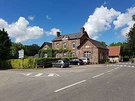 The town hall and school in La Gaillarde | |
 La Gaillarde Location within Normandy region  La Gaillarde | |
| Coordinates: 49°50′11″N 0°51′39″E / 49.8364°N 0.8608°ECoordinates: 49°50′11″N 0°51′39″E / 49.8364°N 0.8608°E | |
| Country | France |
| Region | Normandy |
| Department | Seine-Maritime |
| Arrondissement | Dieppe |
| Canton | Saint-Valery-en-Caux |
| Intercommunality | CC Côte d'Albâtre |
| Government | |
| • Mayor (2008–2014) | Jérôme Lheureux |
| Area1 | 7.78 km2 (3.00 sq mi) |
| Population (2006)2 | 436 |
| • Density | 56/km2 (150/sq mi) |
| Time zone | UTC+1 (CET) |
| • Summer (DST) | UTC+2 (CEST) |
| INSEE/Postal code | 76294 /76740 |
| Elevation |
24–87 m (79–285 ft) (avg. 43 m or 141 ft) |
|
1 French Land Register data, which excludes lakes, ponds, glaciers > 1 km2 (0.386 sq mi or 247 acres) and river estuaries. 2 Population without double counting: residents of multiple communes (e.g., students and military personnel) only counted once. | |
La Gaillarde is a commune in the Seine-Maritime department in the Normandy region in northern France.
Geography
A farming village situated by the banks of the Dun river in the Pays de Caux, some 11 miles (18 km) southwest of Dieppe at the junction of the D4 and the D237 roads.
Population
| Year | 1962 | 1968 | 1975 | 1982 | 1990 | 1999 | 2006 |
|---|---|---|---|---|---|---|---|
| Population | 464 | 519 | 462 | 378 | 420 | 415 | 436 |
| From the year 1962 on: No double counting—residents of multiple communes (e.g. students and military personnel) are counted only once. | |||||||
Places of interest
- Two 16th-century stone crosses.
- A recently restored 11th-century chapel.
- The church of Notre-Dame, dating from the twelfth century.
See also
References
External links
| Wikimedia Commons has media related to La Gaillarde. |
- Website about the village (in French)
- La Gaillarde on the Quid website (in French)
This article is issued from
Wikipedia.
The text is licensed under Creative Commons - Attribution - Sharealike.
Additional terms may apply for the media files.