Saint-Pierre-lès-Elbeuf
| Saint-Pierre-lès-Elbeuf | ||
|---|---|---|
| Commune | ||
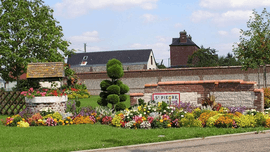 A floral display at the entrance to Saint-Pierre-lès-Elbeuf | ||
| ||
 Saint-Pierre-lès-Elbeuf Location within Normandy region  Saint-Pierre-lès-Elbeuf | ||
| Coordinates: 49°16′41″N 1°02′29″E / 49.2781°N 1.0414°ECoordinates: 49°16′41″N 1°02′29″E / 49.2781°N 1.0414°E | ||
| Country | France | |
| Region | Normandy | |
| Department | Seine-Maritime | |
| Arrondissement | Rouen | |
| Canton | Caudebec-lès-Elbeuf | |
| Intercommunality | Métropole Rouen Normandie | |
| Government | ||
| • Mayor | Patrice Désanglois | |
| Area1 | 6.36 km2 (2.46 sq mi) | |
| Population (2006)2 | 8,429 | |
| • Density | 1,300/km2 (3,400/sq mi) | |
| Time zone | UTC+1 (CET) | |
| • Summer (DST) | UTC+2 (CEST) | |
| INSEE/Postal code | 76640 /76320 | |
| Elevation |
4–75 m (13–246 ft) (avg. 20 m or 66 ft) | |
|
1 French Land Register data, which excludes lakes, ponds, glaciers > 1 km2 (0.386 sq mi or 247 acres) and river estuaries. 2 Population without double counting: residents of multiple communes (e.g., students and military personnel) only counted once. | ||

Saint-Pierre-lès-Elbeuf is a commune in the Seine-Maritime department in the Normandy region in northern France.
Geography
A small suburb town of farming and light industry situated by the banks of the Seine, some 14 miles (23 km) south of Rouen at the junction of the D921 with the D321 and the D913 with the D86 road. The old quarries have some interesting geological strata examples.
Main sights
- The church of St.Pierre, dating from the 19th century.
- The church of St.Louis, also dating from the 19th century.
- The 18th-century château du Parc.
Twin towns

See also
References
External links
| Wikimedia Commons has media related to Saint-Pierre-lès-Elbeuf. |
- Website about Saint-Pierre-lès-Elbeuf (in French)
- Saint-Pierre-lès-Elbeuf on the Quid website (in French)
- Data at INSEE
This article is issued from
Wikipedia.
The text is licensed under Creative Commons - Attribution - Sharealike.
Additional terms may apply for the media files.