Sandouville
| Sandouville | ||
|---|---|---|
| Commune | ||
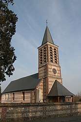 The church in Sandouville | ||
| ||
 Sandouville Location within Normandy region  Sandouville | ||
| Coordinates: 49°29′52″N 0°19′12″E / 49.4978°N 0.32°ECoordinates: 49°29′52″N 0°19′12″E / 49.4978°N 0.32°E | ||
| Country | France | |
| Region | Normandy | |
| Department | Seine-Maritime | |
| Arrondissement | Le Havre | |
| Canton | Saint-Romain-de-Colbosc | |
| Government | ||
| • Mayor | Jacques Dellerie | |
| Area1 | 14.8 km2 (5.7 sq mi) | |
| Population (2009)2 | 764 | |
| • Density | 52/km2 (130/sq mi) | |
| Time zone | UTC+1 (CET) | |
| • Summer (DST) | UTC+2 (CEST) | |
| INSEE/Postal code | 76660 /76430 | |
| Elevation |
0–108 m (0–354 ft) (avg. 96 m or 315 ft) | |
|
1 French Land Register data, which excludes lakes, ponds, glaciers > 1 km2 (0.386 sq mi or 247 acres) and river estuaries. 2 Population without double counting: residents of multiple communes (e.g., students and military personnel) only counted once. | ||
Sandouville is a commune in the Seine-Maritime département in the Normandy region in northern France.
Geography
A farming and light industrial village, by the banks of the Seine, in the Pays de Caux, situated some 11 miles (18 km) east of Le Havre, at the junction of the D80 and D982 roads. The commune has two distinct parts: the north contains the village, farms and woodland, the south, separated by the A131 autoroute and the canal de Tancarville, has some port activity, a Renault factory and reclaimed marshland.
Heraldry
 |
The arms of Sandouville are blazoned : Gules, a toothed wheel Or, and on a chief argent 3 martlets sable. |
Population
| 1962 | 1968 | 1975 | 1982 | 1990 | 1999 | 2006 |
|---|---|---|---|---|---|---|
| 400 | 460 | 566 | 645 | 703 | 754 | 786 |
| Starting in 1962: Population without duplicates | ||||||
Places of interest
- The Pont de Normandie (1995), the cable-stayed bridge over the Seine
- The church of St. Aubin, dating from the twelfth century
See also
References
External links
| Wikimedia Commons has media related to Sandouville. |
- Sandouville on the Quid website (in French)
This article is issued from
Wikipedia.
The text is licensed under Creative Commons - Attribution - Sharealike.
Additional terms may apply for the media files.