Rives-en-Seine
| Rives-en-Seine | |
|---|---|
| Commune | |
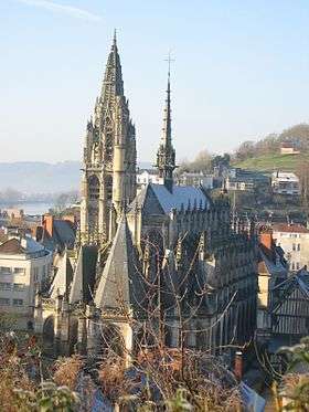 The church in Caudebec | |
 Rives-en-Seine Location within Normandy region  Rives-en-Seine | |
| Coordinates: 49°31′30″N 0°43′23″E / 49.525°N 0.723°ECoordinates: 49°31′30″N 0°43′23″E / 49.525°N 0.723°E | |
| Country | France |
| Region | Normandy |
| Department | Seine-Maritime |
| Arrondissement | Rouen |
| Canton | Notre-Dame-de-Gravenchon |
| Intercommunality | CA Caux vallée de Seine |
| Area1 | 34.14 km2 (13.18 sq mi) |
| Population (2013)2 | 4,213 |
| • Density | 120/km2 (320/sq mi) |
| Time zone | UTC+1 (CET) |
| • Summer (DST) | UTC+2 (CEST) |
| INSEE/Postal code | 76164 /76490 |
|
1 French Land Register data, which excludes lakes, ponds, glaciers > 1 km2 (0.386 sq mi or 247 acres) and river estuaries. 2 Population without double counting: residents of multiple communes (e.g., students and military personnel) only counted once. | |
Rives-en-Seine is a commune in the department of Seine-Maritime, northern France. The municipality was established on 1 January 2016 by merger of the former communes of Caudebec-en-Caux, Saint-Wandrille-Rançon and Villequier.[1]
See also
References
| Wikimedia Commons has media related to Rives-en-Seine. |
- ↑ Arrêté préfectoral 16 December 2015 (in French)
This article is issued from
Wikipedia.
The text is licensed under Creative Commons - Attribution - Sharealike.
Additional terms may apply for the media files.