Ry, Seine-Maritime
| Ry | |
|---|---|
| Commune | |
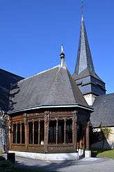 The church in Ry | |
 Ry Location within Normandy region  Ry | |
| Coordinates: 49°28′19″N 1°20′40″E / 49.4719°N 1.3444°ECoordinates: 49°28′19″N 1°20′40″E / 49.4719°N 1.3444°E | |
| Country | France |
| Region | Normandy |
| Department | Seine-Maritime |
| Arrondissement | Rouen |
| Canton | Le Mesnil-Esnard |
| Intercommunality | Plateau de Martainville |
| Government | |
| • Mayor (2008–2014) | Jean-Pierre Auzou |
| Area1 | 5.71 km2 (2.20 sq mi) |
| Population (2006)2 | 709 |
| • Density | 120/km2 (320/sq mi) |
| Time zone | UTC+1 (CET) |
| • Summer (DST) | UTC+2 (CEST) |
| INSEE/Postal code | 76548 /76116 |
| Elevation |
68–157 m (223–515 ft) (avg. 75 m or 246 ft) |
|
1 French Land Register data, which excludes lakes, ponds, glaciers > 1 km2 (0.386 sq mi or 247 acres) and river estuaries. 2 Population without double counting: residents of multiple communes (e.g., students and military personnel) only counted once. | |
Ry (pronounced [ʁi]) is a commune in the Seine-Maritime department in the Normandy region in northern France.
Geography
A farming village situated by the banks of the small river Crevon, some 12 miles (19 km) northeast of Rouen at the junction of the D12, D13, D62 and the D93 roads.
The village of Yonville in Gustave Flaubert's Madame Bovary is traditionally held to have been based on Ry.
Population
| 1962 | 1968 | 1975 | 1982 | 1990 | 1999 | 2006 |
|---|---|---|---|---|---|---|
| 522 | 527 | 525 | 544 | 610 | 605 | 709 |
| Starting in 1962: Population without duplicates | ||||||
Places of interest
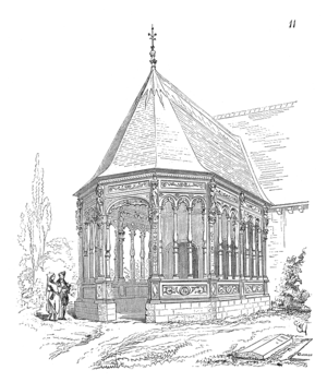
The church porch
See also
References
External links
| Wikimedia Commons has media related to Ry. |
- Photos of the church of Saint-Sulpice at Ry (in French)
- Official village website (in French)
- Ry on the Quid website (in French)
This article is issued from
Wikipedia.
The text is licensed under Creative Commons - Attribution - Sharealike.
Additional terms may apply for the media files.