Vittefleur
| Vittefleur | |
|---|---|
| Commune | |
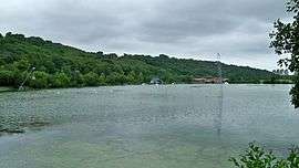 Caniel Lake | |
 Vittefleur Location within Normandy region  Vittefleur | |
| Coordinates: 49°49′10″N 0°38′18″E / 49.8194°N 0.6383°ECoordinates: 49°49′10″N 0°38′18″E / 49.8194°N 0.6383°E | |
| Country | France |
| Region | Normandy |
| Department | Seine-Maritime |
| Arrondissement | Dieppe |
| Canton | Saint-Valery-en-Caux |
| Intercommunality | CC Côte d'Albâtre |
| Government | |
| • Mayor (2001–2008) | Sylvie Houzard |
| Area1 | 8.17 km2 (3.15 sq mi) |
| Population (2006)2 | 636 |
| • Density | 78/km2 (200/sq mi) |
| Time zone | UTC+1 (CET) |
| • Summer (DST) | UTC+2 (CEST) |
| INSEE/Postal code | 76748 /76450 |
| Elevation |
2–100 m (6.6–328.1 ft) (avg. 8 m or 26 ft) |
|
1 French Land Register data, which excludes lakes, ponds, glaciers > 1 km2 (0.386 sq mi or 247 acres) and river estuaries. 2 Population without double counting: residents of multiple communes (e.g., students and military personnel) only counted once. | |
Vittefleur is a commune in the Seine-Maritime department in the Normandy region in northern France.
Geography
A farming village situated on the banks of the Durdent river in the Pays de Caux, some 23 miles (37 km) southwest of Dieppe at the junction of the D69, D10 and the D268 roads.
Population
| Year | 1962 | 1968 | 1975 | 1982 | 1990 | 1999 | 2006 |
|---|---|---|---|---|---|---|---|
| Population | 685 | 651 | 638 | 736 | 678 | 641 | 636 |
| From the year 1962 on: No double counting—residents of multiple communes (e.g. students and military personnel) are counted only once. | |||||||
Places of interest
- The church of St. Pierre and Paul, dating from the thirteenth century.
- The ruins of a sixteenth-century castle.
- A stone cross from the sixteenth century.
- The eighteenth-century chapel of Saint-Pierre at Crosville.
See also
References
External links
| Wikimedia Commons has media related to Vittefleur. |
- Vittefleur on the Quid website (in French)
This article is issued from
Wikipedia.
The text is licensed under Creative Commons - Attribution - Sharealike.
Additional terms may apply for the media files.