Grainville-la-Teinturière
| Grainville-la-Teinturière | ||
|---|---|---|
| Commune | ||
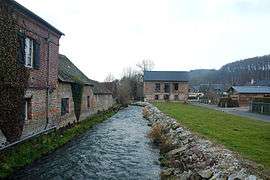 The mill in Grainville-la-Teinturière | ||
| ||
 Grainville-la-Teinturière Location within Normandy region  Grainville-la-Teinturière | ||
| Coordinates: 49°44′55″N 0°38′30″E / 49.7486°N 0.6417°ECoordinates: 49°44′55″N 0°38′30″E / 49.7486°N 0.6417°E | ||
| Country | France | |
| Region | Normandy | |
| Department | Seine-Maritime | |
| Arrondissement | Dieppe | |
| Canton | Saint-Valery-en-Caux | |
| Intercommunality | CC Côte d'Albâtre | |
| Government | ||
| • Mayor | René Vimont | |
| Area1 | 18.41 km2 (7.11 sq mi) | |
| Population (2006)2 | 1,111 | |
| • Density | 60/km2 (160/sq mi) | |
| Time zone | UTC+1 (CET) | |
| • Summer (DST) | UTC+2 (CEST) | |
| INSEE/Postal code | 76315 /76450 | |
| Elevation |
25–142 m (82–466 ft) (avg. 8 m or 26 ft) | |
|
1 French Land Register data, which excludes lakes, ponds, glaciers > 1 km2 (0.386 sq mi or 247 acres) and river estuaries. 2 Population without double counting: residents of multiple communes (e.g., students and military personnel) only counted once. | ||
.svg.png)
Grainville-la-Teinturière (French pronunciation: [ɡʁɛ̃vil la tɛ̃tyʁjɛːʁ]) is a commune in the Seine-Maritime department in the Normandy region in northern France.
Geography
A farming and forestry village situated by the banks of the Durdent river in the Pays de Caux, some 28 miles (45 km) southwest of Dieppe, at the junction of the D71, the D75 and the D131 roads.
Population
| Year | 1962 | 1968 | 1975 | 1982 | 1990 | 1999 | 2006 |
|---|---|---|---|---|---|---|---|
| Population | 794 | 801 | 860 | 882 | 964 | 990 | 1111 |
| From the year 1962 on: No double counting—residents of multiple communes (e.g. students and military personnel) are counted only once. | |||||||
Places of interest
- The church of Notre-Dame, dating from the sixteenth century.
- Vestiges of an 11th-century castle: motte; donjon; moat
- A museum dedicated to Jean de Béthencourt, explorer, who died at the castle.
Twin towns

See also
References
External links
| Wikimedia Commons has media related to Grainville-la-Teinturière. |
- Grainville-la-Teinturière on the Quid website (in French)
This article is issued from
Wikipedia.
The text is licensed under Creative Commons - Attribution - Sharealike.
Additional terms may apply for the media files.