Tourville-la-Rivière
| Tourville-la-Rivière | ||
|---|---|---|
| Commune | ||
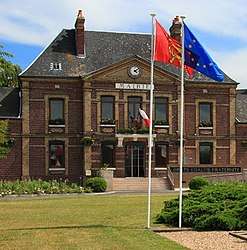 The town hall in Tourville-la-Rivière | ||
| ||
 Tourville-la-Rivière Location within Normandy region  Tourville-la-Rivière | ||
| Coordinates: 49°19′44″N 1°06′22″E / 49.329°N 1.106°ECoordinates: 49°19′44″N 1°06′22″E / 49.329°N 1.106°E | ||
| Country | France | |
| Region | Normandy | |
| Department | Seine-Maritime | |
| Arrondissement | Rouen | |
| Canton | Caudebec-lès-Elbeuf | |
| Intercommunality | Métropole Rouen Normandie | |
| Government | ||
| • Mayor (2008 - 2014) | Noël Levillain | |
| Area1 | 8 km2 (3 sq mi) | |
| Population (2006)2 | 2,350 | |
| • Density | 290/km2 (760/sq mi) | |
| Time zone | UTC+1 (CET) | |
| • Summer (DST) | UTC+2 (CEST) | |
| INSEE/Postal code | 76705 /76410 | |
| Elevation |
2–82 m (6.6–269.0 ft) (avg. 11 m or 36 ft) | |
|
1 French Land Register data, which excludes lakes, ponds, glaciers > 1 km2 (0.386 sq mi or 247 acres) and river estuaries. 2 Population without double counting: residents of multiple communes (e.g., students and military personnel) only counted once. | ||
Tourville-la-Rivière is a commune in the Seine-Maritime department in the Normandy region in northern France.
Geography
A small farming and light industrial town situated by the banks of the Seine, some 9 miles (14 km) south of Rouen at the junction of the D144, D7 and the D13 roads.
Junction 21 of the A13 autoroute is within the commune’s borders. SNCF operates a TER rail service to the town. A huge new shopping centre was opened here in 2006.
Heraldry
 |
The arms of the commune of Tourville-la-Rivière are blazoned : Bendy argent and azure, a crowned lion gules between 3 escallops Or. |
Population
| Year | 1962 | 1968 | 1975 | 1982 | 1990 | 1999 | 2006 |
|---|---|---|---|---|---|---|---|
| Population | 953 | 1102 | 1419 | 1828 | 1886 | 2280 | 2350 |
| From the year 1962 on: No double counting—residents of multiple communes (e.g. students and military personnel) are counted only once. | |||||||
Places of interest
- The shopping centre.
- The church of St. Martin, dating from the sixteenth century.
- The seventeenth-century chateau of Tourville at Bédane, with a dovecote built in 1691 and a 15th-century chapel.
- A seventeenth-century stone cross.
- A Roman necropolis of 150 to 200 tombs with pottery and coins all discovered during the building of the SNCF railway.
See also
References
External links
| Wikimedia Commons has media related to Tourville-la-Rivière. |
- The shopping centre website (in French)
- Official town website (in French)
- Tourville-la-Rivière on the Quid website (in French)
This article is issued from
Wikipedia.
The text is licensed under Creative Commons - Attribution - Sharealike.
Additional terms may apply for the media files.