Tourville-les-Ifs
| Tourville-les-Ifs | |
|---|---|
| Commune | |
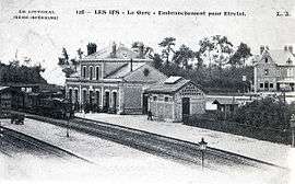 The railway station in Les Ifs | |
 Tourville-les-Ifs Location within Normandy region  Tourville-les-Ifs | |
| Coordinates: 49°42′54″N 0°24′05″E / 49.715°N 0.4014°ECoordinates: 49°42′54″N 0°24′05″E / 49.715°N 0.4014°E | |
| Country | France |
| Region | Normandy |
| Department | Seine-Maritime |
| Arrondissement | Le Havre |
| Canton | Fécamp |
| Intercommunality | CA Fécamp Caux Littoral |
| Government | |
| • Mayor (2001–2008) | Paul Monguillon. |
| Area1 | 8.34 km2 (3.22 sq mi) |
| Population (2006)2 | 549 |
| • Density | 66/km2 (170/sq mi) |
| Time zone | UTC+1 (CET) |
| • Summer (DST) | UTC+2 (CEST) |
| INSEE/Postal code | 76706 /76400 |
| Elevation |
30–131 m (98–430 ft) (avg. 123 m or 404 ft) |
|
1 French Land Register data, which excludes lakes, ponds, glaciers > 1 km2 (0.386 sq mi or 247 acres) and river estuaries. 2 Population without double counting: residents of multiple communes (e.g., students and military personnel) only counted once. | |
Tourville-les-Ifs is a commune in the Seine-Maritime department in the Normandy region in northern France.
Geography
A farming village in the Pays de Caux, situated some 21 miles (34 km) northeast of Le Havre, at the junction of the D73 and D68 roads.
Population
| Year | 1962 | 1968 | 1975 | 1982 | 1990 | 1999 | 2006 |
|---|---|---|---|---|---|---|---|
| Population | 331 | 384 | 427 | 449 | 516 | 547 | 549 |
| From the year 1962 on: No double counting—residents of multiple communes (e.g. students and military personnel) are counted only once. | |||||||
Places of interest
- The church of St. Martin, dating from the nineteenth century.
- The sixteenth-century chateau des Ifs.
- Traces of an eleventh-century castle.
- The sixteenth-century priory.
See also
References
External links
| Wikimedia Commons has media related to Tourville-les-Ifs. |
- Tourville-les-Ifs on the Quid website (in French)
This article is issued from
Wikipedia.
The text is licensed under Creative Commons - Attribution - Sharealike.
Additional terms may apply for the media files.