Morville-sur-Andelle
| Morville-sur-Andelle | |
|---|---|
| Commune | |
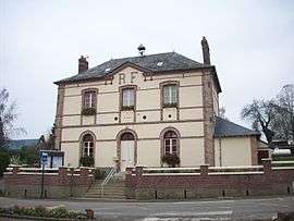 The town hall in Morville-sur-Andelle | |
 Morville-sur-Andelle Location within Normandy region  Morville-sur-Andelle | |
| Coordinates: 49°28′40″N 1°25′56″E / 49.4778°N 1.4322°ECoordinates: 49°28′40″N 1°25′56″E / 49.4778°N 1.4322°E | |
| Country | France |
| Region | Normandy |
| Department | Seine-Maritime |
| Arrondissement | Dieppe |
| Canton | Gournay-en-Bray |
| Intercommunality | CC 4 rivières |
| Government | |
| • Mayor (2014-2020) | Patricia Horville |
| Area1 | 5.17 km2 (2.00 sq mi) |
| Population (2012)2 | 287 |
| • Density | 56/km2 (140/sq mi) |
| Time zone | UTC+1 (CET) |
| • Summer (DST) | UTC+2 (CEST) |
| INSEE/Postal code | 76455 /76780 |
| Elevation |
65–175 m (213–574 ft) (avg. 80 m or 260 ft) |
|
1 French Land Register data, which excludes lakes, ponds, glaciers > 1 km2 (0.386 sq mi or 247 acres) and river estuaries. 2 Population without double counting: residents of multiple communes (e.g., students and military personnel) only counted once. | |
Morville-sur-Andelle is a commune in the Seine-Maritime department in the Normandy region in northern France.
Geography
The commune of Morville-sur-Andelle is centred on a small farming village situated by the banks of the river Andelle in the Pays de Bray, some 15 miles (24 km) east of Rouen at the junction of the D62 and the D238 roads.
Population
| 1962 | 1968 | 1975 | 1982 | 1990 | 1999 | 2006 | 2012 |
|---|---|---|---|---|---|---|---|
| 170 | 173 | 177 | 190 | 173 | 223 | 255 | 287 |
| Starting in 1962: Population without duplicates | |||||||
Places of interest
- The church of Saint-Ouen is 18th century with vestiges from the 13th century in the tower. The bronze bell dates from 1657.[1]
- Moulin (mill) de l'Andelle, situated at Imberville, built in 1839.
See also
References
External links
| Wikimedia Commons has media related to Morville-sur-Andelle. |
- Morville-sur-Andelle on the Quid website (in French)
This article is issued from
Wikipedia.
The text is licensed under Creative Commons - Attribution - Sharealike.
Additional terms may apply for the media files.