Morgny-la-Pommeraye
| Morgny-la-Pommeraye | ||
|---|---|---|
| Commune | ||
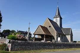 The church in Morgny-la-Pommeraye | ||
| ||
 Morgny-la-Pommeraye Location within Normandy region  Morgny-la-Pommeraye | ||
| Coordinates: 49°30′41″N 1°15′21″E / 49.5114°N 1.2558°ECoordinates: 49°30′41″N 1°15′21″E / 49.5114°N 1.2558°E | ||
| Country | France | |
| Region | Normandy | |
| Department | Seine-Maritime | |
| Arrondissement | Rouen | |
| Canton | Le Mesnil-Esnard | |
| Area1 | 6.48 km2 (2.50 sq mi) | |
| Population (2011)2 | 1,020 | |
| • Density | 160/km2 (410/sq mi) | |
| Time zone | UTC+1 (CET) | |
| • Summer (DST) | UTC+2 (CEST) | |
| INSEE/Postal code | 76453 /76750 | |
| Elevation |
120–168 m (394–551 ft) (avg. 164 m or 538 ft) | |
|
1 French Land Register data, which excludes lakes, ponds, glaciers > 1 km2 (0.386 sq mi or 247 acres) and river estuaries. 2 Population without double counting: residents of multiple communes (e.g., students and military personnel) only counted once. | ||
Morgny-la-Pommeraye is a commune in the Seine-Maritime department in the Normandy region in north-western France.
Geography
A farming village situated some 11 miles (18 km) northeast of Rouen at the junction of the D 12, D 90 and the D 15 roads. SNCF operates a TER train service here.
Heraldry
.svg.png) |
The arms of Morgny-la-Pommeraye are blazoned : Azure, a double-headed eagle (??with wings lowered??), and on a chief Or, in pale a mullet of 5 and a crescent gules, between a swan passant and a broom plant vert. |
Population
| 1962 | 1968 | 1975 | 1982 | 1990 | 1999 | 2006 | 2007 | 2011 |
|---|---|---|---|---|---|---|---|---|
| 305 | 309 | 474 | 590 | 793 | 892 | 1007 | 1023 | 1020 |
| Starting in 1962: Population without duplicates | ||||||||
Places of interest
- The church of Notre-Dame, dating from the seventeenth century.
- The church of St.Madeleine, dating from the seventeenth century.
- The Château de Mondétour.
- A sixteenth century manorhouse.
See also
References
External links
| Wikimedia Commons has media related to Morgny-la-Pommeraye. |
- Morgny-la-Pommeraye on the Quid website (in French)
This article is issued from
Wikipedia.
The text is licensed under Creative Commons - Attribution - Sharealike.
Additional terms may apply for the media files.