Graimbouville
| Graimbouville | |
|---|---|
| Commune | |
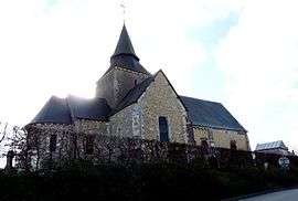 The church in Graimbouville | |
 Graimbouville Location within Normandy region  Graimbouville | |
| Coordinates: 49°34′25″N 0°19′48″E / 49.5736°N 0.33°ECoordinates: 49°34′25″N 0°19′48″E / 49.5736°N 0.33°E | |
| Country | France |
| Region | Normandy |
| Department | Seine-Maritime |
| Arrondissement | Le Havre |
| Canton | Saint-Romain-de-Colbosc |
| Intercommunality | Saint Romain de Colbosc |
| Government | |
| • Mayor (2001–2008) | Sylvain Vasse |
| Area1 | 6.4 km2 (2.5 sq mi) |
| Population (2013)2 | 623 |
| • Density | 97/km2 (250/sq mi) |
| Time zone | UTC+1 (CET) |
| • Summer (DST) | UTC+2 (CEST) |
| INSEE/Postal code | 76314 /76430 |
| Elevation |
98–127 m (322–417 ft) (avg. 101 m or 331 ft) |
|
1 French Land Register data, which excludes lakes, ponds, glaciers > 1 km2 (0.386 sq mi or 247 acres) and river estuaries. 2 Population without double counting: residents of multiple communes (e.g., students and military personnel) only counted once. | |
Graimbouville is a commune in the Seine-Maritime department in the Normandy region in northern France.
Geography
A farming village situated in the Pays de Caux, some 13 miles (21 km) northeast of Le Havre, at the junction of the D234 and D434 roads. The A29 autoroute passes through the southern tip of the commune.
Population
| Year | 1962 | 1968 | 1975 | 1982 | 1990 | 1999 | 2006 |
|---|---|---|---|---|---|---|---|
| Population | 258 | 315 | 390 | 375 | 409 | 496 | 574 |
| From the year 1962 on: No double counting—residents of multiple communes (e.g. students and military personnel) are counted only once. | |||||||
Places of interest
See also
References
External links
| Wikimedia Commons has media related to Graimbouville. |
- Graimbouville on the Quid website (in French)
This article is issued from
Wikipedia.
The text is licensed under Creative Commons - Attribution - Sharealike.
Additional terms may apply for the media files.