Belbeuf
| Belbeuf | ||
|---|---|---|
| Commune | ||
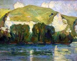 The Cliffs of Belbeuf, by Robert Antoine Pinchon | ||
| ||
 Belbeuf Location within Normandy region  Belbeuf | ||
| Coordinates: 49°23′23″N 1°08′37″E / 49.3897°N 1.1436°ECoordinates: 49°23′23″N 1°08′37″E / 49.3897°N 1.1436°E | ||
| Country | France | |
| Region | Normandy | |
| Department | Seine-Maritime | |
| Arrondissement | Rouen | |
| Canton | Darnétal | |
| Intercommunality | Métropole Rouen Normandie | |
| Government | ||
| • Mayor | Jean-Guy Lecouteux | |
| Area1 | 6.56 km2 (2.53 sq mi) | |
| Population (2006)2 | 2,123 | |
| • Density | 320/km2 (840/sq mi) | |
| Time zone | UTC+1 (CET) | |
| • Summer (DST) | UTC+2 (CEST) | |
| INSEE/Postal code | 76069 /76240 | |
| Elevation |
2–161 m (6.6–528.2 ft) (avg. 156 m or 512 ft) | |
|
1 French Land Register data, which excludes lakes, ponds, glaciers > 1 km2 (0.386 sq mi or 247 acres) and river estuaries. 2 Population without double counting: residents of multiple communes (e.g., students and military personnel) only counted once. | ||
.svg.png)
Belbeuf is a commune in the Seine-Maritime department in the Normandy region in northern France.
Geography
A small town of forestry, farming and a little light industry situated by the banks of the Seine, some 6 miles (9.7 km) south of Rouen at the junction of the D6015 and the D7 roads.
Population
| Year | 1962 | 1968 | 1975 | 1982 | 1990 | 1999 | 2006 |
|---|---|---|---|---|---|---|---|
| Population | 901 | 1240 | 1409 | 1681 | 1696 | 2032 | 2123 |
| From the year 1962 on: No double counting—residents of multiple communes (e.g. students and military personnel) are counted only once. | |||||||
Places of interest
Notable people
- Jacques Anquetil, cyclist, lived here in the 1960s.
- Claude Bébéar, businessman, the founder of AXA Assurance, lived here.
- Jacques Godart, 6th Marquis de Belbeuf
See also
References
External links
| Wikimedia Commons has media related to Belbeuf. |
- Official town website (in French)
- Belbeuf Rowing Club = Club Nautique de Belbeuf (in French) rowing on the Seine, in picturesque surroundings, a few kilometres upstream of Rouen
- Belbeuf on the Quid website (in French)
This article is issued from
Wikipedia.
The text is licensed under Creative Commons - Attribution - Sharealike.
Additional terms may apply for the media files.