Beauvoir-en-Lyons
| Beauvoir-en-Lyons | |
|---|---|
| Commune | |
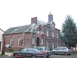 The town hall in Beauvoir-en-Lyons | |
 Beauvoir-en-Lyons Location within Normandy region  Beauvoir-en-Lyons | |
| Coordinates: 49°30′14″N 1°35′13″E / 49.5039°N 1.5869°ECoordinates: 49°30′14″N 1°35′13″E / 49.5039°N 1.5869°E | |
| Country | France |
| Region | Normandy |
| Department | Seine-Maritime |
| Arrondissement | Dieppe |
| Canton | Gournay-en-Bray |
| Intercommunality | CC 4 rivières |
| Government | |
| • Mayor | Dominique Rimbert |
| Area1 | 33.29 km2 (12.85 sq mi) |
| Population (2006)2 | 562 |
| • Density | 17/km2 (44/sq mi) |
| Time zone | UTC+1 (CET) |
| • Summer (DST) | UTC+2 (CEST) |
| INSEE/Postal code | 76067 /76220 |
| Elevation |
129–231 m (423–758 ft) (avg. 248 m or 814 ft) |
|
1 French Land Register data, which excludes lakes, ponds, glaciers > 1 km2 (0.386 sq mi or 247 acres) and river estuaries. 2 Population without double counting: residents of multiple communes (e.g., students and military personnel) only counted once. | |
Beauvoir-en-Lyons is a commune in the Seine-Maritime department in the Normandy region in northern France.
Geography
A forestry and farming village situated in the Pays de Bray, some 27 miles (43 km) east of Rouen at the junction of the D1, D84 and D57 roads.
Population
| Year | 1962 | 1968 | 1975 | 1982 | 1990 | 1999 | 2006 |
|---|---|---|---|---|---|---|---|
| Population | 453 | 561 | 539 | 464 | 463 | 473 | 562 |
| From the year 1962 on: No double counting—residents of multiple communes (e.g. students and military personnel) are counted only once. | |||||||
Places of interest
- The church of St.Nicolas, dating from the eighteenth century.
- The remains of a 12th-century castle.
- Traces of the abbey of Saint-Laurent.
- The two châteaux at Bos-Hyons at Routieux.
See also
References
External links
| Wikimedia Commons has media related to Beauvoir-en-Lyons. |
- Beauvoir-en-Lyons on the Quid website (in French)
This article is issued from
Wikipedia.
The text is licensed under Creative Commons - Attribution - Sharealike.
Additional terms may apply for the media files.